Villers-Tournelle
Villers-Tournelle is a commune in the Somme department in Hauts-de-France in northern France.
Villers-Tournelle | |
|---|---|
_France_(4).JPG) The town hall and school in Villers-Tournelle | |
 Coat of arms | |
Location of Villers-Tournelle 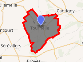
| |
 Villers-Tournelle  Villers-Tournelle | |
| Coordinates: 49°39′15″N 2°27′52″E | |
| Country | France |
| Region | Hauts-de-France |
| Department | Somme |
| Arrondissement | Montdidier |
| Canton | Roye |
| Intercommunality | CC Grand Roye |
| Government | |
| • Mayor (2001–2008) | Jean-Michel Poppe |
| Area 1 | 5.93 km2 (2.29 sq mi) |
| Population (2017-01-01)[1] | 155 |
| • Density | 26/km2 (68/sq mi) |
| Time zone | UTC+01:00 (CET) |
| • Summer (DST) | UTC+02:00 (CEST) |
| INSEE/Postal code | 80805 /80500 |
| Elevation | 75–155 m (246–509 ft) (avg. 114 m or 374 ft) |
| 1 French Land Register data, which excludes lakes, ponds, glaciers > 1 km2 (0.386 sq mi or 247 acres) and river estuaries. | |
Geography
The commune is situated 27 km (16 miles) southeast of Amiens, on the D188 road
Population
| Year | 1962 | 1968 | 1975 | 1982 | 1990 | 1999 | 2006 |
|---|---|---|---|---|---|---|---|
| Population | 88 | 135 | 143 | 138 | 108 | 146 | 160 |
| From the year 1962 on: No double counting—residents of multiple communes (e.g. students and military personnel) are counted only once. | |||||||
See also
References
- "Populations légales 2017". INSEE. Retrieved 6 January 2020.
External links
| Wikimedia Commons has media related to Villers-Tournelle. |
- Villers-Tournelle on the Quid website (in French)
| Authority control |
|
|---|
This article is issued from Wikipedia. The text is licensed under Creative Commons - Attribution - Sharealike. Additional terms may apply for the media files.