Nampont
Nampont (or Nampont-Saint-Martin) is a commune in the Somme department in Hauts-de-France in northern France.
Nampont | |
|---|---|
 The town hall and school in Nampont | |
Location of Nampont 
| |
 Nampont  Nampont | |
| Coordinates: 50°20′58″N 1°44′47″E | |
| Country | France |
| Region | Hauts-de-France |
| Department | Somme |
| Arrondissement | Abbeville |
| Canton | Rue |
| Intercommunality | CC Ponthieu-Marquenterre |
| Government | |
| • Mayor (2001–2008) | Claude Hertault |
| Area 1 | 19.39 km2 (7.49 sq mi) |
| Population (2017-01-01)[1] | 248 |
| • Density | 13/km2 (33/sq mi) |
| Time zone | UTC+01:00 (CET) |
| • Summer (DST) | UTC+02:00 (CEST) |
| INSEE/Postal code | 80580 /80120 |
| Elevation | 2–67 m (6.6–219.8 ft) (avg. 10 m or 33 ft) |
| 1 French Land Register data, which excludes lakes, ponds, glaciers > 1 km2 (0.386 sq mi or 247 acres) and river estuaries. | |
Geography
Nampont is situated on the banks of the Authie river, at the junction of the N1 and D12 roads and on the border of the departments of the Somme and the Pas-de-Calais.
Population
| 1962 | 1968 | 1975 | 1982 | 1990 | 1999 | 2006 |
|---|---|---|---|---|---|---|
| 335 | 342 | 305 | 263 | 242 | 228 | 270 |
| Starting in 1962: Population without duplicates | ||||||
History
Places and monuments
The ‘Maison Forte’, built in the 15th century as a border-post on the Authie. After the Spanish invasion, it was transformed into a customs post for the imposition of the ‘Gabelle’ (taxes levied on salt and other commodities, between Spanish Artois and French Picardy Nowadays, the Maison Forte is the clubhouse of Nampont-Saint-Martin golf club. Public access is limited to exterior views from the road or the courtyard.
 Church in Montigny.
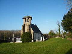
 Church in Nampont.
%2C_Ch%C3%A2teau-fort_(4).JPG) Entrance of the château-fort.
Entrance of the château-fort. On the church in Nampont.
 Old "relais de poste".
 Monument.
%2C_Auberge_des_contrebandiers.JPG) "Auberge des contrebandiers".
"Auberge des contrebandiers".
See also
References
- "Populations légales 2017". INSEE. Retrieved 6 January 2020.
| Wikimedia Commons has media related to Nampont. |
| Authority control |
|
|---|
This article is issued from Wikipedia. The text is licensed under Creative Commons - Attribution - Sharealike. Additional terms may apply for the media files.