Estrées-lès-Crécy
Estrées-lès-Crécy is a commune in the Somme department in Hauts-de-France in northern France.
Estrées-lès-Crécy | |
|---|---|
Location of Estrées-lès-Crécy 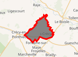
| |
 Estrées-lès-Crécy  Estrées-lès-Crécy | |
| Coordinates: 50°15′14″N 1°55′45″E | |
| Country | France |
| Region | Hauts-de-France |
| Department | Somme |
| Arrondissement | Abbeville |
| Canton | Rue |
| Intercommunality | CC Ponthieu-Marquenterre |
| Government | |
| • Mayor (2001–2008) | Christiane Delannoy |
| Area 1 | 11.19 km2 (4.32 sq mi) |
| Population (2017-01-01)[1] | 391 |
| • Density | 35/km2 (90/sq mi) |
| Time zone | UTC+01:00 (CET) |
| • Summer (DST) | UTC+02:00 (CEST) |
| INSEE/Postal code | 80290 /80150 |
| Elevation | 33–84 m (108–276 ft) (avg. 75 m or 246 ft) |
| 1 French Land Register data, which excludes lakes, ponds, glaciers > 1 km2 (0.386 sq mi or 247 acres) and river estuaries. | |
Geography
The commune is situated on the D938 road, near the site of the Battle of Crecy, 16 kilometres (10 mi) north of Abbeville.
Railway
There was a railway station (Crécy-Estrées) on the branch of the Réseau des Bains de Mer which ran between Abbeville and Dompierre-sur-Authie. It opened on 19 June 1892 and closed to passengers on 10 March 1947. It closed to freight on 1 February 1951.
Population
| Year | 1962 | 1968 | 1975 | 1982 | 1990 | 1999 | 2006 |
|---|---|---|---|---|---|---|---|
| Population | 368 | 406 | 380 | 358 | 353 | 362 | 380 |
| From the year 1962 on: No double counting—residents of multiple communes (e.g. students and military personnel) are counted only once. | |||||||
See also
References
- "Populations légales 2017". INSEE. Retrieved 6 January 2020.
| Wikimedia Commons has media related to Estrées-lès-Crécy. |
| Authority control |
|
|---|
This article is issued from Wikipedia. The text is licensed under Creative Commons - Attribution - Sharealike. Additional terms may apply for the media files.