Crouy-Saint-Pierre
Crouy-Saint-Pierre is a commune in the Somme department in Hauts-de-France in northern France.
Crouy-Saint-Pierre | |
|---|---|
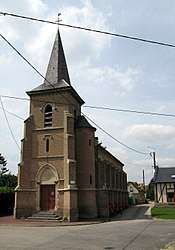 The church in Crouy-Saint-Pierre | |
 Coat of arms | |
Location of Crouy-Saint-Pierre 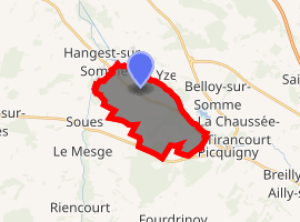
| |
 Crouy-Saint-Pierre  Crouy-Saint-Pierre | |
| Coordinates: 49°58′12″N 2°05′19″E | |
| Country | France |
| Region | Hauts-de-France |
| Department | Somme |
| Arrondissement | Amiens |
| Canton | Ailly-sur-Somme |
| Intercommunality | CC Nièvre et Somme |
| Government | |
| • Mayor (2001–2008) | Jacques Vast |
| Area 1 | 10.51 km2 (4.06 sq mi) |
| Population (2017-01-01)[1] | 346 |
| • Density | 33/km2 (85/sq mi) |
| Time zone | UTC+01:00 (CET) |
| • Summer (DST) | UTC+02:00 (CEST) |
| INSEE/Postal code | 80229 /80310 |
| Elevation | 10–96 m (33–315 ft) (avg. 14 m or 46 ft) |
| 1 French Land Register data, which excludes lakes, ponds, glaciers > 1 km2 (0.386 sq mi or 247 acres) and river estuaries. | |
Geography
The commune is situated on the D3 road, on the banks of the river Somme, some 10 miles (16 km) northwest of Amiens.
Places of interest
A Cistercian abbey, the Abbaye du Gard, founded in 1137 by Gérard de Picquigny, vidame of Amiens, lies within the boundaries of the commune.
Population
| Year | 1962 | 1968 | 1975 | 1982 | 1990 | 1999 | 2006 |
|---|---|---|---|---|---|---|---|
| Population | 197 | 202 | 228 | 229 | 285 | 303 | 336 |
| From the year 1962 on: No double counting—residents of multiple communes (e.g. students and military personnel) are counted only once. | |||||||
See also
References
- "Populations légales 2017". INSEE. Retrieved 6 January 2020.
| Wikimedia Commons has media related to Crouy-Saint-Pierre. |
| Authority control |
|
|---|
This article is issued from Wikipedia. The text is licensed under Creative Commons - Attribution - Sharealike. Additional terms may apply for the media files.