Montauban-de-Picardie
Montauban-de-Picardie is a commune in the Somme department in Hauts-de-France in northern France. Its inhabitants are called "Montalbanais".
Montauban-de-Hauts-de-France | |
|---|---|
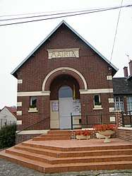 The town hall in Montauban-de-Picardie | |
Location of Montauban-de-Hauts-de-France 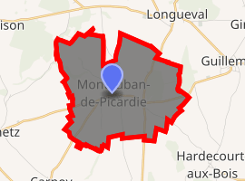
| |
 Montauban-de-Hauts-de-France  Montauban-de-Hauts-de-France | |
| Coordinates: 50°00′26″N 2°46′48″E | |
| Country | France |
| Region | Hauts-de-France |
| Department | Somme |
| Arrondissement | Péronne |
| Canton | Albert |
| Intercommunality | Pays du Coquelicot |
| Government | |
| • Mayor (2001–2008) | Gilbert Froment |
| Area 1 | 7.67 km2 (2.96 sq mi) |
| Population (2017-01-01)[1] | 214 |
| • Density | 28/km2 (72/sq mi) |
| Time zone | UTC+01:00 (CET) |
| • Summer (DST) | UTC+02:00 (CEST) |
| INSEE/Postal code | 80560 /80300 |
| Elevation | 89–143 m (292–469 ft) (avg. 139 m or 456 ft) |
| 1 French Land Register data, which excludes lakes, ponds, glaciers > 1 km2 (0.386 sq mi or 247 acres) and river estuaries. | |
Geography
The commune is situated on the D64 road, some 20 miles (32 km) northeast of Amiens.
History
First World War
The village lies on the First World War battlefield of the Somme. Montauban lay close behind the German front-line and was turned into a fortified strongpoint. On 1 July 1916, the first day on the Somme, the village was seized by the British 30th Division in one of the few successful British advances of the day. In the village itself there is a monument to the Liverpool and Manchester 'Pals', who, as part of the 30th Division, were the first to reach the village.
Population
| 1962 | 1968 | 1975 | 1982 | 1990 | 1999 | 2006 |
|---|---|---|---|---|---|---|
| 206 | 215 | 183 | 176 | 186 | 197 | 215 |
| Starting in 1962: Population without duplicates | ||||||
See also
References
- "Populations légales 2017". INSEE. Retrieved 6 January 2020.
| Wikimedia Commons has media related to Montauban-de-Picardie. |
| Authority control |
|
|---|
This article is issued from Wikipedia. The text is licensed under Creative Commons - Attribution - Sharealike. Additional terms may apply for the media files.