Rue, Somme
Rue is a commune in the Somme department in Hauts-de-France in northern France.
Rue | |
|---|---|
Chapelle du Saint-Esprit in Rue | |
 Coat of arms | |
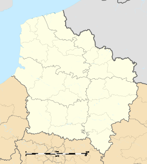
Location of Rue 
| |
 Rue  Rue | |
| Coordinates: 50°16′23″N 1°40′07″E | |
| Country | France |
| Region | Hauts-de-France |
| Department | Somme |
| Arrondissement | Abbeville |
| Canton | Rue |
| Intercommunality | CC Ponthieu-Marquenterre |
| Government | |
| • Mayor (2014–2020) | Richard Renard |
| Area 1 | 29.06 km2 (11.22 sq mi) |
| Population (2017-01-01)[1] | 3,101 |
| • Density | 110/km2 (280/sq mi) |
| Time zone | UTC+01:00 (CET) |
| • Summer (DST) | UTC+02:00 (CEST) |
| INSEE/Postal code | 80688 /80120 |
| Elevation | 2–12 m (6.6–39.4 ft) (avg. 9 m or 30 ft) |
| 1 French Land Register data, which excludes lakes, ponds, glaciers > 1 km2 (0.386 sq mi or 247 acres) and river estuaries. | |
Geography
Rue is situated some 15 miles (24 km) north of Abbeville, on the junction of the D938, D4 and D85 roads.
Population
| 1962 | 1968 | 1975 | 1982 | 1990 | 1999 | 2006 |
|---|---|---|---|---|---|---|
| 2937 | 2952 | 3122 | 3170 | 2942 | 3075 | 3211 |
| Starting in 1962: Population without duplicates | ||||||
Toponymy
The place is first mentioned as Rua in 1042 (diplôme Henrici Regis Gall. Christ, then Rugua in 1090 - 1110, Rue in 1184.[2][3]
Medieval place name meaning "street" in French (French word rue is ultimately from Latin ruga).<ref>Dictionnaire étymologique des noms de lieu en France, Albert Dauzat and Charles Rostaing, 1979, Paris, ISBN 2-85023-076-6, p. 579a.</re
Places of interest
- The chapel of the Holy Spirit (1440–1514) is one of the finest examples of flamboyant gothic in Picardie.
- The bell tower.
See also
- Communes of the Somme department
- Le Chateau du Broutel
References
- "Populations légales 2017". INSEE. Retrieved 6 January 2020.
- Jacques Garnier, Dictionnaire topographique du département de la Somme, tome 2, Archives départementales de la Somme, p. 242, vue 124/267.
- Lire le dictionnaire topographique en ligne sur le site des archives départementales de la Somme.
This article is issued from Wikipedia. The text is licensed under Creative Commons - Attribution - Sharealike. Additional terms may apply for the media files.