Calvert County, Maryland
Calvert County is located in the U.S. state of Maryland. As of the 2010 census, the population was 88,737.[1] Its county seat is Prince Frederick.[2] The county's name is derived from the family name of the Barons of Baltimore, the proprietors of the English Colony of Maryland.
Calvert County | |
|---|---|
.jpg) Drum Point Light | |
 Flag  Seal | |
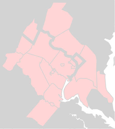
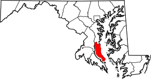 Location within the U.S. state of Maryland | |
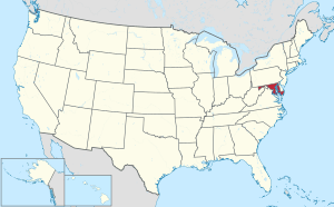 Maryland's location within the U.S. | |
| Coordinates: 38°32′N 76°32′W | |
| Country | |
| State | |
| Founded | 1654 |
| Named for | Calvert family |
| Seat | Prince Frederick |
| Largest town | Chesapeake Beach |
| Area | |
| • Total | 345 sq mi (890 km2) |
| • Land | 213 sq mi (550 km2) |
| • Water | 132 sq mi (340 km2) 38% |
| Population (2010) | |
| • Total | 88,737 |
| • Estimate (2019) | 92,525 |
| • Density | 260/sq mi (99/km2) |
| Time zone | UTC−5 (Eastern) |
| • Summer (DST) | UTC−4 (EDT) |
| Congressional district | 5th |
| Website | www |
Calvert County is included in the Washington-Arlington-Alexandria, DC-VA-MD-WV Metropolitan Statistical Area. It occupies the Calvert Peninsula, which is bordered on the east by Chesapeake Bay and on the west by the Patuxent River.
Calvert County is part of the Southern Maryland region. The county has one of the highest median household incomes in the United States.[3]
History
First colonized as part of Charles County (much larger than the present-day Charles County) circa 1650,[4] it was renamed. Patuxent County was established in 1654 by an Order in Council.[5] In 1658, the county was renamed Calvert County.[6] It is one of the older counties in Maryland, after St. Mary's, Kent County and Anne Arundel counties.
Once made up primarily of farms and tobacco fields, the county has become a fast-growing exurban neighbor of Washington. Many home prices have nearly quadrupled in the past decade, with many four-bedroom homes in the northern half of the county averaging over $1,000,000. The popular weekend resort towns of Solomons, Chesapeake Beach, and North Beach are notable. Calvert County has a long history of using slave labor in said farms and fields.
According to the local "Trail of Souls" project[7], at its height prior to the Civil War, there were over 10,000 enslaved people. According to the Maryland Archives Project, "By 1860, the approximately 46,000 slaves in the counties of southern Maryland, outnumbered those found in all other regions of the state combined. However, the southern counties had a relatively small free black population."
The county has numerous properties on the National Register of Historic Places.[8]
Politics and government
Calvert County is governed by a group of five county commissioners, the traditional form of county government in the State of Maryland.
| Position | Name | Affiliation | District | ||
|---|---|---|---|---|---|
| President | Thomas "Tim" Hutchins | Republican | 2 | ||
| Vice President | Kelly McConkey | Republican | 3 | ||
| Commissioner | Mike Hart | Republican | 1 | ||
| Commissioner | Earl "Buddy" Hance | Republican | At-Large | ||
| Commissioner | Steven R. Weems | Republican | At-Large | ||
In Presidential elections Calvert County has historically and at present leaned strongly towards the Republican Party. It was won by that party in every election from 1884 to 1936 – with the sequence broken in 1940 due to local support for Franklin Delano Roosevelt’s efforts at helping Britain in World War II[9] – and in modern times no Democratic presidential nominee has won Calvert County since Jimmy Carter did so in 1976.
It is part of the 5th Congressional District, along with much of Southern Maryland. The current representative is Democratic House Majority Leader Steny Hoyer.
| Year | Republican | Democratic | Third parties |
|---|---|---|---|
| 2016 | 55.2% 26,176 | 38.4% 18,225 | 6.4% 3,007 |
| 2012 | 52.6% 23,952 | 45.1% 20,529 | 2.3% 1,037 |
| 2008 | 52.4% 23,095 | 46.1% 20,299 | 1.5% 663 |
| 2004 | 58.5% 23,017 | 40.6% 15,967 | 0.9% 367 |
| 2000 | 53.7% 16,004 | 43.6% 12,986 | 2.7% 816 |
| 1996 | 48.8% 11,509 | 42.5% 10,008 | 8.7% 2,049 |
| 1992 | 43.1% 10,026 | 37.1% 8,619 | 19.8% 4,604 |
| 1988 | 63.0% 10,956 | 36.7% 6,376 | 0.4% 65 |
| 1984 | 60.0% 8,303 | 39.4% 5,455 | 0.6% 82 |
| 1980 | 50.1% 5,440 | 43.7% 4,745 | 6.3% 685 |
| 1976 | 42.6% 3,439 | 57.4% 4,626 | |
| 1972 | 63.4% 4,024 | 35.2% 2,232 | 1.4% 88 |
| 1968 | 35.7% 1,946 | 37.3% 2,032 | 27.0% 1,471 |
| 1964 | 34.6% 1,765 | 65.4% 3,335 | |
| 1960 | 46.2% 2,173 | 53.8% 2,535 | |
| 1956 | 58.4% 2,764 | 41.6% 1,966 | |
| 1952 | 55.3% 2,769 | 44.1% 2,209 | 0.7% 34 |
| 1948 | 50.4% 1,919 | 48.7% 1,851 | 0.9% 35 |
| 1944 | 58.5% 2,184 | 41.5% 1,549 | |
| 1940 | 48.7% 2,067 | 50.6% 2,149 | 0.7% 30 |
| 1936 | 52.3% 2,082 | 47.1% 1,872 | 0.6% 25 |
| 1932 | 51.4% 1,838 | 47.4% 1,696 | 1.2% 43 |
| 1928 | 63.9% 2,085 | 35.1% 1,144 | 1.0% 33 |
| 1924 | 54.1% 1,564 | 42.9% 1,242 | 3.0% 87 |
| 1920 | 58.0% 1,741 | 41.0% 1,230 | 1.0% 30 |
| 1916 | 49.8% 975 | 46.5% 910 | 3.7% 72 |
| 1912 | 58.4% 1,035 | 34.7% 616 | 6.9% 122 |
| 1908 | 59.0% 1,070 | 39.4% 714 | 1.6% 29 |
| 1904 | 57.5% 1,030 | 41.3% 740 | 1.2% 22 |
| 1900 | 61.0% 1,414 | 37.3% 865 | 1.7% 40 |
Geography
According to the U.S. Census Bureau, the county has a total area of 345 square miles (890 km2), of which 213 square miles (550 km2) is land and 132 square miles (340 km2) (38%) is water.[12] It is the smallest county in Maryland by land area and third-smallest by total area.
Climate
Calvert County lies in the humid subtropical climate zone, with hot, humid summers and mild to chilly winters with plentiful precipitation year-round. Its proximity to the Chesapeake Bay has a moderating effect on temperatures compared with locales further inland.
Adjacent counties
- Anne Arundel County (north)
- Prince George's County (northwest)
- Charles County (west)
- Dorchester County (east)
- Talbot County (northeast)
- St. Mary's County (south)
Demographics
| Historical population | |||
|---|---|---|---|
| Census | Pop. | %± | |
| 1790 | 8,652 | — | |
| 1800 | 8,297 | −4.1% | |
| 1810 | 8,005 | −3.5% | |
| 1820 | 8,073 | 0.8% | |
| 1830 | 8,900 | 10.2% | |
| 1840 | 9,229 | 3.7% | |
| 1850 | 9,646 | 4.5% | |
| 1860 | 10,447 | 8.3% | |
| 1870 | 9,865 | −5.6% | |
| 1880 | 10,538 | 6.8% | |
| 1890 | 9,860 | −6.4% | |
| 1900 | 10,223 | 3.7% | |
| 1910 | 10,325 | 1.0% | |
| 1920 | 9,744 | −5.6% | |
| 1930 | 9,528 | −2.2% | |
| 1940 | 10,484 | 10.0% | |
| 1950 | 12,100 | 15.4% | |
| 1960 | 15,826 | 30.8% | |
| 1970 | 20,682 | 30.7% | |
| 1980 | 34,638 | 67.5% | |
| 1990 | 51,372 | 48.3% | |
| 2000 | 74,563 | 45.1% | |
| 2010 | 88,737 | 19.0% | |
| Est. 2019 | 92,525 | [13] | 4.3% |
| U.S. Decennial Census[14] 1790-1960[15] 1900-1990[16] 1990-2000[17] 2010–2018[1] | |||
2000 census
As of the census[18] of 2000, there were 74,563 people, 25,447 households, and 20,154 families residing in the county. The population density was 346 people per square mile (134/km²). There were 27,576 housing units at an average density of 128 per square mile (49/km²). The racial makeup of the county was 83.93% White, 13.11% Black or African American, 0.30% Native American, 0.88% Asian, 0.03% Pacific Islander, 0.49% from other races, and 1.27% from two or more races. 1.52% of the population were Hispanic or Latino of any race. 15.5% were of Irish, 15.0% German, 12.0% English, 11.5% United States or American and 7.1% Italian ancestry.
There were 25,447 households out of which 41.70% had children under the age of 18 living with them, 64.80% were married couples living together, 9.90% had a female householder with no husband present, and 20.80% were non-families. 16.30% of all households were made up of individuals and 5.70% had someone living alone who was 65 years of age or older. The average household size was 2.91 and the average family size was 3.26.
In the county, the population was spread out with 29.60% under the age of 18, 6.40% from 18 to 24, 31.70% from 25 to 44, 23.40% from 45 to 64, and 8.90% who were 65 years of age or older. The median age was 36 years. For every 100 females there were 97.30 males. For every 100 females age 18 and over, there were 94.00 males.
The median income for a household in the county was $65,945, and the median income for a family was $71,545 (these figures had risen to $88,989 and $100,229 respectively as of a 2007 estimate[19]). Males had a median income of $48,664 versus $32,265 for females. The per capita income for the county was $25,410. About 3.10% of families and 4.40% of the population were below the poverty line, including 5.10% of those under age 18 and 5.70% of those age 65 or over.
2010 census
As of the 2010 United States Census, there were 88,737 people, 30,873 households, and 23,732 families residing in the county.[20] The population density was 416.3 inhabitants per square mile (160.7/km2). There were 33,780 housing units at an average density of 158.5 per square mile (61.2/km2).[21] The racial makeup of the county was 81.4% white, 13.4% black or African American, 1.4% Asian, 0.4% American Indian, 0.7% from other races, and 2.7% from two or more races. Those of Hispanic or Latino origin made up 2.7% of the population.[20] In terms of ancestry, 19.6% were German, 17.6% were Irish, 13.9% were English, 8.4% were Italian, and 7.4% were American.[22]
Of the 30,873 households, 40.4% had children under the age of 18 living with them, 60.6% were married couples living together, 11.3% had a female householder with no husband present, 23.1% were non-families, and 18.1% of all households were made up of individuals. The average household size was 2.85 and the average family size was 3.23. The median age was 40.1 years.[20]
The median income for a household in the county was $90,838 and the median income for a family was $102,638. Males had a median income of $66,909 versus $49,337 for females. The per capita income for the county was $36,323. About 2.8% of families and 4.4% of the population were below the poverty line, including 5.3% of those under age 18 and 5.3% of those age 65 or over.[23]
According to the 2010 Census the racial and ethnic make-up of the Calvert County Population was 79.65% Non-Hispanic whites, 13.44% blacks, 0.37% Native Americans, 1.42% Asians, 0.05% Pacific Islanders, 0.12% Non-Hispanics reporting some other race, 2.40% Non-Hispanics reporting multiple races and 2.75% Hispanic.
Economy
Calvert Cliffs Nuclear Power Plant is located on the western shore of Chesapeake Bay at Lusby, as is the Cove Point LNG Terminal.
The Chesapeake Biological Laboratory, part of the University of Maryland Center for Environmental Science is located in Solomons.
A branch of the United States Naval Research Laboratory is located at Chesapeake Beach.
The Patuxent River Naval Air Station is located immediately to the south of Calvert County, in St. Mary's County.
Top employers
According to the County's 2009 Comprehensive Annual Financial Report,[24] the top employers in the county are:
| # | Employer | # of Employees |
|---|---|---|
| 1 | Calvert County Public Schools | 2,264 |
| 2 | Calvert County Government | 1,257 |
| 3 | Calvert Memorial Hospital | 1,057 |
| 4 | Constellation | 800 |
| 5 | Wal-Mart | 500 |
| 6 | Arc of Southern Maryland | 455 |
| 7 | Giant Food | 385 |
| 8 | Safeway | 290 |
| 9 | Chesapeake Beach Resort & Spa | 230 |
| 10 | Recorded Books | 230 |
Education
Calvert County is served by Calvert County Public Schools. The county's education system consists of 13 elementary schools, six middle schools, four high schools, vocational education center, and a variety of other facilities.
Transportation
_just_south_of_Southern_Maryland_Boulevard_in_Calvert_County%2C_Maryland.jpg)
The main artery serving Calvert County is Maryland Route 4 (which begins in Washington, D.C. as Pennsylvania Avenue before crossing into Prince George's County, Maryland and Anne Arundel County, Maryland). Route 4 in Calvert County begins at the very northern tip of the county at Lyons Creek, approximately 3 miles north of Dunkirk. At Sunderland, Route 4 meets Maryland Route 2 (traveling south as a two-lane road from Annapolis) and the two roads merge as Maryland Route 2-4. Route 2-4 continues south through Prince Frederick, St. Leonard and Lusby. At Solomons, Routes 2 and 4 split again, with Route 2 heading towards downtown Solomons and Route 4 crossing the Patuxent River at the Governor Thomas Johnson Bridge into St. Mary's County.
Route 2-4 is designated Solomons Island Road throughout much of the county, with the section south of Prince Frederick being recently renamed Louis Goldstein Highway in memory of Louis L. Goldstein, the former comptroller of Maryland and Calvert County resident.
In the 1970s and 1980s, Route 2-4 underwent an extensive expansion project, with the formerly two-lane road becoming a four-lane dual highway. Certain portions of the highway were re-aligned, with the former roadway becoming Maryland Route 765. The final portion of the dualized Route 2-4 between St. Leonard and Solomons was completed in 1988. In 2009, a portion of Route 2-4 in Prince Frederick was expanded to three lanes, along with sidewalks added.
Other major roadways in Calvert County include:
- Maryland Route 231, which travels west from Prince Frederick to the Patuxent River, ultimately crossing the river at the Benedict Bridge into Charles County.
- Maryland Route 260, which starts at an overpass interchange at the Calvert-Anne Arundel border and travels southeast to Chesapeake Beach. A portion of Route 260 is a four-lane dual highway.
Communities
Towns
Census-designated places
The Census Bureau recognizes the following census-designated places in the county:
- Broomes Island
- Calvert Beach
- Chesapeake Ranch Estates
- Drum Point
- Dunkirk
- Huntingtown
- Long Beach
- Lusby
- Owings
- Prince Frederick (county seat)
- St. Leonard
- Solomons
Dunkirk, Huntingtown, Lusby, Owings, Prince Frederick, St. Leonard and Solomons have all been designated by Calvert County government as being "town centers". The "town center" designation means while these communities may not have incorporated central governments, they do have specified boundaries surrounding the central business and residential areas for zoning purposes. The reason behind the "town center" designation is to cluster new development within established areas with existing infrastructure, thus discouraging urban sprawl. The implementation of the "town center" concept in Calvert County over the past two decades has for the most part been successful in preserving rural and agricultural areas outside the designated "town centers", and stands as a key example of the smart growth planning strategy.[25][26]
Unincorporated communities
Notable people
- Louisa Adams, First Lady of the United States, wife of President John Quincy Adams
- Charles Ball, an enslaved man famous for his epic journey to freedom, his service in the War of 1812 and his autobiography
- Harriet Elizabeth Brown, Calvert County school teacher, catalyst in education in Maryland and throughout the US for equal pay
- Judith Catchpole, an indentured servant who in 1656 was tried and acquitted of murdering her unborn child by one of the earliest all-female juries in the United States
- Brett Cecil, professional baseball pitcher for the Toronto Blue Jays and St. Louis Cardinals
- Cupid Childs, professional baseball player
- Tom Clancy, author
- Bernie Fowler, former Maryland State Senator and Patuxent River advocate
- Jon Franklin, two-time Pulitzer winner and author[27]
- Louis L. Goldstein, former Comptroller of Maryland
- Earl F. Hance, Secretary of the Maryland Department of Agriculture
- Doug Hill, WJLA-TV weatherman
- Al Hunt, Bloomberg News executive editor
- Thomas Johnson, first elected governor of Maryland, Continental Congress delegate, Associate Justice of the Supreme Court of the United States
- Joseph Kent, U.S. senator, governor of Maryland
- Cliff Kincaid, investigative journalist with Accuracy in Media and American Survival, Inc.
- Robert McClain, pro football player for the Atlanta Falcons
- Thomas V. Miller, Jr., Maryland Senate president
- Augustus Rhodes Sollers, congressman
- Arthur Storer, first astronomer in the American colonies, original namesake for Halley's Comet
- Roger Brooke Taney, Chief Justice of the United States, presided over the Dred Scott decision
- Margaret Taylor, First Lady of the United States, wife of President Zachary Taylor
- Robert Ulanowicz, theoretical ecologist
- Michael Willis, actor
- Judy Woodruff, news anchor and journalist
In popular culture
Calvert County has been the setting for several movies and television programs. The opening scene of the 1993 Clint Eastwood movie In the Line of Fire was filmed at Flag Harbor Marina in St. Leonard. More recently, the Calvert County Sheriff's Department has been featured on several reality television programs, including Speeders on the truTV network, MTV's Busted, and is currently featured weekly on A&E's Live PD.
See also
References
- Specific
- "State & County QuickFacts". United States Census Bureau. Archived from the original on May 12, 2001. Retrieved August 20, 2013.
- "Find a County". National Association of Counties. Archived from the original on 2011-05-31. Retrieved June 7, 2011.
- Highest-income counties in the United States#Counties with populations 65,000-250,000
- Arnett, pp 92, discusses role of Robert Brooke, Sr.
- Calvert County Guide states that it was the Puritans, who named it for an Indian word meaning "place where tobacco grows"
- Maryland Online Encyclopedia Calvert County
- Trail of Souls Project, http://ccd7fae51be7d3e9b11f-7a238febfb6dc77c392de145b8e7a053.r7.cf2.rackcdn.com/uploaded/t/0e4716290_1449286479_trail-of-souls-full-story.pdf#page=5
- "National Register Information System". National Register of Historic Places. National Park Service. April 15, 2008.
- Menendez, Albert J.; The Geography of Presidential Elections in the United States, 1868-2004, pp. 67-68 ISBN 0786422173
- Leip, David. "Dave Leip's Atlas of U.S. Presidential Elections". uselectionatlas.org. Retrieved 2018-06-10.
- "Washington-Arlington-Alexandria, DC-VA-MD-WV". U.S. Census Bureau. U.S. Department of Commerce. Retrieved 12 April 2017.
- "2010 Census Gazetteer Files". United States Census Bureau. August 22, 2012. Archived from the original on September 13, 2014. Retrieved September 12, 2014.
- "Population and Housing Unit Estimates". Retrieved April 26, 2019.
- "U.S. Decennial Census". United States Census Bureau. Retrieved September 12, 2014.
- "Historical Census Browser". University of Virginia Library. Retrieved September 12, 2014.
- "Population of Counties by Decennial Census: 1900 to 1990". United States Census Bureau. Retrieved September 12, 2014.
- "Census 2000 PHC-T-4. Ranking Tables for Counties: 1990 and 2000" (PDF). United States Census Bureau. Retrieved September 12, 2014.
- "U.S. Census website". United States Census Bureau. Retrieved 2008-01-31.
- "DP-1 Profile of General Population and Housing Characteristics: 2010 Demographic Profile Data". United States Census Bureau. Archived from the original on 2020-02-13. Retrieved 2016-01-22.
- "Population, Housing Units, Area, and Density: 2010 - County". United States Census Bureau. Archived from the original on 2020-02-13. Retrieved 2016-01-22.
- "DP02 SELECTED SOCIAL CHARACTERISTICS IN THE UNITED STATES – 2006-2010 American Community Survey 5-Year Estimates". United States Census Bureau. Archived from the original on 2020-02-13. Retrieved 2016-01-22.
- "DP03 SELECTED ECONOMIC CHARACTERISTICS – 2006-2010 American Community Survey 5-Year Estimates". United States Census Bureau. Archived from the original on 2020-02-13. Retrieved 2016-01-22.
- Calvert County, Maryland Comprehensive Annual Financial Report, for the Year ended June 30, 2009 Archived July 19, 2011, at the Wayback Machine
- "Zoning Information". Calvert County Department of Economic Development. Archived from the original on October 11, 2008. Retrieved 2007-10-06.
- "Architectural Review in Calvert County" (PDF). Calvert County Planning and Zoning. 2007-03-06. Archived from the original (PDF) on 2007-11-28. Retrieved 2007-10-06.
- "Archived copy". Archived from the original on 2013-10-29. Retrieved 2013-04-16.CS1 maint: archived copy as title (link)
- General
- Arnett, Earl; Dr. Robert J Brugger; Edward C. Papenfuse (1999). Maryland: A New Guide to the Old Line State. Johns Hopkins University Press. p. 92. Retrieved 2007-10-06.
- "Calvert County". Maryland Online Encyclopedia. 2005. Archived from the original on July 19, 2008. Retrieved 2007-10-06.
- "Calvert County Guide". Southern Maryland Info. 2007. Archived from the original on 2003-08-13. Retrieved 2007-10-06.
External links
| Wikimedia Commons has media related to Calvert County, Maryland. |
| Wikisource has the text of an 1879 American Cyclopædia article about Calvert County, Maryland. |
- Official website
- Calvert County at the Wayback Machine (archived December 22, 1996)

Places adjacent to Calvert County, Maryland | ||||||||||
|---|---|---|---|---|---|---|---|---|---|---|
| ||||||||||
Municipalities and communities of Calvert County, Maryland, United States | ||
|---|---|---|
| Towns | | |
| CDPs | ||
| Other communities | ||
| Ghost town | ||
.svg.png)
| Principal cities (and city-like entities) |
|   | |||||||
|---|---|---|---|---|---|---|---|---|---|
| Counties (and county equivalents) |
| ||||||||
The District of Columbia itself, and Virginia's incorporated cities, are county equivalents. Virginia's incorporated cities are listed under their surrounding county. The incorporated cities bordering more than one county (Alexandria, Falls Church and Fredericksburg) are listed under the county they were part of before incorporation as a city. Some unincorporated areas and census-designated places like Silver Spring and Bethesda in Maryland, Reston in Virginia, as well as the County of Arlington in Virginia are also treated as city-like entities (or principal cities) even though they have not been legally incorporated as such. | |||||||||
| Authority control |
|
|---|