1810 United States Census
The United States Census of 1810 was the third Census conducted in the United States. It was conducted on August 6, 1810. It showed that 7,239,881 people were living in the United States, of whom 1,191,362 were slaves.[1]
| 1810 United States Census | |
|---|---|
 Seal of the United States Census Bureau | |
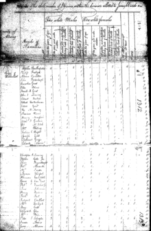 A page of the 1810 United States Census | |
| General information | |
| Country | United States |
| Date taken | August 6, 1810 |
| Total population | 7,239,881 |
| Percent change | |
| Most populous state | New York 959,049 |
| Least populous state | Delaware 72,674 |
The 1810 Census included one new state: Ohio. The original census returns for the District of Columbia, Georgia, Mississippi, New Jersey, and Ohio were lost or destroyed over the years.[2] Most of Tennessee's original forms were also lost, other than Grainger and Rutherford counties.[3]
This was the first census in which New York was ranked as the most populous state. It would occupy this spot for the next fifteen censuses, before being overtaken by California in 1970. This would also be the last census until 1860 in which Philadelphia was ranked as the second-most populous city.
Census questions
The 1810 Census form contained the following information (identical to the 1800 census):
- City or township
- Name of the head of family
- Number of free white males under age 10
- Number of free white males age 10–15
- Number of free white males age 16–25
- Number of free white males age 26–44
- Number of free white males age 45 and over
- Number of free white females under age 10
- Number of free white females age 10–15
- Number of free white females age 16–25
- Number of free white females age 26–44
- Number of free white females age 45 and over
- Number of all other free persons
- Number of slaves
Note to researchers
Census taking was not yet an exact science. Before 1830, enumerators lacked pre-printed forms, and some drew up their own, resulting in pages without headings. Some enumerators did not tally their results. As a result, census records for many towns before 1830 are idiosyncratic. This is not to suggest that they are less reliable than subsequent censuses, but that they may require more work on the part of the researcher.
Data availability
No microdata from the 1810 population census are available, but aggregate data for small areas, together with compatible cartographic boundary files, can be downloaded from the National Historical Geographic Information System.
State rankings
| Rank | State | Population |
|---|---|---|
| 01 | New York | 959,049 |
| 02 | Virginia | 877,683 |
| 03 | Pennsylvania | 810,091 |
| 04 | North Carolina | 556,526 |
| 05 | Massachusetts | 472,040 |
| 06 | South Carolina | 415,115 |
| 07 | Kentucky | 406,511 |
| 08 | Maryland | 380,546 |
| 09 | Connecticut | 262,042 |
| 10 | Tennessee | 261,727 |
| 11 | Georgia | 251,407 |
| 12 | New Jersey | 245,555 |
| 13 | Ohio | 230,760 |
| X | Maine [4] | 228,705 |
| 14 | Vermont | 217,713 |
| 15 | New Hampshire | 214,360 |
| X | West Virginia [5] | 105,469 |
| 16 | Rhode Island | 76,931 |
| X | Louisiana | 76,556 |
| 17 | Delaware | 72,674 |
| X | Mississippi | 31,306 |
| X | Indiana | 24,520 |
| X | Missouri | 19,783 |
| X | District of Columbia [6] | 15,471 |
| X | Illinois | 12,282 |
| X | Alabama | 9,046 |
| X | Michigan | 4,762 |
| X | Arkansas | 1,062 |
City rankings
References
- "Bicentennial Edition: Historical Statistics of the United States, Colonial Times to 1970" (PDF). census.gov.
- Dollarhide, William (2001). The Census Book: A Genealogists Guide to Federal Census Facts, Schedules and Indexes. North Salt Lake, Utah: HeritageQuest. p. 8.
- "Tennessee Census Availability at TSLA and Online". March 5, 2013. Archived from the original on January 23, 2014. Retrieved December 28, 2013.
- Between 1790 and 1820, the District of Maine was part of the state of Massachusetts.
- Between 1790 and 1860, the state of West Virginia was part of Virginia; the data for each states reflect the present-day boundaries.
- The District of Columbia is not a state but was created with the passage of the Residence Act of 1790. The territory that formed that federal capital was originally donated by both Maryland and Virginia; however, the Virginia portion was returned by Congress in 1846.
- Population of the 100 Largest Cities and Other Urban Places in the United States: 1790 to 1990, U.S. Census Bureau, 1998
- "Population of Connecticut Towns 1756-1820". Connecticut Secretary of the State. State of Connecticut. Archived from the original on January 13, 2017. Retrieved April 13, 2020.
- "Regions and Divisions". U.S. Census Bureau. Archived from the original on December 3, 2016. Retrieved September 9, 2016.
External links
| Authority control |
|
|---|