Spotsylvania County, Virginia
Spotsylvania County is a county in the U.S. state of Virginia. As of the 2019 estimate, the population was 136,215.[6] Its county seat is Spotsylvania Courthouse.[7] Spotsylvania is a part of the Baltimore–Washington metropolitan area. Spotsylvania is one of Virginia's fastest-growing counties, largely because of its location along Interstate 95 and its midway point between Washington, D.C., and Richmond, Virginia. It is part of the Baltimore-Washington metropolitan area.
Spotsylvania County | |
|---|---|
| County of Spotsylvania | |
.png) Historic home listed on the National Register of Historic Places in Spotsylvania County | |
 Flag  Seal  Logo | |
| Motto(s): | |
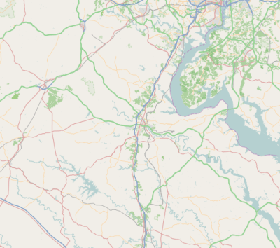
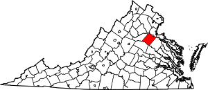 Location within the U.S. state of Virginia | |
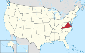 Virginia's location within the U.S. | |
| Coordinates: 38°11′N 77°39′W | |
| Country | |
| State | |
| Founded | 1721 |
| Named for | Alexander Spotswood |
| Seat | Spotsylvania Courthouse |
| Largest community | Spotsylvania Courthouse |
| Area | |
| • Total | 414 sq mi (1,070 km2) |
| • Land | 401 sq mi (1,040 km2) |
| • Water | 13 sq mi (30 km2) 3.1% |
| Population (2010) | |
| • Total | 122,397 |
| • Estimate (2019)[5] | 136,215 |
| • Density | 300/sq mi (110/km2) |
| Time zone | UTC−5 (Eastern) |
| • Summer (DST) | UTC−4 (EDT) |
| Congressional districts | 1st, 7th |
| Website | www |
History
At the time of European encounter, the inhabitants of the area that became Spotsylvania County were a Siouan-speaking tribe called the Manahoac.[8]
As the colonial population increased, Spotsylvania County was established in 1721 from parts of Essex, King and Queen, and King William counties. The county was named in Latin for Lieutenant Governor of Virginia Alexander Spotswood.
Many major battles were fought in this county during the Civil War, including the Battle of Chancellorsville, Battle of the Wilderness, Battle of Fredericksburg, and Battle of Spotsylvania Court House. The war resulted in widespread disruption and opportunity: some 10,000 African-American slaves left area plantations and city households to cross the Rappahannock River, reaching the Union lines and gaining freedom. This exodus is commemorated by historical markers on both sides of the river.[9]
General Stonewall Jackson was shot and mortally wounded by friendly fire in Spotsylvania County during the Battle of Chancellorsville. A group of Confederate soldiers from North Carolina were in the woods and heard General Jackson's party returning from reconnoitering the Union lines. They mistook them for a Federal patrol and fired on them, wounding Jackson in both arms. His left arm was amputated. General Jackson died a few days later from pneumonia at nearby Guinea Station. He and other Confederate wounded were being gathered there for evacuation to hospitals to the south and further away from enemy lines.
Geography
It is bounded on the north by the Rappahannock and Rapidan rivers, the independent city of Fredericksburg (all of which were part of the area's early history), and the counties of Stafford and Culpeper; on the south by the North Anna River and its impoundment, Lake Anna, and by the counties of Hanover and Louisa; on the west by Orange County and Culpeper County; and on the east by Caroline County.
Adjacent counties and independent city
- Culpeper County, Virginia – north
- Stafford County, Virginia – northeast
- City of Fredericksburg, Virginia – northeast
- Caroline County, Virginia – southeast
- Hanover County, Virginia – south
- Louisa County, Virginia – southwest
- Orange County, Virginia – west and northwest
National protected area
Points of interest
- Lake Anna State Park
- Spotsylvania County Public Schools
- Spotsylvania Courthouse
- Fredericksburg and Spotsylvania National Military Park
- Spotsylvania Towne Centre
- Spotsylvania County Sheriff’s Office
- Central Rappahannock Regional Library
- Dominion Raceway
Communities
There are no incorporated towns or cities in Spotsylvania County. Unincorporated communities in the county include:
Census-designated places
Other unincorporated communities
- Alsop
- Arcadia
- Artillery Ridge
- Bells Crossroad
- Belmont
- Blades Corner
- Brandon
- Brockroad
- Brokenburg
- Carters Store
- Chancellor
- Chancellorsville
- Chewnings Corner
- Cookstown
- Cosner's Corner
- Dunavant
- Five Mile Fork
- Four Mile Fork
- Granite Springs
- Lanes Corner
- Leavells
- Lewiston
- Margo
- Marye
- Massaponax
- McHenry
- Old Trap
- Olivers Corner
- Partlow
- Paytes
- Post Oak
- Shady Grove Corner
- Snell
- Stubbs
- Thornburg
- Todds Tavern
Many areas of the county have Fredericksburg addresses.
_in_Fourmile_Fork%2C_Spotsylvania_County%2C_Virginia.jpg)
Governance
County government
Spotsylvania County's highest level of management is that of County Administrator. This post oversees all county departments and agencies and serves as the Spotsylvania County's Board of Supervisors' liaison to state and regional agencies.
Board of Supervisors
Spotsylvania is governed by a Board of Supervisors. The board consists of seven members (one from each district within the county). The Board of Supervisors sets county policies, adopts ordinances, appropriates funds, approves land rezoning and special exceptions to the zoning ordinance, and carries out other responsibilities set forth by the county code.[10]
The following is the current list of supervisors and districts which they represent:
| Position | Name | Affiliation | District | |
|---|---|---|---|---|
| Chairman | Gary Skinner | Independent | Lee's Hill | |
| Vice Chairman | Kevin Marshall | Independent | Berkeley | |
| Member | David Ross | Republican | Courtland | |
| Member | Barry K. Jett | Republican | Livingston | |
| Member | Tim McLaughlin | Independent | Chancellor | |
| Member | Chris Yakabouski | Republican | Battlefield | |
| Member | Deborah Frazier | Independent | Salem | |
State representation
| Office | Name | Party | District | |
|---|---|---|---|---|
| Delegate | Robert D. "Bobby" Orrock | Republican Party | 54 | |
| Delegate | Hyland F. "Buddy" Fowler Jr. | Republican Party | 55 | |
| Delegate | John McGuire | Republican Party | 56 | |
| Delegate | Mark Cole | Republican Party | 88 | |
| Office | Name | Party | District | |
|---|---|---|---|---|
| Senator | Ryan McDougle | Republican Party | 4 | |
| Senator | Bryce Reeves | Republican Party | 17 | |
| Senator | Richard Stuart | Republican Party | 28 | |
Federal representation
Spotsylvania residents are represented by either Abigail Spanberger (D-7th District) or Rob Wittman (R-1st District) in the House of Representatives. The current U.S. Senators from the Commonwealth of Virginia are Mark Warner (D) and Tim Kaine (D).
| Year | Republican | Democratic | Third parties |
|---|---|---|---|
| 2016 | 55.4% 34,623 | 38.7% 24,207 | 6.0% 3,719 |
| 2012 | 54.9% 31,844 | 43.4% 25,165 | 1.7% 965 |
| 2008 | 52.9% 28,610 | 46.1% 24,897 | 1.0% 562 |
| 2004 | 62.8% 28,527 | 36.6% 16,623 | 0.7% 295 |
| 2000 | 59.2% 20,739 | 38.4% 13,455 | 2.4% 827 |
| 1996 | 52.6% 13,786 | 39.5% 10,342 | 7.9% 2,069 |
| 1992 | 49.3% 11,829 | 33.9% 8,133 | 16.9% 4,052 |
| 1988 | 66.2% 10,978 | 33.1% 5,486 | 0.8% 129 |
| 1984 | 66.7% 8,207 | 32.6% 4,012 | 0.6% 78 |
| 1980 | 53.8% 5,385 | 40.4% 4,039 | 5.8% 581 |
| 1976 | 42.5% 3,210 | 55.7% 4,210 | 1.9% 140 |
| 1972 | 65.7% 3,577 | 32.6% 1,775 | 1.7% 90 |
| 1968 | 34.0% 1,675 | 33.4% 1,647 | 32.6% 1,604 |
| 1964 | 37.5% 1,261 | 62.3% 2,097 | 0.3% 9 |
| 1960 | 46.0% 1,288 | 53.0% 1,482 | 1.0% 29 |
| 1956 | 51.9% 1,244 | 41.5% 993 | 6.6% 158 |
| 1952 | 49.0% 1,174 | 49.8% 1,194 | 1.2% 29 |
| 1948 | 34.2% 517 | 54.2% 818 | 11.6% 175 |
| 1944 | 40.3% 504 | 59.5% 744 | 0.2% 3 |
| 1940 | 31.6% 365 | 68.0% 785 | 0.4% 4 |
| 1936 | 35.0% 453 | 64.6% 836 | 0.4% 5 |
| 1932 | 30.2% 346 | 68.4% 784 | 1.5% 17 |
| 1928 | 59.8% 654 | 40.2% 439 | |
| 1924 | 34.7% 255 | 60.9% 448 | 4.5% 33 |
| 1920 | 45.6% 380 | 52.8% 440 | 1.7% 14 |
| 1916 | 38.4% 249 | 61.3% 398 | 0.3% 2 |
| 1912 | 9.4% 58 | 63.2% 390 | 27.4% 169 |
Demographics
| Historical population | |||
|---|---|---|---|
| Census | Pop. | %± | |
| 1790 | 11,252 | — | |
| 1800 | 13,002 | 15.6% | |
| 1810 | 13,296 | 2.3% | |
| 1820 | 14,254 | 7.2% | |
| 1830 | 15,134 | 6.2% | |
| 1840 | 15,161 | 0.2% | |
| 1850 | 14,911 | −1.6% | |
| 1860 | 16,076 | 7.8% | |
| 1870 | 11,728 | −27.0% | |
| 1880 | 14,828 | 26.4% | |
| 1890 | 14,233 | −4.0% | |
| 1900 | 9,239 | −35.1% | |
| 1910 | 9,935 | 7.5% | |
| 1920 | 10,571 | 6.4% | |
| 1930 | 10,056 | −4.9% | |
| 1940 | 9,905 | −1.5% | |
| 1950 | 11,920 | 20.3% | |
| 1960 | 13,819 | 15.9% | |
| 1970 | 16,424 | 18.9% | |
| 1980 | 34,435 | 109.7% | |
| 1990 | 57,403 | 66.7% | |
| 2000 | 90,395 | 57.5% | |
| 2010 | 122,397 | 35.4% | |
| Est. 2019 | 136,215 | [5] | 11.3% |
| U.S. Decennial Census[12] 1790–1960[13] 1900–1990[14] 1990–2000[15] | |||
As of the census[16] of 2010, there were 122,397 people, 31,308 households, and 24,639 families residing in the county. The population density was 226 people per square mile (87/km2). There were 33,329 housing units at an average density of 83 per square mile (32/km2). The racial makeup of the county was:
- 78.4% White
- 15.8% Black or African American
- 0.4% Native American
- 2.4% Asian
- 0.05% Pacific Islander
- 2.8% from other races, and
- 1.88% from two or more races.
7.8% of the population were Hispanic or Latino of any race.
There were 31,308 households, out of which 42.40% had children under the age of 18 living with them, 64.80% were married couples living together, 9.90% had a female householder with no husband present, and 21.30% were non-families. 16.40% of all households were made up of individuals, and 5.40% had someone living alone who was 65 years of age or older. The average household size was 2.87 and the average family size was 3.22.
In the county, the population was spread out, with 30.00% under the age of 18, 7.30% from 18 to 24, 32.20% from 25 to 44, 22.20% from 45 to 64, and 8.30% who were 65 years of age or older. The median age was 34 years. For every 100 females, there were 97.10 males. For every 100 females age 18 and over, there were 93.00 males.
The 2018 median income for a household in the county was $85,330 compared to $58,100 for the United States; the median income for a family was $87,922. Males had a median income of $49,166 versus $38,076 for females. The per capita income for the county was $35,794. About 3.90% of families and 7.5% of the population were below the poverty line, including 6.70% of those under age 18 and 5.20% of those age 65 or over.[17]
Infrastructure
Emergency services
Fire and rescue services in Spotsylvania County are provided by a combination of career and volunteer organizations. The career staff of the Department of Fire, Rescue, and Emergency Management provide fire and rescue services 24/7/365 at all 11 stations, 1 (Courthouse), 2 (Brokenburg), 3 (Partlow), 4 (Four Mile Fork), 5 (Chancellor), 6 (Salem Church), 7 (Wilderness), 8 (Thornburg), 9 (Belmont), 10 (Salem Fields), 11 (Crossroads). Volunteers provide additional staffing nights and weekends at Stations 1, 2, 4, 5, and 8. The volunteer organizations include: Chancellor Volunteer Fire & Rescue, The Spotsylvania Volunteer Fire Department, and The Spotsylvania Volunteer Rescue Squad.[18]
Education
Public schools
Spotsylvania County Public Schools is a public school district serving Spotsylvania County, Virginia. It consists of 17 Elementary, 7 Middle, and 5 High Schools and has a total enrollment of over 24,000 students.[19] The Spotsylvania County School division also has a Career and Technical Center and participates with other local school systems to offer the Commonwealth Governor's School. The district partners with area businesses to develop learning opportunities for the students.[20] Spotsylvania County Public Schools works with the area Parks and Recreation Department to help maintain the area around the Schools (athletic facilities, etc.).
Private schools
- Fredericksburg Academy
- Fredericksburg Christian School
- The Summit Academy
- Odyssey Montessori School
- Saint Patrick School
- Saint Michael the Archangel High School
- Faith Baptist Christian School
- Mount Hope Academy
Colleges and universities
Germanna Community College is part of the Virginia Community College System and serves the City of Fredericksburg, and the counties of Stafford, Spotsylvania, Orange, Culpeper, and King George.
The University of Mary Washington located in neighboring Fredericksburg, Virginia, is a four-year university and graduate school that also serves the area.
Notable people
- Thomas Dickens Arnold, United States Congressman from Virginia[21]
- Francis Asbury (1745–1816), one of the first two bishops of the Methodist Episcopal Church[22]
- Caressa Cameron, Miss Virginia 2009 and Miss America 2010[23]
- Elijah Craig, Baptist minister arrested in Fredericksburg for preaching without a license from the Anglican Church before the American Revolution[24]
- Evelyn Magruder DeJarnette (1842–1914), author[25][26]
- Joe Gibbs, former Washington Redskins coach[27]
- Rahman "Rock" Harper, chef, television personality, and restaurateur [28]
- Alexander Holladay (1811–1877), U. S. Representative
- Kunta Kinte, a.k.a. Toby Waller (1750–1822), character in novel Roots: The Saga of an American Family and television miniseries Roots
- John Maine, pitcher for the New York Mets
- Danny McBride, actor[29]
- Phil Short, former member of the Louisiana State Senate and United States Marine Corps officer[30]
- Matthew Fontaine Maury, father of modern oceanography[31]:452 [32]:2318
References
- "Latin Lovers". The Washington Times. November 4, 2002. Archived from the original on August 30, 2016. Retrieved August 30, 2016.CS1 maint: BOT: original-url status unknown (link)
- "motto". www.jsasoc.com.
- "Clan Spottiswood - ScotClans - Scottish Clans".
- "Surname Database: Spens Last Name Origin". The Internet Surname Database.
- "Population and Housing Unit Estimates". Retrieved July 14, 2019.
- "State & County QuickFacts". United States Census Bureau. Retrieved January 5, 2014.
- "Find a County". National Association of Counties. Retrieved 2011-06-07.
- Swanton, John R. (1952). The Indian Tribes of North America. Smithsonian Institution. pp. 61–62. ISBN 0-8063-1730-2. OCLC 52230544.
- "Trail of Freedom", Rappahannock River Heritage Trail, University of Mary Washington blog
- "Spotsylvania County Home : Departments : Board of Supervisors". Spotsylvania.va.us. Retrieved 2018-01-18.
- David Leip. "Dave Leip's Atlas of U.S. Presidential Elections". Uselectionatlas.org. Retrieved 2018-01-18.
- "U.S. Decennial Census". United States Census Bureau. Retrieved January 5, 2014.
- "Historical Census Browser". University of Virginia Library. Retrieved January 5, 2014.
- "Population of Counties by Decennial Census: 1900 to 1990". United States Census Bureau. Retrieved January 5, 2014.
- "Census 2000 PHC-T-4. Ranking Tables for Counties: 1990 and 2000" (PDF). United States Census Bureau. Retrieved January 5, 2014.
- "U.S. Census website". United States Census Bureau. Retrieved 2011-05-14.
- Census Bureau Median Income Figures Archived 2020-02-10 at Archive.today, census.gov.
- Spotsylvania County Fire;Rescue and Emergency Services Volunteer Agencies Archived 2007-10-14 at the Wayback Machine
- "VDOE :: Fall Membership". Doe.virginia.gov. Retrieved 2010-05-21.
- Annette Jones (2005-09-13). "Incentives for Education Businesses Encourage Learning". The Free Lance-Star. Retrieved 2008-03-15.
- Who Was Who in America, Historical Volume, 1607–1896. Chicago: Marquis Who's Who. 1963.
- now the United Methodist Church in the United States
- Gross, Edie. "Covering Caressa Cameron". www.fredericksburg.com. Archived from the original on 2013-01-23.
- "Fredericksburg Baptist Church" Archived February 21, 2014, at the Wayback Machine, Nomination for National Register of Historic Places, State of Virginia; cf. "The First Hundred Years Were The Hardest". The Free Lance-Star. Fredericksburg, Virginia. November 18, 1967. p. 8.
- Willard, Frances Elizabeth; Livermore, Mary Ashton Rice (1893). A Woman of the Century: Fourteen Hundred-seventy Biographical Sketches Accompanied by Portraits of Leading American Women in All Walks of Life (Public domain ed.). Moulton. pp. 237–.
- Frost, May (Miller) (1954). De Jarnette and Allied Families in America (1699-1954).
- Couloumbis, Angela E. (1996-03-02). "Fawn Lake: On The Water In Spotsylvania". The Washington Post. Retrieved 2018-01-18.
- Black, Jane (2008-12-26). ""Hell's Kitchen" winner Rahman "Rock" Harper Readying Menu for New D.C. Eatery". ISSN 0190-8286. Retrieved 2018-02-17.
- "Movie, TV projects fall in line for local native". Fredericksburg.com. 2008-01-24. Archived from the original on 2013-01-24. Retrieved 2013-09-08.
- "A Virginian in Short". enlou.com. Retrieved November 3, 2009.
- Birth: Stevens, J. A., DeCosta, B. F., Johnston, H. P., Lamb, M. J., & Pond, N. G. (1887). The Magazine of American History with Notes and Queries. A. S. Barnes.
- Father of modern oceanography: Hager, W. H. (2015). Hydraulicians in the USA 1800-2000: A biographical dictionary of leaders in hydraulic engineering and fluid mechanics. CRC Press.
External links
| Wikimedia Commons has media related to Spotsylvania County, Virginia. |
- Spotsylvania County Official Website
- Spotsylvania County Department of Economic Development
- Spotsylvania County Public Schools
- Fredericksburg.com, site of The Free Lance-Star
- Spotsylvania County Virginia Zip Codes
- Spotsylvania County Sheriff's Office
Places adjacent to Spotsylvania County, Virginia | ||||||||||
|---|---|---|---|---|---|---|---|---|---|---|
| ||||||||||
Municipalities and communities of Spotsylvania County, Virginia, United States | ||
|---|---|---|
| CDPs | Map of Virginia highlighting Spotsylvania County | |
| Unincorporated communities |
| |
| Footnotes | ‡This populated place also has portions in an adjacent county or counties | |
| Principal cities (and city-like entities) |
|   | |||||||
|---|---|---|---|---|---|---|---|---|---|
| Counties (and county equivalents) |
| ||||||||
The District of Columbia itself, and Virginia's incorporated cities, are county equivalents. Virginia's incorporated cities are listed under their surrounding county. The incorporated cities bordering more than one county (Alexandria, Falls Church and Fredericksburg) are listed under the county they were part of before incorporation as a city. Some unincorporated areas and census-designated places like Silver Spring and Bethesda in Maryland, Reston in Virginia, as well as the County of Arlington in Virginia are also treated as city-like entities (or principal cities) even though they have not been legally incorporated as such. | |||||||||
| Authority control |
|
|---|