Cambridge, Maryland
Cambridge is a city in Dorchester County, Maryland, United States. The population was 12,326 at the 2010 census. It is the county seat of Dorchester County and the county's largest municipality. Cambridge is the fourth most populous city in Maryland's Eastern Shore region, after Salisbury, Elkton and Easton.[6][7]
Cambridge, Maryland | |
|---|---|
City | |
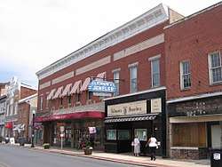 Poplar Street, Downtown Cambridge | |
 Seal | |
| Motto(s): "Living, Working, Relaxing...And Loving It"[1] | |
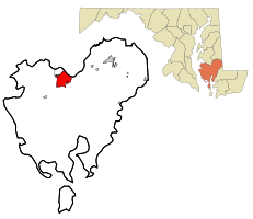 Location in Dorchester County and the State of Maryland | |
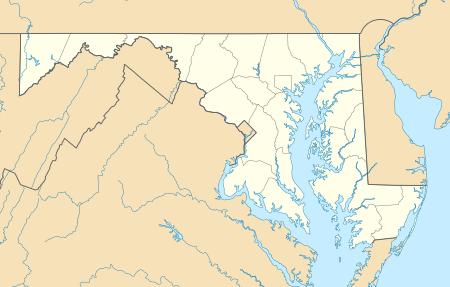 Cambridge Location within the U.S. state of Maryland  Cambridge Cambridge (the United States) | |
| Coordinates: 38°33′59″N 76°4′37″W | |
| Country | |
| State | |
| County | |
| Incorporated | 1793[2] |
| Government | |
| • Mayor | Victoria Jackson-Stanley |
| Area | |
| • Total | 12.95 sq mi (33.54 km2) |
| • Land | 10.65 sq mi (27.58 km2) |
| • Water | 2.30 sq mi (5.96 km2) |
| Elevation | 20 ft (6 m) |
| Population | |
| • Total | 12,326 |
| • Estimate (2019)[5] | 12,260 |
| • Density | 1,151.17/sq mi (444.48/km2) |
| Time zone | UTC−5 (Eastern (EST)) |
| • Summer (DST) | UTC−4 (EDT) |
| ZIP code | 21613 |
| Area code | 410 Exchanges: 221,228,901 |
| FIPS code | 24-12400 |
| GNIS feature ID | 0589879 |
| Website | www |
History
Colonial era

Settled by English colonists in 1684, Cambridge is one of the oldest colonial cities in Maryland.[8] At the time of English colonization, the Algonquian-speaking Choptank Indians were wandering along the river of the same name. During the colonial years, the English colonists developed farming on the Eastern Shore. The largest plantations were devoted first to tobacco, and then mixed farming. Planters bought slaves to farm tobacco and mixed farming. The town was a trading center for the area. The town pier was the center for slave trading for the region, a history well documented by historical markers throughout the town center.
National era
It was incorporated officially in 1793, and occupies part of the former Choptank Indian Reservation.[9] Cambridge was named after the city and county in England.[10] The town became a stop on the Underground Railroad, which had an extensive network of safe houses for slaves escaping to the north.
Cambridge developed food processing industries in the late 19th century, canning oysters, tomatoes and sweet potatoes. Industrial growth in Cambridge was led by the Phillips Packing Company, which eventually grew to become the area's largest employer. The company won contracts with the Department of Defense during the First and Second World wars that aided its growth. At its peak, it employed as many as 10,000 workers.[11] Changing tastes brought about a decline in business leading Phillips to downsize its operations. By the early 1960s the company ceased operations altogether. This led to widescale unemployment and added to the city's growing social problems.[11]
Cambridge movement
During the period from 1962 until 1967, Cambridge was a center of protests during the Civil Rights Movement as local blacks sought equal access to employment and housing. They also sought to end racial segregation of schools and other public accommodations. Riots erupted in Cambridge in 1963 and 1967, and the Maryland National Guard were deployed to the city to assist local authorities with peace-keeping efforts.[12] The leader of the movement was Gloria Richardson. With the passage of the Civil Rights Act of 1964, public segregation in Cambridge officially ended.
Present
In 2002, the city's economy was boosted by jobs and tourism associated with the opening of the 400-room Hyatt Regency Chesapeake Bay resort. This resort includes a golf course, spa, and marina. The resort was the site of the 2007 US House Republican Conference, which included an address by U.S. President George W. Bush, as well as subsequent visits by U.S. President Barack Obama.[13]
Cambridge was designated a Maryland Main Street community on July 1, 2003. Cambridge Main Street is a comprehensive downtown revitalization process created by the Maryland Department of Housing and Community Development. It plans to strengthen the economic potential of select cities around the state. The initiative has led to enhancements of its heritage tourism attractions. Together with other cities on the Eastern Shore, Cambridge is attracting more tourists. It has revitalized its downtown business district, part of which was designated a historical district in 1990.[14]
Four different teams in the old Eastern Shore Baseball League—the Canners, Cardinals, Clippers, and Dodgers—were located in Cambridge.
The Brinsfield I Site, Cambridge Historic District, Wards I and III, Christ Episcopal Church and Cemetery, Dale's Right, Dorchester County Courthouse and Jail, Glasgow, Goldsborough House, LaGrange, Annie Oakley House, Patricia (log canoe), Pine Street Neighborhood Historic District, Rock Methodist Episcopal Church, Stanley Institute, Sycamore Cottage, and Yarmouth are listed on the National Register of Historic Places.[15]
Geography
Cambridge is located at 38°33′59″N 76°4′37″W.[16]
According to the United States Census Bureau, the city has a total area of 12.64 square miles (32.74 km2), of which, 10.34 square miles (26.78 km2) is land and 2.30 square miles (5.96 km2) is water.[17]
Cambridge is on the southern bank of the Choptank River.
Climate and climate mitigation
The climate in this area is characterized by hot, humid summers and generally mild to cool winters. According to the Köppen climate classification system, Cambridge has a humid subtropical climate, abbreviated "Cfa" on climate maps.[18]
A 4.3 MW solar farm in Cambridge supplies about 40% of the power for the National Aquarium, and saves about 1,300 metric tons of carbon dioxide during the summer.[19][20]
Demographics
| Historical population | |||
|---|---|---|---|
| Census | Pop. | %± | |
| 1860 | 1,862 | — | |
| 1870 | 1,642 | −11.8% | |
| 1880 | 2,262 | 37.8% | |
| 1890 | 4,192 | 85.3% | |
| 1900 | 5,747 | 37.1% | |
| 1910 | 6,407 | 11.5% | |
| 1920 | 7,467 | 16.5% | |
| 1930 | 8,544 | 14.4% | |
| 1940 | 10,102 | 18.2% | |
| 1950 | 10,351 | 2.5% | |
| 1960 | 12,239 | 18.2% | |
| 1970 | 11,595 | −5.3% | |
| 1980 | 11,703 | 0.9% | |
| 1990 | 11,514 | −1.6% | |
| 2000 | 10,911 | −5.2% | |
| 2010 | 12,326 | 13.0% | |
| Est. 2019 | 12,260 | [5] | −0.5% |
| U.S. Decennial Census | |||
2010 census
As of the census[4] of 2010, there were 12,326 people, 5,144 households, and 3,040 families residing in the city. The population density was 1,192.1 inhabitants per square mile (460.3/km2). There were 6,228 housing units at an average density of 602.3 per square mile (232.5/km2). The racial makeup of the city was 47.9% African American, 45.9% Euro-American, 0.4% Amerindian, 1.3% Asian, 2.0% from other races, and 2.5% from two or more races. Hispanic or Latino of any race were 4.9% of the population.
There were 5,144 households of which 31.1% had children under the age of 18 living with them, 30.0% were married couples living together, 24.0% had a female householder with no husband present, 5.1% had a male householder with no wife present, and 40.9% were non-families. 34.1% of all households were made up of individuals and 12.8% had someone living alone who was 65 years of age or older. The average household size was 2.31 and the average family size was 2.93.
The median age in the city was 37.6 years. 24.5% of residents were under the age of 18; 9.6% were between the ages of 18 and 24; 24.9% were from 25 to 44; 25.6% were from 45 to 64; and 15.4% were 65 years of age or older. The gender makeup of the city was 45.8% male and 54.2% female.
2000 census
As of the census[21] of 2000, there were 10,911 people, 4,629 households, and 2,697 families residing in the city. The population density was 1,622.3 people per square mile (626.0/km2). There were 4,629 housing units at an average density of 777.6 per square mile (300.0/km2). The racial makeup of the city was 47.75% White, 49.9% Black, 0.16% Native American, 0.65% Asian, 0.01% Pacific Islander, 0.61% from other races, and 0.87% from two or more races. Hispanic or Latino of any race were 1.44% of the population.
There were 4,629 households out of which 27.2% had children under the age of 18 living with them, 30.7% were married couples living together, 23.1% had a female householder with no husband present, and 41.7% were non-families. 36.1% of all households were made up of individuals and 16.7% had someone living alone who was 65 years of age or older. The average household size was 2.23 and the average family size was 2.88.
In the city, the age distribution of the population shows 24.4% under the age of 18, 7.9% from 18 to 24, 26.6% from 25 to 44, 22.3% from 45 to 64, and 18.7% who were 65 years of age or older. The median age was 39 years. For every 100 females, there were 84.2 males. For every 100 females age 18 and over, there were 78.9 males.
The median income for a household in the city was $25,967, and the median income for a family was $32,118. Males had a median income of $25,705 versus $21,221 for females. The per capita income for the city was $15,647. About 17.2% of families and 20.3% of the population were below the poverty line, including 25.0% of those under age 18 and 18.6% of those age 65 or over.
Popular culture
Cambridge was the inspiration of the fictional town Patamoke in James Michener's novel, Chesapeake. In the book, Patamoke is located on a fictitious promontory on the Choptank River, opposite of Cambridge's actual location.[22]
Media
Draper Media broadcasts WCEM (AM), WCEM-FM, WTDK-FM and WAAI-FM radio stations from studios at Cambridge Marketplace. This facility also serves as the home to the Mid-Shore Bureau for WBOC-TV. Weeknights, they cover news affecting Cambridge and surrounding communities.
WHCP-LP 101.5 FM is a community sponsored low powered station broadcasting from studios in downtown Cambridge.
The Dorchester Banner is a weekly newspaper published in Cambridge. The paper was founded by Lindsay C. Marshall and Armistead R. Michie as The Daily Banner, notable for being the Eastern Shore's first daily newspaper. The first issue was published on September 22, 1897.[23]
Infrastructure
Transportation
U.S. Route 50, a major east-west route of the U.S. Highway System, bisects Cambridge on its 3,011 mi (4,846 km) journey from Ocean City, Maryland to Sacramento, California. U.S. 50 is locally known as "Ocean Gateway," with the segment running from the Choptank River to Cambridge's eastern city limit designated "Sunburst Highway."
The Cambridge-Dorchester Airport (FAA Identifier: CGE) is a county-owned, public-use airport located just southeast of the city of Cambridge. The airport is a general aviation facility with a lighted 4,477 foot asphalt runway.
The Maryland & Delaware Railroad (MDDE), a shortline railroad, until recently provided freight rail service to Cambridge. The city had served as the western terminus of the railroad's Seaford Line. The Maryland & Delaware interchanges with the Delmarva Central Railroad at Seaford, Delaware, which in turn interchanges with the Norfolk Southern Railway at Clayton, Delaware. The line remains in place, though rail service was suspended in May 2016 due to derailment issues along the line south of Hurlock, MD.
Horn Point Laboratory
Horn Point Laboratory is home to the largest oyster hatchery on the East Coast.[24][25]
A myth states that in 1699 William Kidd hid treasure, stolen from sugar traders, on land which today is Horn Point Lab. Students and researchers enjoy speculating where the treasure may be.[26]
Notable people
- James A. Adkins, 28th Adjutant General of Maryland and former Secretary of Veterans Affairs of Maryland
- Beatrice Arthur, Emmy and Tony Award-winning actress; star of the television sitcoms Maude and The Golden Girls; grew up in Cambridge, where her parents owned and operated a clothing store; voted "wittiest girl" by classmates at Cambridge High School[27]
- John Barth, writer, born in Cambridge in 1930
- Stephen Allen Benson, second President of Liberia
- Troy Brohawn, retired Major League Baseball player with the Arizona Diamondbacks
- Darnell Clash, football player
- Willis Conover, "Voice of America" DJ, lived in Cambridge during the late 1930s
- Charles Goldsborough (July 15, 1765 – December 13, 1834), State Senator 1791–1795 and 1799–1801, U.S. Congressman 1789–1791, Governor of Maryland 1818–1819
- Phillips Lee Goldsborough (August 6, 1865 – October 22, 1946), a member of the Republican Party (United States), was a United States Senator representing State of Maryland from 1929 to 1935, 47th Governor of Maryland from 1912 to 1916 and Comptroller of the Maryland Treasury from 1898 to 1900
- Emerson Columbus Harrington (March 26, 1864 – December 15, 1945), 48th Governor of Maryland in the United States from 1916 to 1920, Comptroller of the Maryland Treasury from 1912 to 1916
- Thomas Holliday Hicks (September 2, 1798 – February 14, 1865), 31st Governor of Maryland (January 13, 1858 – January 8, 1862), buried in Cambridge Cemetery
- Arty Hill, country singer, was raised here[28]
- Antwan Lake, NFL defensive end who has played with the Detroit Lions, Atlanta Falcons, and New Orleans Saints
- Henry Lloyd (February 21, 1852 – December 30, 1920), 40th Governor of Maryland (1885 to 1888); lived in Dorchester County and Cambridge
- Carolyn Long, opera singer
- William Vans Murray, U.S. Congressman for Maryland's 5th District, 1789–1791
- Annie Oakley, sharpshooter, lived in Cambridge from 1913 to 1915
- Charles Quinn, reporter for NBC News from 1962 to 1980[29]
- Gloria Richardson Dandridge, leader of the Cambridge movement during the Civil Rights Movement, 1962–1964
- Sheriff Robinson, baseball player and coach
- Harriet Tubman, escaped slave and activist on the Underground Railroad
- Jay-Z, lived in Cambridge for a short period, before pursuing a music career[30]
References
- "City of Cambridge, Maryland". City of Cambridge, Maryland. Retrieved August 24, 2012.
- "Cambridge". Maryland Manual. Retrieved June 25, 2017.
- "2019 U.S. Gazetteer Files". United States Census Bureau. Retrieved July 25, 2020.
- "U.S. Census website". United States Census Bureau. Retrieved January 25, 2013.
- "Population and Housing Unit Estimates". United States Census Bureau. May 24, 2020. Retrieved May 27, 2020.
- "U.S. Census website". U.S. Census Bureau. Retrieved June 17, 2011.
- "Find a County". National Association of Counties. Archived from the original on May 31, 2011. Retrieved 2011-06-07.
- History Of Dorchester County, Maryland. Williams & Wilkins. 1902. p. 60.
- "Cambridge, Maryland". Maryland Municipal League. Archived from the original on June 6, 2011. Retrieved April 6, 2009.
- "Profile for Cambridge, Maryland, MD". ePodunk. Archived from the original on September 10, 2015. Retrieved August 24, 2012.
- John R. Wennersten (August 14, 2006). "The Phillips Packing Company". In Beatriz B. Hardy (ed.). Maryland Online Encyclopedia (MdOE) (concept demonstration ed.). jointly by Maryland Historical Society, Maryland Humanities Council, Enoch Pratt Free Library, and Maryland State Department of Education. Archived from the original on July 17, 2014. Retrieved January 21, 2008.
When the Phillips Company ceased its operations in the 1960s, an era had passed.
- Cambridge MD – 1962; Cambridge, MD – 1963 ~ Civil Rights Movement Veterans, accessed Mar 18, 2010
- "President Bush Speaks to the House Republican Conference". georgewbush-whitehouse.archives.gov.
- "Cambridge Historic District, Wards I & III". Maryland's National Register Database. Maryland Historical Trust. Retrieved January 21, 2008.
Wards I and III of the Cambridge Historic District are a large residential, commercial, and governmental area in the northwest section of the city.
- "National Register Information System". National Register of Historic Places. National Park Service. July 9, 2010.
- "US Gazetteer files: 2010, 2000, and 1990". United States Census Bureau. February 12, 2011. Retrieved April 23, 2011.
- "US Gazetteer files 2010". United States Census Bureau. Archived from the original on February 20, 2011. Retrieved 2013-01-25.
- "Cambridge, Maryland Köppen Climate Classification (Weatherbase)". Weatherbase.
- "National Aquarium | Solar Solutions, FTW!". National Aquarium. Retrieved January 28, 2020.
- "National Aquarium, Constellation efforts yield major summer savings". OneEnergy Renewables. September 30, 2015. Retrieved January 28, 2020.
- "U.S. Census website". United States Census Bureau. Retrieved 2008-01-31.
- James Michener, Chesapeake; see also Google maps.
- "Maryland State Archives, Guide to Special Collections". speccol.mdarchives.state.md.us.
- Taylor Robson, Nancy (November 19, 2018). "Planting Hope". Chesapeake Bay Magazine. Retrieved June 2, 2019.
...the University of Maryland Center for Environmental Science’s Horn Point Oyster Hatchery in Cambridge, the largest oyster hatchery on the East Coast.
- "About Horn Point Oyster Hatchery". Horn Point Lab Oyster Hatchery. Retrieved June 2, 2019.
- "Pirates - Chesapeake Bay Program". chesapeakebay.net.
- "Bea Arthur - Jewish Women's Archive". jwa.org.
- "Arty Hill & the Long Gone Daddys". Maryland State Arts Council. Archived from the original on July 5, 2018. Retrieved March 28, 2018.
- McDonough, Megan (July 22, 2013). "Charles N. Quinn, NBC news correspondent". Washington Post. Retrieved August 1, 2013.
- "'Oh, I'm So Good at Math': Lessons From the Jay-Z Business Model". July 15, 2013.
Further reading
- Peter B. Levy, Civil War on Race Street: The Civil Rights Movement in Cambridge, Maryland, Gainesville, Florida: University of Florida Press, 2003
- John R. Wennersten, Maryland's Eastern Shore: A Journey in Time and Place, Centreville, Maryland: Tidewater Publishers, 1992.
External links
| Wikimedia Commons has media related to Cambridge, Maryland. |
| Wikivoyage has a travel guide for Cambridge, Maryland. |
| Wikisource has the text of a 1911 Encyclopædia Britannica article about Cambridge, Maryland. |
- Cambridge, MD Official Website

- . New International Encyclopedia. 1905.
.svg.png)
Municipalities and communities of Dorchester County, Maryland, United States | ||
|---|---|---|
| City | 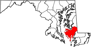 | |
| Towns | ||
| CDP | ||
| Other communities | ||
| Footnotes | ‡This populated place also has portions in an adjacent county or counties | |
| Counties |  | |
|---|---|---|
| Principal city | ||
| Places 5k–20k | ||
| Places 1k–5k | ||
| Authority control |
|
|---|