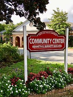
Falls Church, Virginia
Falls Church is an independent city in the Commonwealth of Virginia.[3] As of the 2010 census, the population was 12,332.[4] The estimated population in 2019 was 14,617.[5] Falls Church is included in the Washington metropolitan area.
Falls Church, Virginia | |
|---|---|
| City of Falls Church | |
 | |
 Seal | |
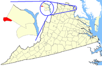 Location of Falls Church in Virginia | |
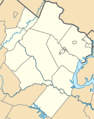 Falls Church Location of Falls Church in Virginia 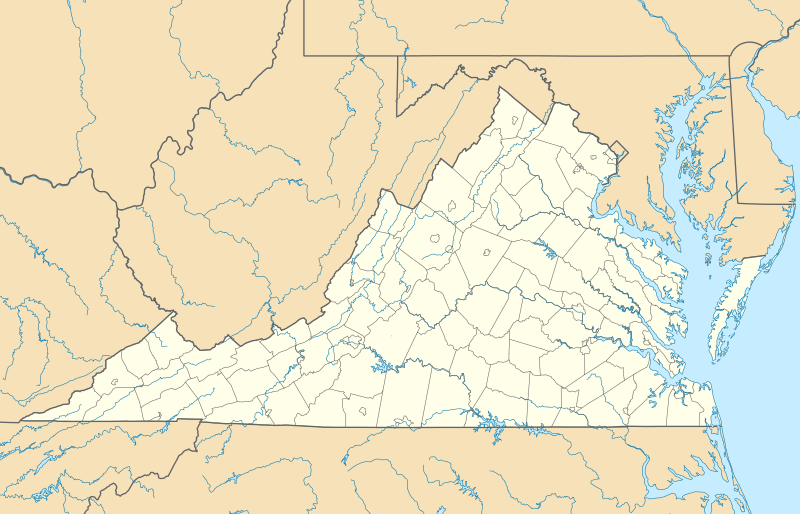 Falls Church Falls Church (Virginia)  Falls Church Falls Church (the United States) | |
| Coordinates: 38°53′09″N 77°10′20″W | |
| Country | |
| State | |
| Pre-incorporation County | |
| Settled | c. 1699 |
| Incorporated (town) | 1875 |
| Incorporated (city) | 1948 |
| Government | |
| • Type | Council–manager |
| • Mayor | David Tarter |
| Area | |
| • Total | 2.05 sq mi (5.30 km2) |
| • Land | 2.05 sq mi (5.30 km2) |
| • Water | 0.00 sq mi (0.00 km2) |
| Elevation | 328 ft (99 m) |
| Population (2010) | |
| • Total | 12,332 |
| • Estimate (2019)[2] | 14,617 |
| • Density | 7,144.18/sq mi (2,757.79/km2) |
| Time zone | UTC−5 (EST) |
| • Summer (DST) | UTC−4 (EDT) |
| ZIP codes | 22040, 22042, 22044, 22046 |
| Area code(s) | 703 and 571 |
| FIPS code | 51-27200 |
| GNIS feature ID | 1495526[3] |
| Website | fallschurchva |
| Sister city is Kokolopori, Democratic Republic of Congo | |
Taking its name from The Falls Church, an 18th-century Church of England (later Episcopal Church) parish, Falls Church gained township status within Fairfax County in 1875. In 1948, it was incorporated as the City of Falls Church, an independent city with county-level governance status although it is not a county.[6]
The city's corporate boundaries do not include all of the area historically known as Falls Church; these areas include portions of Seven Corners and other portions of the current Falls Church postal districts of Fairfax County, as well as the area of Arlington County known as East Falls Church, which was part of the town of Falls Church from 1875 to 1936.[7] For statistical purposes, the U.S. Department of Commerce's Bureau of Economic Analysis combines the City of Falls Church with Fairfax City and Fairfax County.
At 2.11 square miles, Falls Church is the smallest incorporated municipality in the Commonwealth of Virginia and the smallest county-equivalent municipality in the United States.
Etymology
The independent city of Falls Church is named for the 1734 religious institution named The Falls Church founded at the intersection of important Indian trails that were later paved and named Broad Street, Lee Highway and Little Falls Street.[8]
History
The first known government in the area was the Iroquois Confederacy.[9] After exploration by Captain John Smith, England began sending colonists to what they called Virginia.[10] While no records have yet been found showing the earliest colony settlement in the area, a cottage demolished between 1908 and 1914, two blocks from the city center, bore a stone engraved with the date "1699" set into one of its two large chimneys.[11]
During the American Revolution the area is most known for The Falls Church vestrymen George Washington and George Mason.[12] A copy of the United States Declaration of Independence was read to citizens from the steps of The Falls Church during the summer of 1776.[13]
During the American Civil War Falls Church voted 44–26 in favor of secession.[14] The Confederate Army occupied the then village of Falls Church as well as Munson's and Upton's hills to the East, probably due to their views of Washington, D.C..[15] On September 28, 1861, Confederate troops withdrew from Falls Church and nearby hills, retreating to the heights at Centreville. Union troops took Munson's and Upton's hills, yet the village was never entirely brought under Union rule.[16] Mosby's Raiders made several armed incursions into the heart of Falls Church to kidnap and murder suspected Northern sympathizers in 1864 and 1865.[17]
Historic sites
Cherry Hill Farmhouse and Barn, an 1845 Greek-Revival farmhouse and 1856 barn, owned and managed by the city of Falls Church, are open to the public on select Saturdays in summer.[18] Tinner Hill Arch and Tinner Hill Heritage Foundation represent a locus of early African American history in the area, including the site of the first rural chapter of the NAACP. Two of the District of Columbia's original 1791 boundary stones (see: Boundary Markers of the Original District of Columbia) are located in public parks on the boundary between Falls Church and Arlington County. The West cornerstone stands in Andrew Ellicott Park at 2824 Meridian Street, Falls Church and N. Arizona Street, Arlington, just south of West Street.[19] Stone number SW9 stands in Benjamin Banneker Park on Van Buren Street, south of 18th Street, near the East Falls Church Metro station. Most of Banneker Park is in Arlington County, across Van Buren Street from Isaac Crossman Park at Four Mile Run.[20]
Sites on the National Register of Historic Places
| Site | Year built | Address | Listed |
|---|---|---|---|
| Birch House (Joseph Edward Birch House) | 1840 | 312 East Broad Street | 1977 |
| Cherry Hill (John Mills Farm) | 1845 | 312 Park Avenue | 1973 |
| The Falls Church | 1769 | 115 East Fairfax Street | 1970 |
| Federal District Boundary Marker, SW 9 Stone | 1791 | 18th and Van Buren Streets | 1976 |
| Federal District Boundary Marker, West Cornerstone | 1791 | 2824 Meridian Street | 1991 |
| Mount Hope | 1790s | 203 South Oak Street | 1984 |
Geography
According to the United States Census Bureau, the city has a total area of 2.0 square miles (5.2 km2), all of it land and none of it water.[21] Falls Church is the smallest independent city by area in Virginia. Since independent cities in Virginia are considered county-equivalents, it is also the smallest county-equivalent in the United States by area.
The center of the city is the crossroads of Virginia State Route 7 (Broad St./Leesburg Pike) and U.S. Route 29 (Washington St./Lee Highway).
Tripps Run, a tributary of the Cameron Run Watershed, drains two-thirds of Falls Church, while the Four Mile Run watershed drains the other third of the city. Four Mile Run flows at the base of Minor's Hill, which overlooks Falls Church on its north, and Upton's Hill, which bounds the area to its east.[22]
Demographics
| Historical population | |||
|---|---|---|---|
| Census | Pop. | %± | |
| 1880 | 660 | — | |
| 1890 | 792 | 20.0% | |
| 1900 | 1,007 | 27.1% | |
| 1910 | 1,128 | 12.0% | |
| 1920 | 1,659 | 47.1% | |
| 1930 | 2,019 | 21.7% | |
| 1940 | 2,576 | 27.6% | |
| 1950 | 7,535 | 192.5% | |
| 1960 | 10,192 | 35.3% | |
| 1970 | 10,772 | 5.7% | |
| 1980 | 9,515 | −11.7% | |
| 1990 | 9,578 | 0.7% | |
| 2000 | 10,377 | 8.3% | |
| 2010 | 12,332 | 18.8% | |
| Est. 2019 | 14,617 | [2] | 18.5% |
| U.S. Decennial Census[23] 1790–1960[24] 1900–1990[25] 1990–2000[26] | |||
2010 census
As of the census[27] of 2010, Falls Church City had a population of 12,332. The population density was 6,169.1 people per square mile. There were 5,496 housing units. The racial makeup of the city was 80.6% White, 5.3% Black or African American, 0.5% Native American, 9.3% Asian, 0.1% Pacific Islander, and 4.3% from two or more races. Hispanic or Latino of any race were 9.5% of the population.
In the city, the population was spread out, with 7.3% under the age of five, 26.6% under the age of 18, and 11.6% over the age of 65. The percentage of the population that were female was 51%. 74.4% of the population had a bachelor's degree or higher (age 25+).
The median income for a household in the city was $120,000, with 4% of the population below the poverty line, the lowest level of poverty of any independent city or county in the United States.
2000 census
As of the census[28] of 2000, there were 10,377 people, 4,471 households, and 2,620 families residing in the city. The population density was 5,225.8 people per square mile (2,013.4/km2). There were 4,725 housing units at an average density of 2,379.5/sq mi (916.8/km2). The racial makeup of the city was 84.97% White, 3.28% Black or African American, 0.24% Native American, 6.50% Asian, 0.07% Pacific Islander, 2.52% from other races, and 2.43% from two or more races. Hispanic or Latino of any race were 8.44% of the population.
There were 4,471 households, out of which 30.1% had children under the age of 18 living with them; 47.1% were married couples living together, 8.6% had a female householder with no husband present, and 41.4% were non-families. 33.8% of all households were made up of individuals, and 10.1% had someone living alone who was 65 years of age or older. The average household size was 2.31 and the average family size was 3.01.
In the city, the population was spread out, with 23.4% under the age of 18, 5.1% from 18 to 24, 31.1% from 25 to 44, 28.1% from 45 to 64, and 12.2% who were 65 years of age or older. The median age was 40 years. For every 100 females, there were 94.8 males. For every 100 females age 18 and over, there were 89.9 males.
The median income for a household in the city was $74,924, and the median income for a family was $97,225. Males had a median income of $65,227 versus $46,014 for females. The per capita income for the city was $41,051. About 2.8% of families and 4.2% of the population were below the poverty line, including 4.3% of those under age 18 and 4.1% of those age 65 or over.
Economy
In 2011, Falls Church was named the richest county in the United States, with a median annual household income of $113,313.[29] While Fortune 500 companies General Dynamics and Northrop Grumman have headquarters with mailing addresses in Falls Church, they are physically in Fairfax County.[30]
Top employers
According to the city's 2016 Comprehensive Annual Financial Report,[31] the top employers in the City are:
| Employer | Employees |
|---|---|
| Falls Church City Public Schools | 576 |
| City of Falls Church | 312 |
| BG Healthcare | 312 |
| Kaiser Permanente | 257 |
| Tax Analysts | 182 |
| Koons Ford | 167 |
| VL Home Health Care, Inc | 160 |
| BJ's Wholesale Club | 125 |
| Don Beyer Volvo | 119 |
The city has broken ground on several redevelopment projects to be completed in the next few years, including the West Falls Church Economic Development Project and Founders Row along Route 7/Broad street.
Arts and culture
Annual events
The city holds an annual Memorial Day Parade with bands, military units, civic associations, and fire/rescue stations, in recent years the event has featured a street festival with food, crafts, and non-profit organization booths, and a 3K fun run (the 2009 race drew some 3,000 runners).[32] the Falls Church Farmer's Market is held Saturdays year-round, Jan 3 – April 25 (9 am – Noon), May 2 – Dec 26 (8 am – Noon), at the City Hall Parking Lot, 300 Park Ave. In addition to regional attention,[33] in 2010 the market was ranked first in the medium category of the American Farmland Trust's contest to identify America's Favorite Farmers' Markets.[34]
Cultural institutions
The Falls Church Village Preservation and Improvement Society was founded in 1885 by Arthur Douglas and re-established in 1965 to promote the history, culture, and beautification of the city. The Tinner Hill Heritage Foundation was founded in 1997 by Edwin B. Henderson II to preserve the Civil Rights and African American history and culture. Falls Church is where the first rural branch of the NAACP was established stemming from events that took place in 1915, when the town attempted to pass a segregation ordinance by creating segregated districts in the town. The ordinance was not enforced after the U. S. Supreme Court ruling in Buchanan v. Warley in 1917. The Mary Riley Styles Public Library is Falls Church's public library; established in 1928, its current building was constructed for the purpose in 1958 and expanded in 1993.[35] In addition to its circulating collections, it houses a local history collection, including newspaper files, local government documents, and photographs. The State Theatre stages a wide variety of live performances. Built as a movie house in 1936, it was reputed to be the first air-conditioned theater on the east coast. It closed in 1983; after extensive renovations in the 1990s, including a stage, bar, and restaurant, it re-opened as a music venue.[36]
Fountain of Faith
The Fountain of Faith, Swedish sculptor Carl Milles's masterpiece, is in Falls Church's National Memorial Park.
Government
| Year | Republican | Democratic | Third Parties |
|---|---|---|---|
| 2016 | 17.1% 1,324 | 75.0% 5,819 | 7.9% 614 |
| 2012 | 29.5% 2,147 | 68.9% 5,015 | 1.6% 114 |
| 2008 | 29.2% 1,970 | 69.6% 4,695 | 1.3% 85 |
| 2004 | 34.0% 2,074 | 64.7% 3,944 | 1.3% 80 |
| 2000 | 38.1% 2,131 | 55.6% 3,109 | 6.3% 353 |
| 1996 | 38.4% 1,644 | 55.4% 2,375 | 6.2% 265 |
| 1992 | 35.4% 1,912 | 53.0% 2,864 | 11.6% 628 |
| 1988 | 49.5% 2,470 | 49.8% 2,484 | 0.7% 35 |
| 1984 | 52.6% 2,684 | 47.0% 2,398 | 0.4% 19 |
| 1980 | 52.2% 2,485 | 35.8% 1,703 | 12.0% 570 |
| 1976 | 50.6% 2,323 | 48.0% 2,202 | 1.4% 63 |
| 1972 | 60.0% 2,967 | 38.3% 1,895 | 1.6% 81 |
| 1968 | 45.8% 2,005 | 42.5% 1,860 | 11.8% 517 |
| 1964 | 35.9% 1,329 | 64.0% 2,371 | 0.2% 7 |
| 1960 | 48.2% 1,525 | 51.5% 1,629 | 0.4% 11 |
| 1956 | 53.1% 1,462 | 44.8% 1,233 | 2.1% 57 |
| 1952 | 59.8% 1,386 | 40.1% 930 | 0.0% 1 |
Falls Church is governed by a seven-member city council, each elected at large for four-year, staggered terms.[38] Council members are typically career professionals holding down full-time jobs.[38] In addition to attending a minimum of 22 council meetings and 22 work sessions each year, they also attend meetings of local boards and commissions and regional organizations (several Council Members serve on committees of regional organizations as well).[38] Members also participate in the Virginia Municipal League and some serve on statewide committees.[38] The mayor is elected by members of the council.[38] The city operates in a typical council–manager form of municipal government, with a city manager hired by the council to serve as the city's chief administrative officer.[38] The city's elected Sheriff is S. Steven Bittle. Candidates for city elections typically do not run under a nationally affiliated party nomination.[38]
City services and functions include education, parks and recreation, library, police, land use, zoning, building inspections, street maintenance, and storm water and sanitary sewer service. Often named a Tree City USA, the city has one full-time arborist. Some public services are provided by agreement with the city's county neighbors of Arlington and Fairfax, including certain health and human services (Fairfax); and court services, transport, and fire/rescue services (Arlington). The city provided water utility service to a large portion of eastern Fairfax County, including the dense commercial areas of Tysons Corner and Merrifield, until January 2014, when the water utility was sold to the Fairfax County Water Authority.[39]
Education
The city is served by Falls Church City Public Schools:
- Jessie Thackrey Preschool
- Mount Daniel Elementary School, which includes kindergarten through second grade.
- Thomas Jefferson Elementary School, which includes grades 3–5.
- Mary Ellen Henderson Middle School, which includes grades 6–8.
- George Mason High School, which includes grades 9–12.
Of these four Falls Church City Public Schools, one, Mount Daniel Elementary School, is located outside city limits in neighboring Fairfax County.[40] Falls Church High School is not part of the Falls Church City Public School system, but rather the Fairfax County Public School system; it does not serve the city of Falls Church.
Falls Church City is eligible to send up to three students per year to the Fairfax County magnet school, Thomas Jefferson High School for Science and Technology.[41]
The city is home to Saint James Catholic School, a parochial school serving grades K–8, and Grace Christian Academy,[42] a Pre-K to 8th grade Christian parochial school of the Wisconsin Evangelical Lutheran Synod.
Media
The Falls Church News-Press is a free weekly newspaper founded in 1991 that focuses on local news and commentary and includes nationally syndicated columns.[43] The area is also served by national and regional newspapers, including The Washington Examiner, The Washington Times, and The Washington Post. The City is also served by numerous citizen- and corporate-sponsored Internet blogs. WAMU Radio 88.5 produces news and opinion programs with a local focus.
Infrastructure
Transportation
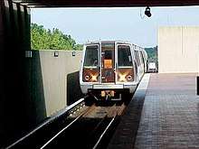
Although two stations on the Washington Metro's Orange Line have "Falls Church" in their names, neither lies within the City of Falls Church: East Falls Church station is in Arlington County and West Falls Church station is in Fairfax County.
- Metro's Silver Line, completed July 2014, serves the East Falls Church station. It runs between Largo Town Center in the east, following the Blue Line route to Stadium-Armory, the Orange and Blue Lines to Rosslyn, and finally the Orange route alone until it reaches East Falls Church, where it branches off towards the northwest, currently terminating at the Wiehle-Reston East station. The next phase of the Silver Line will eventually reach eastern Loudoun County, including a station at Dulles International Airport. East Falls Church is the westernmost designated transfer station.
- The Washington Metropolitan Area Transit Authority provides bus service throughout the Washington metropolitan area, including Falls Church.
- A small portion of the 45-mile (72 km) Washington & Old Dominion Railroad Trail (W&OD Trail) runs through the City (see: Washington & Old Dominion Railroad Regional Park). The trail enters the City from the west between mile markers 7 and 7.5 (near Broad Street). The trail enters the city from the east between mile markers 5.5 and 6. The W&OD Trail travels on the rail bed of the Washington and Old Dominion Railroad and various predecessor lines, which provided passenger service from 1860 to May 31, 1951, with exception of a few years during the U.S. Civil War. Freight service was abandoned when the railroad closed in August 1968. The Four Mile Run Trail, which ends at an intersection with the Mount Vernon Trail near Ronald Reagan Washington National Airport, begins in the city at Van Buren Street. These trails comprise a major bicycle commuting route to Washington, D.C.
Major highways
_at_Virginia_State_Route_7_(Broad_Street)_in_Falls_Church%2C_Virginia.jpg)
The primary roads serving Falls Church directly are U.S. Route 29 and Virginia State Route 7. The portion of US 29 through Falls Church is also coincident with Virginia State Route 237. Most of Virginia State Route 338 is also within Falls Church. Interstate 66 passes just north of the city, while Interstate 495 passes a few miles to the west.
Notable people
- Golnar Adili (1976), multidisciplinary artist[44]
- Tommy Amaker (1965), current men's basketball head coach at Harvard University[45]
- Allan Bridge, conceptual artist[46]
- Jane Brucker, actress and screenwriter[47]
- Hal Corley, Emmy-winning TV writer, published playwright
- Jayme Cramer, backstroke and butterfly swimmer[48]
- Nick Galifianakis, cartoonist[49]
- Ryan Hall, professional mixed martial artist who won the 22nd season of The Ultimate Fighter, now currently competing in the featherweight division of the UFC.
- John Hartman, musician and founding member of The Doobie Brothers[50]
- Molly Henneberg, news reporter, grew up in Falls Church[51]
- Mike Hindert, bass guitarist[52]
- John Kirby, attorney, credited as namesake for Nintendo's character "Kirby"[53]
- Louisa Krause, actress[54]
- Nancy Kyes, film and television actress
- Matthew F. McHugh, former US congressman[55]
- Kyle E. McSlarrow, former Deputy Secretary of the United States Department of Energy
- Alixa Naff, historian[56]
- Joseph Harvey Riley, ornithologist[57]
- Eric Schmidt (1955), Executive Chairman & former CEO of Google, former CEO of Novell, 138th-richest person in the world in 2012[58]
- Mohamed Soltan, political activist[59]
- Fred Talbot (1941–2013), professional baseball player[60]
- Taryn Manning, actress
- Caroline Calloway, Instagram personality
- Tatianna, drag performer and competitor on RuPaul's Drag Race[61]
References
- "2019 U.S. Gazetteer Files". United States Census Bureau. Retrieved August 7, 2020.
- "Population and Housing Unit Estimates". United States Census Bureau. May 24, 2020. Retrieved May 27, 2020.
- "Falls Church". Geographic Names Information System. United States Geological Survey.
- "Geographic Identifiers: 2010 Demographic Profile Data (G001): Falls Church city, Virginia". U.S. Census Bureau, American Factfinder. Retrieved October 20, 2016.
- "Population and Housing Unit Estimates". Retrieved April 1, 2020.
- "Municipal Code of the City of Falls Church: Incorporation and Boundaries". Library1.municode.com:80. Archived from the original on January 21, 2012. Retrieved May 14, 2012.
- Gernard and Netherton, Falls Church: A Virginia Village Revisited, p.65.
- "About Falls Church". Fallschurchva.gov. Retrieved May 14, 2012.
- Bradley E. Gernand and Nan Netherton, Falls Church—A Virginia Village Revisited. Virginia Beach: The Donning Company, 2000. Page 13, citing interviews with Fairfax County archaeologists Michael Johnson and Martha Williams.
- Gernand and Netherton, Falls Church, p. 13, citing Fairfax Harrison, The Landmarks of Old Prince William, pp. 143, 148.
- Gernand and Netherton, Falls Church, p. 13, citing Melvin Steadman, Falls Church By Fence and Fireside, pp. iii, x.
- Gernand and Netherton, Falls Church, p. 27, citing Emily Salmon and Edward Campell, Hornbook of Virginia History, pp. 27–29; Nan Netherton, Fairfax County, pp. 102–103; Tony Wrenn, Falls Church—History of a Village, p. 6.
- Gernand and Netherton, Falls Church, p. 28, citing Beekman, Bridges and the City of Washington, pp. v, 1, 3.
- Gernand, A Virginia Village Goes to War, pp. 22–29, quoting Southern Claims Commission case files and Evening Star newspaper articles.
- Gernand, pp. 56–62, quoting Evening Star, New York Times and Hartford Courant newspaper articles and regimental histories.
- Gernand, A Virginia Village Goes to War, pp. 98-100, quoting newspaper articles published in the New York Times, Evening Star, Elmira Weekly Advertiser, Buffalo Daily Courier, several regimental histories, and soldiers' letters home.
- Gernand, A Virginia Village Goes to War, pp. 191–195, 200–201, 203–211, quoting Southern Claims Commission case files; books regarding Mosby's Raiders; and a local history of Falls Church which cites family members’ statements.
- "About Cherry Hill". Friends of Cherry Hill Foundation, Inc. Retrieved July 12, 2012.
- West cornerstone: Steadman Jr., Melvin Lee (1964). Falls Church: By Fence and Fireside. Falls Church Public Library.:3"Boundary Stones of the District of Columbia". Boundary Stones of the District of Columbia. Archived from the original on December 27, 2014. Retrieved February 19, 2010."Andrew Ellicott Park at the West Cornerstone". Arlington County, Virginia. Archived from the original on October 18, 1996. Retrieved March 31, 2014.
- Stone SW9: "Boundary Stones of the District of Columbia". Boundary Stones of the District of Columbia. Archived from the original on December 27, 2014. Retrieved February 19, 2010."Isaac Crossman Park at Four Mile Run". Arlington County, Virginia. Arlington County, Virginia. Archived from the original on October 18, 1996. Retrieved March 31, 2014.
- "US Gazetteer files: 2010, 2000, and 1990". United States Census Bureau. February 12, 2011. Retrieved April 23, 2011.
- "The Hills and Valleys of Falls Church". Fallschurchenvironment.org. Archived from the original on February 26, 2012. Retrieved May 14, 2012.
- "U.S. Decennial Census". United States Census Bureau. Retrieved January 2, 2014.
- "Historical Census Browser". University of Virginia Library. Retrieved January 2, 2014.
- "Population of Counties by Decennial Census: 1900 to 1990". United States Census Bureau. Retrieved January 2, 2014.
- "Census 2000 PHC-T-4. Ranking Tables for Counties: 1990 and 2000" (PDF). United States Census Bureau. Retrieved January 2, 2014.
- "U.S. Census website". United States Census Bureau. Retrieved May 14, 2011.
- "U.S. Census website". United States Census Bureau. Retrieved January 31, 2008.
- Vardi, Nathan "America's Richest Counties", Forbes, April 11, 2011, accessed June 6, 2011.
- General Dynamics: "Contacts". General Dynamics. Archived from the original on September 9, 2015. Retrieved August 30, 2012.Northrop Grumman:"Locations". Northrop Grumman. Retrieved August 30, 2012.
- "2016 Annual Financial Report, City of Falls Church".
- "Article in Falls Church News-Press, May 2009". Fcnp.com. May 28, 2009. Archived from the original on February 23, 2012. Retrieved May 14, 2012.
- "Stephanie Willis, "Falls Church Farmer's Market," D.C. Foodies, Feb. 2, 2009". Dcfoodies.com. Retrieved May 14, 2012.
- "American Farmland Trust: Current Top 20 America's Favorite Farmers Markets". Action.farmland.org. Archived from the original on September 4, 2011. Retrieved May 14, 2012.
- Mary Riley Styles Public Library – History
- "The State Theatre – History". Thestatetheatre.com. November 27, 1988. Retrieved May 14, 2012.
- http://uselectionatlas.org/RESULTS
- "About the City Council". Fallschurchva.gov. July 14, 2008. Archived from the original on May 11, 2012. Retrieved May 14, 2012.
- "City Agrees to Sell Water System to Fairfax". Falls Church Times. Archived from the original on August 26, 2014. Retrieved August 23, 2014.
- Barton, Mary Ann. "It's Official: Fairfax Water Purchases Falls Church Water System for $40 Million" (Archive). Falls Church Patch. Retrieved on May 2, 2015. "This agreement also included a boundary adjustment that transferred 38.4 acres of land into the City of Falls Church. The largest parcel includes the 36 acres on which the City's George Mason High School and Mary Ellen Henderson Middle School sit."
- Thomas Jefferson High School for Science and Technology
- "Grace Christian Academy".
- "The Publisher: Q&A with Falls Church News-Press Owner-Editor Nicholas F. Benton," Out Front Blog, July 7, 2009 Archived February 1, 2015, at the Wayback Machine
- "Golnar Adili". Victori Contemporary. Archived from the original on October 6, 2016. Retrieved April 10, 2016.
- Fenno, Nathan (April 5, 2006). "Amaker 2006 profile: Who is Tommy Amaker?". Ann Arbor News. reprinted at McVety, Dave (March 17, 2007). "Amaker 2006 profile: Who is Tommy Amaker?". Mlive.com. Retrieved April 2, 2010.
- "Allan Bridge". The Apology Line. Retrieved April 24, 2019.
- "Different Moves". PEOPLE.com. Retrieved April 24, 2019.
- "Player Bio: Jayme Cramer". Stanford University Athletics. Retrieved April 24, 2019.
- Provence, Lisa (March 14, 2012). "Happily-divorced relationship cartoonist tells all". The Hook. Retrieved May 16, 2016.
- Larkin, Colin (May 27, 2011). The Encyclopedia of Popular Music. Omnibus Press. ISBN 9780857125958.
- "More wedding bells at Fox". Washington Examiner. May 16, 2008. Retrieved January 31, 2018.
- Fulton, Robert (October 11, 2009). "Homecoming: The Bravery set to play D.C.'s 9:30 Club". Washington Examiner. Retrieved January 31, 2018.
- "John J. Kirby, lawyer and namesake of the Nintendo character, dies at 79 credits". Retrieved October 7, 2019.
- "Louisa Krause credits". Broadway.com. Retrieved June 9, 2016.
- "McHUGH, Matthew Francis, (1938 - )". Biographical Directory of the United States Congress. Retrieved August 29, 2017.
- Barakat, Matthew (June 5, 2013). "Arab-American scholar Alixa Naff dies at 93". Seattle Times. Associated Press. Archived from the original on July 18, 2014. Retrieved June 30, 2013.
- Alexander Wetmore (1943). "In Memoriam: Joseph Harvey Riley". Auk. 60 (1): 1–15. doi:10.2307/4079305.
- Esposito, Greg (November 10, 2006). "Google CEO gives Va. Tech $2 million". Roanoke.com. Archived from the original on May 26, 2012. Retrieved January 13, 2013.
- "Activist Mohamed Soltan slams Egyptian President Abdel Fattah el-Sisi's regime". Retrieved July 15, 2020.
- "Death Notice: FREDERICK L. TALBOT", The Washington Post, January 16, 2013
- Benton, Nicholas (March 10, 2010). "Falls Church's Tatianna Rocks RuPaul's World". fcnp.com. Retrieved May 27, 2020.
External links
| Wikimedia Commons has media related to Falls Church, Virginia. |

Places adjacent to Falls Church, Virginia | ||||||||||
|---|---|---|---|---|---|---|---|---|---|---|
| ||||||||||
| Principal cities (and city-like entities) |
|   | |||||||
|---|---|---|---|---|---|---|---|---|---|
| Counties (and county equivalents) |
| ||||||||
The District of Columbia itself, and Virginia's incorporated cities, are county equivalents. Virginia's incorporated cities are listed under their surrounding county. The incorporated cities bordering more than one county (Alexandria, Falls Church and Fredericksburg) are listed under the county they were part of before incorporation as a city. Some unincorporated areas and census-designated places like Silver Spring and Bethesda in Maryland, Reston in Virginia, as well as the County of Arlington in Virginia are also treated as city-like entities (or principal cities) even though they have not been legally incorporated as such. | |||||||||
| Authority control |
|---|