Manassas Park, Virginia
Manassas Park is an independent city in the U.S. state of Virginia. As of the 2010 census, the population was 14,273.[5] Manassas Park is bordered by the city of Manassas and Prince William County. Manassas Park is a part of the Washington-Arlington-Alexandria, DC-VA-MD-WV Metropolitan Statistical Area. "A" Fort and Battery Hill Redoubt-Camp Early resides in Manassas Park.
Manassas Park, Virginia | |
|---|---|
| City of Manassas Park | |
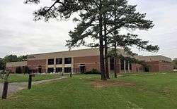 Manassas Park community center | |
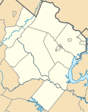 Manassas Park 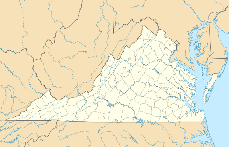 Manassas Park  Manassas Park | |
| Coordinates: 38°46′19″N 77°27′09″W | |
| Country | United States |
| State | Virginia |
| Pre-incorporation County | |
| Incorporated | 1975 |
| Government | |
| • Mayor | Jeanette Rishell |
| Area | |
| • Total | 3.03 sq mi (7.86 km2) |
| • Land | 3.03 sq mi (7.86 km2) |
| • Water | 0.00 sq mi (0.00 km2) |
| Population (2010) | |
| • Total | 14,273 |
| • Estimate (2019)[2] | 17,478 |
| • Density | 5,760.71/sq mi (2,224.36/km2) |
| Time zone | UTC-5 |
| • Summer (DST) | UTC-4 |
| Zip Code | 20111 |
| FIPS code | 51-48968[3] |
| GNIS feature ID | 1495894[4] |
| Website | City of Manassas Park |
History
Manassas Park was incorporated as a town in 1957 and incorporated as a city in 1975.
Education
The city is served by Manassas Park City Schools, with a total of 4 schools: Cougar Elementary, Manassas Park Elementary, Manassas Park Middle, and Manassas Park High School. There are also Private Schools.
Transportation
_at_Conner_Drive%2C_entering_Manassas_Park%2C_Virginia_from_Buckhall%2C_Prince_William_County%2C_Virginia.jpg)
Virginia State Route 28 is the main highway serving the city. From Manassas Park, SR 28 extends north to Interstate 66 and south to Virginia State Route 234, providing connections to major cities through the region.
Virginia State Route 213 follows Manassas Drive, serving as a main roadway within Manassas Park. However, the route designation is unsigned.
Notable people
- Johnny Micheal Spann (1969–2001), was an employee of the Central Intelligence Agency (CIA) and the first American killed in combat after the U.S. invasion of Afghanistan.
Geography
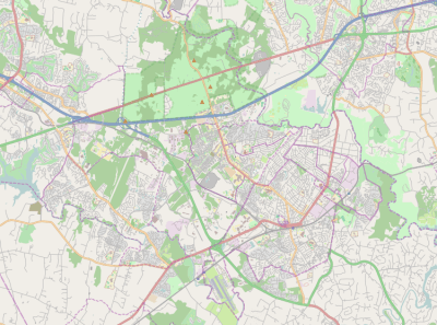
Manassas Park is located at 38°46′19″N 77°27′09″W (38.771944, -77.45250). It is roughly dumbbell-shaped and lies to the south of Bull Run. It is longest NW–SE along Manassas Drive, and is bisected by Virginia State Route 28 at its narrowest section.
According to the United States Census Bureau, the city has a total area of 2.5 square miles (6.5 km2), all of it land.[6]
Adjacent county / Independent city
- Prince William County, Virginia - north, east, south
- Manassas, Virginia - west, southwest
Demographics
| Year | Republican | Democratic | Third Parties |
|---|---|---|---|
| 2016 | 33.1% 1,733 | 61.2% 3,204 | 5.6% 295 |
| 2012 | 36.5% 1,699 | 61.8% 2,879 | 1.7% 78 |
| 2008 | 39.5% 1,634 | 59.5% 2,463 | 1.0% 43 |
| 2004 | 54.2% 1,807 | 45.0% 1,498 | 0.8% 27 |
| 2000 | 54.4% 1,460 | 42.4% 1,048 | 2.8% 72 |
| 1996 | 49.8% 748 | 40.7% 916 | 9.5% 174 |
| 1992 | 46.0% 792 | 33.0% 567 | 21.0% 361 |
| 1988 | 68.7% 993 | 30.0% 434 | 1.3% 19 |
| 1984 | 72.0% 975 | 27.7% 375 | 0.4% 5 |
| 1980 | 58.1% 729 | 35.6% 447 | 6.2% 78 |
| 1976 | 37.3% 444 | 59.6% 709 | 3.0% 36 |
| Historical population | |||
|---|---|---|---|
| Census | Pop. | %± | |
| 1960 | 5,342 | — | |
| 1970 | 6,844 | 28.1% | |
| 1980 | 6,524 | −4.7% | |
| 1990 | 6,734 | 3.2% | |
| 2000 | 10,290 | 52.8% | |
| 2010 | 14,273 | 38.7% | |
| Est. 2019 | 17,478 | [2] | 22.5% |
| U.S. Decennial Census[8] 1790-1960[9] 1900-1990[10] 1990-2000[11] | |||
At the 2000 census there were 10,290 people, 3,254 households and 2,557 families in the city. The population density was 4,129.0 people per square mile (1,595.6/km²). There were 3,365 housing units at an average density of 1,350.3 per square mile (521.8/km²). The racial makeup of the city was 72.79% White, 11.17% African American, 0.44% Native American, 4.06% Asian, 0.07% Pacific Islander, 8.14% from other races, and 3.33% from two or more races. Hispanic or Latino of any race were 15.00%.[12]
Of the 3,254 households 45.4% had children under the age of 18 living with them, 59.9% were married couples living together, 12.1% had a female householder with no husband present, and 21.4% were non-families. 14.4% of households were one person and 2.6% were one person aged 65 or older. The average household size was 3.16 and the average family size was 3.47.
The age distribution was 31.0% under the age of 18, 8.7% from 18 to 24, 40.1% from 25 to 44, 15.9% from 45 to 64, and 4.3% 65 or older. The median age was 30 years. For every 100 females, there were 103.8 males. For every 100 females age 18 and over, there were 103.0 males.
The median household income was $60,794 and the median family income was $61,075. Males had a median income of $38,643 versus $30,942 for females. The per capita income for the city was $21,048. About 4.7% of families and 5.2% of the population were below the poverty line, including 5.8% of those under age 18 and 11.2% of those age 65 or over.
References
- "2019 U.S. Gazetteer Files". United States Census Bureau. Retrieved August 7, 2020.
- "Population and Housing Unit Estimates". United States Census Bureau. May 24, 2020. Retrieved May 27, 2020.
- "U.S. Census website". United States Census Bureau. Retrieved 2008-01-31.
- "US Board on Geographic Names". United States Geological Survey. 2007-10-25. Retrieved 2008-01-31.
- "State & County QuickFacts". United States Census Bureau. Retrieved January 6, 2014.
- "US Gazetteer files: 2010, 2000, and 1990". United States Census Bureau. 2011-02-12. Retrieved 2011-04-23.
- http://uselectionatlas.org/RESULTS
- "U.S. Decennial Census". United States Census Bureau. Retrieved January 6, 2014.
- "Historical Census Browser". University of Virginia Library. Retrieved January 6, 2014.
- "Population of Counties by Decennial Census: 1900 to 1990". United States Census Bureau. Retrieved January 6, 2014.
- "Census 2000 PHC-T-4. Ranking Tables for Counties: 1990 and 2000" (PDF). United States Census Bureau. Retrieved January 6, 2014.
- "U.S. Census website". United States Census Bureau. Retrieved 2011-05-14.
External links
| Principal cities (and city-like entities) |
|   | |||||||
|---|---|---|---|---|---|---|---|---|---|
| Counties (and county equivalents) |
| ||||||||
The District of Columbia itself, and Virginia's incorporated cities, are county equivalents. Virginia's incorporated cities are listed under their surrounding county. The incorporated cities bordering more than one county (Alexandria, Falls Church and Fredericksburg) are listed under the county they were part of before incorporation as a city. Some unincorporated areas and census-designated places like Silver Spring and Bethesda in Maryland, Reston in Virginia, as well as the County of Arlington in Virginia are also treated as city-like entities (or principal cities) even though they have not been legally incorporated as such. | |||||||||
| Authority control |
|
|---|