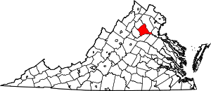
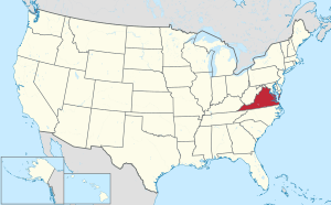
Culpeper County, Virginia
Culpeper County is a county in the central region of the Commonwealth of Virginia. As of the 2010 United States Census, the population was 46,689.[1] Its county seat and only incorporated community is Culpeper.[2]
Culpeper County | |
|---|---|
.jpg) Culpeper County Courthouse | |
 Flag  Seal | |
 Location within the U.S. state of Virginia | |
 Virginia's location within the U.S. | |
| Coordinates: 38°29′N 77°58′W | |
| Country | |
| State | |
| Founded | 1749 |
| Named for | Thomas Colepeper |
| Seat | Culpeper |
| Largest town | Culpeper |
| Area | |
| • Total | 383 sq mi (990 km2) |
| • Land | 379 sq mi (980 km2) |
| • Water | 3.3 sq mi (9 km2) 0.9% |
| Population (2010) | |
| • Total | 46,689 |
| • Estimate (2018) | 51,859 |
| • Density | 120/sq mi (47/km2) |
| Time zone | UTC−5 (Eastern) |
| • Summer (DST) | UTC−4 (EDT) |
| Congressional district | 7th |
| Website | www |
Culpeper County is included in the Washington-Arlington-Alexandria, DC-VA-MD-WV Metropolitan Statistical Area.
History
At the time of European encounter, the inhabitants of future Culpeper County were a Siouan-speaking sub-group of the Manahoac tribe called the Tegninateo.[3] Culpeper County was established in 1749, with territory partitioned from Orange County. The county is named for Thomas Colepeper, 2nd Baron Colepeper, colonial governor of Virginia from 1677 to 1683.
During the Civil War the Battle of Cedar Mountain took place on 9 August 1862, and the Battle of Brandy Station occurred on 9 June 1863, in Culpeper County.
In May 1749, the first Culpeper Court convened in the home of Robert Tureman, near the present location of the Town of Culpeper. In July 1749, Tureman commissioned 17-year-old George Washington as the first County surveyor.[4] One of his first duties was to lay out the County's courthouse complex, which included the courthouse, jail, stocks, gallows and accessory buildings. By 1752 the complex stood at the present northeast corner of Davis and Main Streets. The courthouse village was named Town of Fairfax for Thomas Fairfax, 6th Lord Fairfax of Cameron (1693–1781).[5]

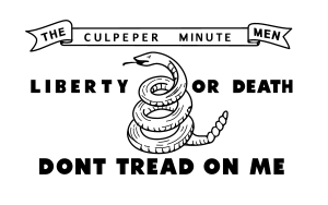
During the Virginia convention held in May 1775, the colony was divided into sixteen districts. Each district had instructions to raise a battalion of men "to march at a minute's notice." Culpeper, Orange and Fauquier, forming one district, raised 350 men in "Clayton's old field" on the Catalpa estate; they were called the Culpeper Minute Men. In December, the Minute Men, marching under their flag depicting a rattlesnake and inscribed with the words "Liberty or Death" and "Don't Tread on Me", took part in the Battle of Great Bridge, the first Revolutionary battle on Virginia soil. The Culpeper Minute Men reorganized in 1860 in response to the impending Civil War and became part of 13th Infantry's Company B, fighting against the US Government forces. The Culpeper Minutemen were again organized for World War I, and joined the 116th Infantry.
In 1833, based on the county's growing population and the need of those in the northwestern area for easier access to a county seat, the upper 267 square miles (692 km2) of Culpeper County was partitioned off to create Rappahannock County, Virginia, which was founded by an act of the Virginia General Assembly.
Culpeper was the boyhood home of Civil War General A. P. Hill, who fought against Union forces.
The negative impact of the Massive Resistance campaign against school integration led to the statewide election of a pro-desegregation governor. By the middle of the 1970s,[6] Culpeper was the last county in Virginia to desegregate its public schools. In 2018 Culpeper County Public Schools[7] has six elementary, two middle schools and two high schools. In 1935 the Rotary Club of Culpeper began a college loan fund, which in 1966 became a four-year scholarship based on academic achievement. The group also provides a Technical School scholarship based on academic achievement.[8]
Culpeper County is home to Commonwealth Park, site for many world-class equestrian events. It was here that actor Christopher Reeve suffered his 1995 accident during a competition.
The town of Culpeper was rated #10 by Norman Crampton, author of "The 100 Best Small Towns in America," in February, 1993.
In April 2016, the county Board of Supervisors denied a routine request from the Islamic Center of Culpeper for a pump and haul permit to serve their envisioned mosque. This resulted in a lawsuit by the US Department of Justice in December.[9]
Geography
_from_the_overpass_for_U.S._Route_522_and_Virginia_State_Route_3_(Germanna_Highway)_just_southeast_of_Culpeper_in_Culpeper_County%2C_Virginia.jpg)
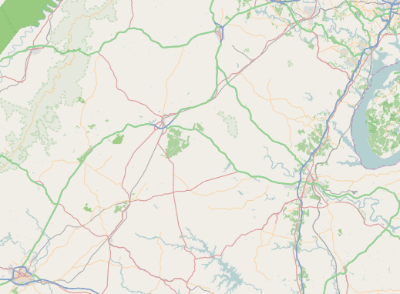
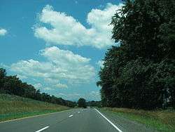
The northeast border of Culpeper County is defined by the Rappahannock River which flows east-southeastward along its border, while the south border of the county is similarly defined by the meanders of the Rapidan River. The Hazel River flows eastward through the county, discharging into the Rappahannock on the county's east border, while the Thornton River also flows eastward through the county, discharging into the Hazel in the north part of the county. The county is in the foothills of the Blue Ridge Mountains, which are quickly accessed beginning with Old Rag Mountain and the Skyline Drive just up Route 522.[10] The rolling hills generally slope to the south and east, with its highest point near its west corner at 705' (215m) ASL.[11] The county has a total area of 383 square miles (990 km2), of which 379 square miles (980 km2) is land and 3.3 square miles (8.5 km2) (0.9%) is water.[12]
Adjacent counties
- Fauquier County - north
- Stafford County – east
- Spotsylvania County - southeast
- Orange County – south
- Madison County – southwest
- Rappahannock County – northwest
Protected areas[10]
- Brandy Station Battlefield Park
- Mountain Run Lake Park
Lakes[10]
- Balds Run Reservoir
- Brandy Rock Farm Lake
- Caynor Lake
- Lake Pelham
- Merrimac/Mountain Run Lake
Government
Board of Supervisors
- Catalpa District: Sue D. Hansohn (R)
- Cedar Mountain District: C. Jack Frazier (I)
- East Fairfax District: Steven L. Walker (R)
- Jefferson District: Brad C. Rosenberger (R)
- Salem District: Alexa V. Fritz (R)
- Stevensburg District: William C. Chase, Jr. Vice Chairman (I)
- West Fairfax District: Gary M. Deal (R)
Constitutional officers
- Clerk of the Circuit Court: Janice J. Corbin (I)
- Commissioner of the Revenue: Terry L. Yowell (I)
- Commonwealth's Attorney: Paul R. Walther (R)
- Sheriff: Scott H. Jenkins (I)
- Treasurer: David L. Dejarnette (R)
Culpeper County is represented by Republicans Bryce E. Reeves, Emmett W. Hanger, Jr., and Jill Holtzman Vogel in the Virginia Senate, Republicans Michael J. Webert and Edward T. Scott in the Virginia House of Delegates, and Democrat Abigail Spanberger in the U.S. House of Representatives.
Culpeper County has been a Republican precinct for several decades. In only one national election since 1948 has the county selected the Democratic Party candidate (as of 2016).
| Year | Republican | Democratic | Third parties |
|---|---|---|---|
| 2016 | 60.1% 13,349 | 34.9% 7,759 | 5.0% 1,110 |
| 2012 | 57.3% 11,580 | 41.0% 8,285 | 1.7% 346 |
| 2008 | 54.3% 10,711 | 44.6% 8,802 | 1.2% 228 |
| 2004 | 64.3% 10,026 | 35.1% 5,476 | 0.7% 103 |
| 2000 | 60.8% 7,440 | 35.6% 4,364 | 3.6% 440 |
| 1996 | 53.9% 5,688 | 37.0% 3,907 | 9.1% 958 |
| 1992 | 49.9% 5,226 | 32.9% 3,444 | 17.2% 1,796 |
| 1988 | 68.6% 5,896 | 29.7% 2,555 | 1.7% 148 |
| 1984 | 70.6% 5,596 | 28.5% 2,255 | 1.0% 75 |
| 1980 | 59.4% 4,312 | 34.7% 2,519 | 5.8% 424 |
| 1976 | 54.6% 3,659 | 43.2% 2,892 | 2.2% 145 |
| 1972 | 72.8% 3,707 | 25.8% 1,316 | 1.4% 69 |
| 1968 | 47.5% 2,229 | 26.4% 1,239 | 26.1% 1,226 |
| 1964 | 48.4% 1,775 | 51.5% 1,886 | 0.1% 4 |
| 1960 | 54.9% 1,630 | 44.8% 1,332 | 0.3% 9 |
| 1956 | 56.4% 1,502 | 36.3% 966 | 7.3% 193 |
| 1952 | 60.3% 1,507 | 39.5% 987 | 0.2% 4 |
| 1948 | 40.1% 682 | 47.3% 804 | 12.5% 213 |
| 1944 | 42.3% 750 | 57.6% 1,022 | 0.1% 1 |
| 1940 | 32.3% 579 | 67.3% 1,208 | 0.4% 7 |
| 1936 | 30.2% 551 | 69.4% 1,266 | 0.4% 7 |
| 1932 | 23.4% 417 | 75.7% 1,349 | 0.9% 16 |
| 1928 | 47.4% 753 | 52.6% 836 | |
| 1924 | 17.2% 190 | 79.1% 876 | 3.8% 42 |
| 1920 | 25.3% 330 | 74.5% 973 | 0.2% 3 |
| 1916 | 17.7% 184 | 81.8% 849 | 0.5% 5 |
| 1912 | 11.8% 108 | 82.2% 752 | 6.0% 55 |
Procurement
Recent media investigations regarding law enforcement procurement of military equipment through the "1033" program offered by the Defense Logistics Agency identified Culpeper County as having received, as donations, a "Mine Resistant Vehicle" in 2013 worth $412,000 and 20 night-vision optics worth an additional $136,000.00.[14] This equipment, valued at more than half a million dollars, was obtained at no additional cost to Culpeper County residents.
Demographics
| Historical population | |||
|---|---|---|---|
| Census | Pop. | %± | |
| 1790 | 22,105 | — | |
| 1800 | 18,100 | −18.1% | |
| 1810 | 18,967 | 4.8% | |
| 1820 | 20,944 | 10.4% | |
| 1830 | 24,027 | 14.7% | |
| 1840 | 11,393 | −52.6% | |
| 1850 | 12,282 | 7.8% | |
| 1860 | 12,063 | −1.8% | |
| 1870 | 12,227 | 1.4% | |
| 1880 | 13,408 | 9.7% | |
| 1890 | 13,233 | −1.3% | |
| 1900 | 14,123 | 6.7% | |
| 1910 | 13,472 | −4.6% | |
| 1920 | 13,292 | −1.3% | |
| 1930 | 13,306 | 0.1% | |
| 1940 | 13,365 | 0.4% | |
| 1950 | 13,242 | −0.9% | |
| 1960 | 15,088 | 13.9% | |
| 1970 | 18,218 | 20.7% | |
| 1980 | 22,620 | 24.2% | |
| 1990 | 27,791 | 22.9% | |
| 2000 | 34,262 | 23.3% | |
| 2010 | 46,689 | 36.3% | |
| Est. 2018 | 51,859 | [15] | 11.1% |
| US Decennial Census[16] 1790–1960[17] 1900–1990[18] 1990–2000[19] | |||
2000 census
As of the 2000 United States Census, there were 34,262 people, 12,141 households, and 9,045 families in the county. The population density was 90.4/sqmi (34.9/km2). There were 12,871 housing units at an average density of 34.0/sqmi (13.1/km2). The racial makeup of the county was 68.27% White, 28.15% Black or African American, 0.33% Native American, 0.66% Asian, 0.01% Pacific Islander, 1.15% from other races, and 1.43% from two or more races. 2.50% of the population were Hispanic or Latino of any race.
There were 12,141 households out of which 35.00% had children under the age of 18 living with them, 58.50% were married couples living together, 11.30% had a female householder with no husband present, and 25.50% were non-families. 20.60% of all households were made up of individuals and 7.90% had someone living alone who was 65 years of age or older. The average household size was 2.68 and the average family size was 3.08.
The county population contained 25.70% under the age of 18, 8.10% from 18 to 24, 31.10% from 25 to 44, 23.30% from 45 to 64, and 11.90% who were 65 years of age or older. The median age was 36 years. For every 100 females, there were 103.30 males. For every 100 females age 18 and over, there were 103.20 males.
The median income for a household in the county was $45,290, and the median income for a family was $51,475. Males had a median income of $36,621 versus $25,985 for females. The per capita income for the county was $20,162. About 27.00% of families and 29.20% of the population were below the poverty line, including 38.30% of those under age 18 and 28.60% of those age 65 or over.
Education
Culpeper County Public Schools
Elementary schools
- A.G. Richardson Elementary
- Culpeper Christian
- Emerald Hill Elementary
- Farmington Elementary
- Pearl Sample Elementary
- Sycamore Park Elementary
- Yowell Elementary
Middle schools
- Culpeper Christian
- Culpeper Middle
- Floyd T. Binns Middle
High schools
Communities
Town
Unincorporated communities[10]
- Alanthus
- Boston
- Brandy Station
- Buena
- Cardova
- Catalpa
- Eggbornsville
- Eldorada
- Elkwood
- Griffinsburg
- Jeffersonton
- Kellys Ford
- Lagrange
- Lignum
- Mitchells
- Rapidan
- Reva
- Richardsville
- Rixeyville
- Stevensburg
- Wakefield
- Waterloo
- Winston
Notable people
- Kenny Alphin - (b. 1963) country music singer
- Thomas Colepeper - Governor of Virginia Colony (1677-1683)
- Pete Hill - (1882-1951) professional baseball player, in Hall of Fame
- Eppa Rixey - (1891-1963) professional baseball player, in Hall of Fame
- D. French Slaughter, Jr. - US Congressman (1985-1991)
- Andrew Stevenson – Speaker of the House of Representatives
- French Strother - (1730-1800) significant political figure in early national history
References
- "State & County QuickFacts". United States Census Bureau. Retrieved January 1, 2014.
- "Find a County". National Association of Counties. Archived from the original on 31 May 2011. Retrieved 7 June 2011.
- Swanton, John R. (1952), The Indian Tribes of North America, Smithsonian Institution, pp. 61–62, ISBN 0-8063-1730-2, OCLC 52230544
- Abbott, W.W., editor. The Papers of George Washington: Colonial Series, Vol. 1 (University Press of Virginia: 1983) p. 9
- Culpeper County Comprehensive Plan, 2005 Archived October 24, 2007, at the Wayback Machine
- Encyclopedia Virginia: Desegregation in Public Schools, accessed March 2018.
- Culpeper County Public Schools official website, accessed March 2018.
- Rotary Club of Culpeper: Scholarships, accessed 2018.
- Washington Post (15 December 2016)
- Culpeper County VA Google Maps (accessed 14 April 2019)
- ""Find an Altitude/Culpeper County VA" Google Maps (accessed 14 April 2019)". Archived from the original on 21 May 2019. Retrieved 14 April 2019.
- "US Gazetteer files: 2010, 2000, and 1990". US Census Bureau. 12 February 2011. Retrieved 23 April 2011.
- Leip, David. "Atlas of US Presidential Elections". uselectionatlas.org. Retrieved 18 October 2018.
- DHS 1033 Program Database http://www.freep.com/article/20140817/NEWS06/140726001
- "Population and Housing Unit Estimates". Retrieved July 14, 2019.
- "US Decennial Census". US Census Bureau. Archived from the original on April 26, 2015. Retrieved January 1, 2014.
- "Historical Census Browser". University of Virginia Library. Retrieved January 1, 2014.
- "Population of Counties by Decennial Census: 1900 to 1990". US Census Bureau. Retrieved January 1, 2014.
- "Census 2000 PHC-T-4. Ranking Tables for Counties: 1990 and 2000" (PDF). US Census Bureau. Retrieved January 1, 2014.
External links
| Wikimedia Commons has media related to Culpeper County, Virginia. |
- Culpeper County Government
- Culpeper County Public Schools
- Culpeper Regional Hospital
- Culpeper Chamber of Commerce
- Culpeper County During the Civil War in Encyclopedia Virginia
Places adjacent to Culpeper County, Virginia | ||||||||||
|---|---|---|---|---|---|---|---|---|---|---|
| ||||||||||
Municipalities and communities of Culpeper County, Virginia, United States | ||
|---|---|---|
| Town | Map of Virginia highlighting Culpeper County | |
| Unincorporated communities | ||
| Principal cities (and city-like entities) |
|   | |||||||
|---|---|---|---|---|---|---|---|---|---|
| Counties (and county equivalents) |
| ||||||||
The District of Columbia itself, and Virginia's incorporated cities, are county equivalents. Virginia's incorporated cities are listed under their surrounding county. The incorporated cities bordering more than one county (Alexandria, Falls Church and Fredericksburg) are listed under the county they were part of before incorporation as a city. Some unincorporated areas and census-designated places like Silver Spring and Bethesda in Maryland, Reston in Virginia, as well as the County of Arlington in Virginia are also treated as city-like entities (or principal cities) even though they have not been legally incorporated as such. | |||||||||
| Authority control |
|
|---|