Tusara
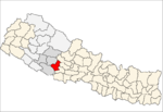
Tusara is a town and Village Development Committee in Pyuthan, a Middle Hills district of Rapti Zone, western Nepal.
Tuzara तुषारा | |
|---|---|
Village Development Committee | |
 Tuzara Location in Nepal | |
| Coordinates: 28.16°N 82.95°E | |
| Country | |
| Region | Mid-Western |
| Zone | Rapti Zone |
| District | Pyuthan District |
| VDC | Tusara |
| Population (2001 Census[1]) | |
| • Total | 4,584 |
| 896 households | |
| Time zone | UTC+5:45 (Nepal Time) |
Villages in this VDC
| Ward | Lat. | Lon | Elev. | ||
|---|---|---|---|---|---|
| Batule | बाटुले | 28°09'N | 82°57'E | 950m | |
| Belghari | बेलघारी | 28°09'N | 82°56'E | 885 | |
| Chhatipata | छातिपाटा | 28°09'N | 82°57'E | 925 | |
| Gabdi | गब्दी | 28°10'N | 82°58'E | 1,230 | |
| Hiddanda | हिडडाँडा | 7 | 28°10'N | 82°56'E | 1,450 |
| Kaprekholagaun | काप्रेखोला | 8 | 28°09'N | 82°58'E | 1,225 |
| Kitghat | किटघाट | 28°09'N | 82°55'E | 870 | |
| TusaraKot | तुषाराकोट | 28°10'N | 82°56'E | 1,670 | |
| Kuta | कुता | 28°10'N | 82°56'E | 1,505 | |
| Kutakholagaun | कुताखोलागाउँ | 28°09'N | 82°56'E | 1,090 | |
| Pidalne | पिडाल्ने | 28°09'N | 82°58'E | 955 | |
| Ratamata | रातामाटा | 28°10'N | 82°58'E | 1,175 | |
| Rattari | राटटारी | 28°08'N | 82°56'E | 905 | |
| Simalchaur | सिमलचौर | 28°09'N | 82°56'E | 915 | |
| Simpani | सिमपानी | 28°09'N | 82°57'E | 1,470 | |
| Tusara | तुषारा | 28°10'N | 82°57'E | 1,550 | |
| Upallo Kot | उपल्लो कोट | 28°11'N | 82°56'E | 1,710 |
gollark: At some point you probably have to decide that some issues aren't really realistic or useful to consider, such as "what if there are significant backdoors in every consumer x86 CPU".
gollark: Presumably most of the data on the actual network links is encrypted. If you control the hardware you can read the keys out of memory or something (or the decrypted data, I suppose), but it's at least significantly harder and probably more detectable than copying cleartext traffic.
gollark: Well, yes, but people really like blindly unverifiably trusting if it's convenient.
gollark: Or you can actually offer something much nicer and better in some way, a "killer app" for decentralized stuff, but if you do that and it's not intrinsically tied to the decentralized thing the big platforms will just copy it.
gollark: Yes, users are bad and won't care unless something directly affects them.
References
- "Nepal Census 2001". Nepal's Village Development Committees. Digital Himalaya. Retrieved 21 September 2008.
- "Index of Geographical Names of Nepal, Volume IV: Mid Western Development Region, List of Settlements, Pyuthan" (PDF). Government of Nepal, National Geographic Information Infrastructure Program. Archived from the original (PDF) on 2011-07-24. Retrieved 2011-03-12.
This article is issued from Wikipedia. The text is licensed under Creative Commons - Attribution - Sharealike. Additional terms may apply for the media files.
