Khabang
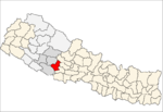
Khabang is a town and Village Development Committee in Pyuthan, a Middle Hills district of Rapti Zone, western Nepal.
Khabang खबाङ | |
|---|---|
Village Development Committee | |
 Khabang Location in Nepal | |
| Coordinates: 28.24°N 82.95°E | |
| Country | |
| Region | Mid-Western |
| Zone | Rapti Zone |
| District | Pyuthan District |
| VDC | Khabang |
| Population (2001 Census[1]) | |
| • Total | 4,217 |
| 769 households | |
| Time zone | UTC+5:45 (Nepal Time) |
Villages in VDC
| Ward | Lat. | Lon | Elev. | ||
|---|---|---|---|---|---|
| Bayapakha | बयपाखा | 28°13'N | 82°56'E | 1,502m | |
| Chisapani | चिसापानी | 28°13'N | 82°57'E | 1,990 | |
| Dhamche | धाम्चे | 28°15'N | 82°56'E | 1,410 | |
| Ekrate | एकराते | 7 | 28°14'N | 82°57'E | 1,950 |
| Ghagu | घागु | 28°15'N | 82°58'E | 1,790 | |
| Ghogalne | घोगाल्ने | 28°14'N | 82°57'E | 1,830 | |
| Jhimp | झिम्प | 5 | 28°14'N | 82°56'E | 1,564 |
| Jhungdi | झुङडी | 2 | 28°12'N | 82°56'E | 1,910 |
| Kainyagaun | काँइयागाउँ | 9 | 28°15'N | 82°56'E | 1,530 |
| Kanaghare | कानाघरे | 28°13'N | 82°57'E | 1,815 | |
| Kaphalbutta | काफलबुट्टा | 28°17'N | 82°57'E | 2,110 | |
| Khabang | खबाङ | 4 | 28°13'N | 82°56'E | 1,530 |
| Khalabang | खलाबाङ | 28°13'N | 82°57'E | 1,490 | |
| Kot | कोट | 28°14'N | 82°56'E | 1,325 | |
| Kukarchen | कुकरचेन | 28°16'N | 82°57'E | 2,050 | |
| Lihi | लिही | 28°14'N | 82°56'E | 1,450 | |
| Lingbang | लिङबाङ | 28°15'N | 82°56'E | 1,330 | |
| Masara | मसरा | 28°14'N | 82°56'E | 1,295 | |
| Naban | नबन | 28°14'N | 82°58'E | 1,975 | |
| Okhaldhunga | ओखलढुङ्गा | 28°15'N | 82°57'E | 1,750 | |
| Phant | फाँट | 28°14'N | 82°57'E | 1,585 | |
| Putlibang | पुत्लीबाङ | 28°14'N | 82°56'E | 1,270 | |
| Ratamata | रातामाटा | 28°13'N | 82°56'E | 1,738 | |
| Rotepani | रोटेपानी | 28°13'N | 82°56'E | 1,478 | |
| Rujim | रुजिम | 28°14'N | 82°58'E | 1,905 | |
| Rumbang | रुमबाङ | 28°15'N | 82°56'E | 1,535 | |
| Sutlaban | सुत्लाबाङ | 28°14'N | 82°57'E | 1,550 | |
| Thulaban | ठूलाबन | 28°15'N | 82°56'E | 1,715 | |
| Thulasiu | ठूलासिउ | 28°13'N | 82°57'E | 1,670 | |
| Balipuk | बालिपुक | 28°13'N | 82°55'E | 1,210 |
gollark: ε
gollark: η
gollark: δoДεcæħæðρoν
gollark: Д
gollark: I can't type that easily.
References
- "Nepal Census 2001". Nepal's Village Development Committees. Digital Himalaya. Archived from the original on 12 October 2008. Retrieved 21 September 2008.
- "Index of Geographical Names of Nepal, Volume IV: Mid Western Development Region, List of Settlements, Pyuthan" (PDF). Government of Nepal, National Geographic Information Infrastructure Program. Archived from the original (PDF) on 2011-07-24. Retrieved 2011-03-12.
This article is issued from Wikipedia. The text is licensed under Creative Commons - Attribution - Sharealike. Additional terms may apply for the media files.
