Chunja, Rapti
Chunja is a town and Village Development Committee in Pyuthan, a Middle Hills district of Rapti Zone, western Nepal.
Chunja चुँजा | |
|---|---|
Village Development Committee | |
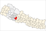
 Chunja Location in Nepal | |
| Coordinates: 28.08°N 82.96°E | |
| Country | |
| Region | Mid-Western |
| Zone | Rapti Zone |
| District | Pyuthan District |
| VDC | Chunja |
| Population (2001 Census[1]) | |
| • Total | 4,526 |
| 855 households | |
| Time zone | UTC+5:45 (Nepal Time) |
Villages in VDC
| Ward | Lat. | Lon | Elev. | |||||||||
|---|---|---|---|---|---|---|---|---|---|---|---|---|
| Arauti | अरौटी | 2 | 28°05'N | 82°57'E | 1,290 | |||||||
| Arbang | अर्बाङ | 1 | 28°05'N | 82°57'E | 1,470 | |||||||
| Barthum | बारथुम | 2 | 28°06'N | 82°57'E | 1,330 | |||||||
| Bhainsamare | भैंसामारे | 6 | 28°04'N | 82°58'E | 1,018 | |||||||
| Birauta | बिरौटा | 5 | 28°04'N | 82°58'E | 950 | |||||||
| Chaduli | चदुली | 28°06'N | 82°58'E | 1,925 | ||||||||
| Chiuriya Bagar | चिउरिया बगर | 5 | 28°04'N | 82°58'E | 1,050 | |||||||
| Chunja | चुँजा | 8 / 9 | 28°04'N | 82°57'E | 1,410 | |||||||
| Chujakharka | चुँजाखर्क | 6 | 28°04'N | 82°58'E | 1,110 | Chitredanda | Darimkharka | दारिमखर्क | 28°05'N | 82°56'E | 1,410 | |
| Dharedhunga | धरेढुङ्गा | 28°06'N | 82°58'E | 1,418 | ||||||||
| Gaira | गैरा | 6 | 28°06'N | 82°59'E | 1,690 | |||||||
| Harthunga | हर्थुङ्गा | 28°06'N | 82°58'E | 1,732 | ||||||||
| Khaniyokhola gaun | खनियोखोलागाउँ | 8 | 28°04'N | 82°57'E | 1,008 | |||||||
| Kharindanda | खरिनडाँडा | 7 | 28°03'N | 82°57'E | 1,050 | |||||||
| Khoriyabari | खोरियाबारी | 28°06'N | 82°59'E | 1,650 | ||||||||
| Lukka | लुक्का | 3 | 28°06'N | 83°00'E | 1,680 | |||||||
| Madukare | मदुकरे | 8 | 28°03'N | 82°57'E | 930 | |||||||
| Majhpani | माझपानी | 28°06'N | 82°59'E | 1,935 | ||||||||
| Marung | मरुङ | 5 | 28°05'N | 82°58'E | 1,035 | |||||||
| Paderakhola gaun | पदेराखोलागाउँ | 28°04'N | 82°57'E | 1,130 | ||||||||
| Padime | पदिमे | 28°06'N | 82°59'E | 1,710 | ||||||||
| Rajme | राज्मे | 28°03'N | 82°58'E | 1,225 | ||||||||
| Salhanna | सलहान्ना | 28°06'N | 82°59'E | 1,818 | ||||||||
| Salithum | सालिथुम | 28°06'N | 82°59'E | 1,635 | ||||||||
| Sindure | सिँदुरे | 28°06'N | 82°58'E | 1,912 | ||||||||
| Siute | सिउते | 6 | 28°04'N | 82°58'E | 1,259 | |||||||
| Syani Lekh | स्यानी लेख | 1 | 28°05'N | 82°56'E | 1,636 | |||||||
| Tham | थाम | 28°05'N | 82°59'E | 1,590 | ||||||||
| Thulachaur | ठूलाचौर | 28°06'N | 83°00'E | 1,910 | ||||||||
| Todke | टोड्के | 28°06'N | 82°58'E | 1,910 | Upallo Rajime | उपल्लो राजिमे | 28°04'N | 82°58'E | 1,496 |
gollark: One often imports a type from a module and the module qualified.
gollark: 'Tis stupid.
gollark: A Foolish Consistency is the Hobgoblin of Little Minds, you know.
gollark: 80 is a ridiculous maximum.
gollark: Screens are big.
References
- "Nepal Census 2001". Nepal's Village Development Committees. Digital Himalaya. Archived from the original on 12 October 2008. Retrieved 21 September 2008.
- "Index of Geographical Names of Nepal, Volume IV: Mid Western Development Region, List of Settlements, Pyuthan" (PDF). Government of Nepal, National Geographic Information Infrastructure Program. Archived from the original (PDF) on 2011-07-24. Retrieved 2011-03-12.
External links
This article is issued from Wikipedia. The text is licensed under Creative Commons - Attribution - Sharealike. Additional terms may apply for the media files.