Hansapur, Rapti
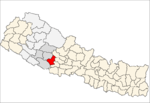
Hansapur is a Village Development Committee in Pyuthan, a Middle Hills district of Rapti Zone, western Nepal. The village lies to the northeast of the district sharing its border mainly to Aargakhanchi. The area is mostly inhabited by Brahmins and other castes, too. The village or VDC is a developing area in the district with proper facilities of electricity and communication. The place is well established for ginger (Aduwa) and bee honey (Maha; local).
Hansapur हंसपुर | |
|---|---|
Village Development Committee | |
 Hansapur Location in Nepal | |
| Coordinates: 27.93°N 82.90°E | |
| Country | |
| Region | Mid-Western |
| Zone | Rapti Zone |
| District | Pyuthan District |
| VDC | Hansapur |
| Population (2001 Census[1]) | |
| • Total | 3,008 |
| 495 households | |
| Time zone | UTC+5:45 (Nepal Time) |
Etymology
hamsa (Nepali: हंस) - soul, spirit, heart
pur (Nepali: पुर)- town or city.
Thus: town of souls
Villages in VDC
| Village| | Ward | Lat. | Lon | Elev. | |
|---|---|---|---|---|---|
| Baguwa | बगुवा | 1 | 27°55'N | 82°55'E | 430m |
| Baike | बैके | 9 | 27°58'N | 82°50'E | 510 |
| Bange | बाङगे | 6 | 27°58'N | 82°52'E | 670 |
| Bangge | बाङगे | 6 | 27°58'N | 82°53'E | 430 |
| Beore | बेवरे | 7 | 27°58'N | 82°51'E | 610 |
| Chabha | चाभा | 6 | 27°57'N | 82°52'E | 890 |
| Dhab | ढाब | 7 | 27°57'N | 82°51'E | 910 |
| Dumai | दुमै | 1 | 27°56'N | 82°56'E | 550 |
| Dhuwakot | दुवाकोट | 8 | 27°57'N | 82°51'E | 990 |
| Ghorlate | घोर्लटे | 5 | 27°57'N | 82°54'E | 690 |
| Gotheri | गोठेरी | 4 | 27°56'N | 82°54'E | 810 |
| Gurungdanda | गुरुङडाँडा | 8 | 27°57'N | 82°51'E | 1,043 |
| Hansapur | हंसपुर | 1 | 27°56'N | 82°54'E | 810 |
| Jabune | जाबुने | 1 | 27°55'N | 82°55'E | 410 |
| Kaskot | कासकोट | 6 | 27°57'N | 82°53'E | 930 |
| Khewarepani | केवरेपानी | 9 | 27°58'N | 82°50'E | 870 |
| Machhedi | मछेडी | 1 | 27°57'N | 82°55'E | 410 |
| Odale | ओदाले | 5 | 27°58'N | 82°53'E | 490 |
| Okhardanda | ओखरडाँडा | 9 | 27°57'N | 82°51'E | 870 |
| Panaha | पनाहा | 7 | 27°58'N | 82°52'E | 430 |
| Sajekot | सजेकोट | 4 | 27°57'N | 82°53'E | 950 |
| Sujinpur | सुजनपुर | 5 | 27°57'N | 82°53'E | 690 |
| Udin dhungga | उदिन ढुङगा | 8 | 27°57'N | 82°52'E | 950 |
gollark: Obvious reasons.
gollark: It isn't as if GTech™ stuff is even operating. Much. Probably.
gollark: I simply automate them. Although for some horrific reason they need an automatic rightclicker.
gollark: It sometimes doesn't consume any. I think the exact random number varies with starlight input (from the actual sky) but it might not. You can apparently use a containment chalice to things.
gollark: The puddle of starlight around it.
References
- "Nepal Census 2001". Nepal's Village Development Committees. Digital Himalaya. Retrieved 21 September 2008.
- "Index of Geographical Names of Nepal, Volume IV: Mid Western Development Region, List of Settlements, Pyuthan" (PDF). Government of Nepal, National Geographic Information Infrastructure Program. Archived from the original (PDF) on 2011-07-24. Retrieved 2011-03-12.
This article is issued from Wikipedia. The text is licensed under Creative Commons - Attribution - Sharealike. Additional terms may apply for the media files.
