Swargadwarikhal
Swargadwarikhal is a Village Development Committee in Pyuthan, a Middle Hills district of Rapti Zone, western Nepal.
Swargadwarikhal स्वर्गद्धारी खाल | |
|---|---|
Village Development Committee | |
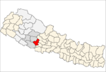
 Swargadwarikhal Location in Nepal | |
| Coordinates: 28.15°N 82.64°E | |
| Country | |
| Region | Mid-Western |
| Zone | Rapti Zone |
| District | Pyuthan District |
| VDC | Swargadwarikhal |
| Population (2001 Census[1]) | |
| • Total | 3,808 |
| 751 households | |
| Time zone | UTC+5:45 (Nepal Time) |
Villages in this VDC
| Ward | Lat. | Lon | Elev. | ||
|---|---|---|---|---|---|
| Adebas | अडेबास | 4 | 28°09'N | 82°38'E | 1,490m |
| Bajam | बाजम | 9 | 28°07'N | 82°37'E | 1,242 |
| Balidhara | बलिधारा | 28°09'N | 82°39'E | 1,495 | |
| Bandrekhola gaun | बान्द्रेखोलागाउँ | 28°08'N | 82°36'E | 1,262 | |
| Bhalkuna | भलकुना | 28°08'N | 82°37'E | 1,551 | |
| Daban | दबन | 28°10'N | 82°38'E | 1,370 | |
| Daiya | दैया | 28°08'N | 82°36'E | 1,618 | |
| Dhanbang | धनबाङ | 1 | 28°09'N | 82°40'E | 1,393 |
| Dhanbangdanda | धनबाङडाँडा | 28°09'N | 82°39'E | 1,725 | |
| Dhandanda | धनडाँडा | 28°08'N | 82°37'E | 1,479 | |
| Ghorkholagaun | घोरखोलागाउँ | 28°10'N | 82°37'E | 1,020 | |
| Hamja | हम्जा | 5 | 28°10'N | 82°38'E | 1,315 |
| Hartap | हार्ताप | 28°09'N | 82°37'E | 1,470 | |
| Jhurbang | झुर्बाङ | 28°07'N | 82°37'E | 1,338 | |
| Jogimara | जोगीमारा | 28°08'N | 82°40'E | 1,885 | |
| Khal | खाल | 28°08'N | 82°37'E | 1,650 | |
| Libja | लिब्जा | 28°08'N | 82°39'E | 1,671 | |
| Nayagaun | नयाँगाउँ | 6 | 28°10'N | 82°37'E | 1,250 |
| Nos | नोस | 7 | 28°09'N | 82°37'E | 1,478 |
| Palla Dhanbang | पल्ला धनबाङ | 28°09'N | 82°40'E | 1,330 | |
| Ritdada | रितडाँडा | 28°08'N | 82°36'E | 1,250 | |
| Salle | सल्ले | 28°10'N | 82°39'E | 1,270 | |
| Sirbigaira | सिर्बि गैरा | 28°08'N | 82°36'E | 1,718 | |
| Sirwali | सिर्वाली | 28°10'N | 82°40'E | 1,685 | |
| Tallo Malarani | तल्लो मालारानी | 28°10'N | 82°40'E | 1,598 | |
| Untuk | उनतुक | 28°07'N | 82°37'E | 1,340 |
gollark: ```osmarks@fenrir /t/home> make dalegcc -o .ogcc: fatal error: no input filescompilation terminated.make: *** [<builtin>: .o] Error 1```now. I'll try with `make clean` then that.
gollark: Maybe I should just compile it manually.
gollark: Perhaps my copy of make is afflicted by a trusting trust attack launched by palaiologos which mysteriously breaks certain makefiles.
gollark: ```osmarks@fenrir /t/home> makegcc -Wall -g -c src/host/posix.c -o src/host/posixgcc -o .ogcc: fatal error: no input filescompilation terminated.make: *** [<builtin>: .o] Error 1```
gollark: `
References
- "Nepal Census 2001". Nepal's Village Development Committees. Digital Himalaya. Retrieved 21 September 2008.
- "Index of Geographical Names of Nepal, Volume IV: Mid Western Development Region, List of Settlements, Pyuthan" (PDF). Government of Nepal, National Geographic Information Infrastructure Program. Archived from the original (PDF) on 2011-07-24. Retrieved 2011-03-12.
External links
This article is issued from Wikipedia. The text is licensed under Creative Commons - Attribution - Sharealike. Additional terms may apply for the media files.