Raspurkot
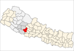
Raspurkot is a town and Village Development Committee in Pyuthan, a Middle Hills district of Province No. 5, western Nepal.
Raspurkot रस्पुरकोट | |
|---|---|
Village Development Committee | |
 Raspurkot Location in Nepal | |
| Coordinates: 28.05°N 82.90°E | |
| Country | |
| Region | Mid-Western |
| Province | Province No. 5 |
| District | Pyuthan District |
| VDC | Raspurkot |
| Population (2001 Census[1]) | |
| • Total | 3,144 |
| 626 households | |
| Time zone | UTC+5:45 (Nepal Time) |
Villages in this VDC
| Name | Native Name | Ward No. | Lat. | Lon | Elev. |
|---|---|---|---|---|---|
| Bali Bisauna | बाली बिसौना | 5 | 28°02'N | 82°55'E | 967m |
| Budhichaur | बुढीचौर | 8 | 28°03'N | 82°55'E | 1,130 |
| Chaurpani | चौरपानी | 8 | 28°03'N | 82°55'E | 1,210 |
| Dandakharka | डाँडाखर्क | 5 | 28°02'N | 82°54'E | 1,170 |
| Darga | दर्गा | 28°03'N | 82°51'E | 790 | |
| Dhuibang | धुइबाङ | 4 | 28°02'N | 82°54'E | 658 |
| Gothibang | गोठीबाङ | 4 | 28°02'N | 82°55'E | 710 |
| Khaban | खबाङ | 3 | 28°02'N | 82°53'E | 725 |
| Raspurkot | रस्पुरकोट | 28°03'N | 82°54'E | 1,590 | |
| Sarangbesi | सराङबेसी | 2 | 28°02'N | 82°52'E | 705 |
| Sinduredanda | सिन्दुरेडाँडा | 28°03'N | 82°52'E | 1,150 |
gollark: Nobody isn't even in the same country.
gollark: How do you *accidentally* get someone's name?
gollark: I still hold that stalking people is very triangular. But nobody also does it, so perhaps he is more okay with it.
gollark: ah yesrandom hexadecimal
gollark: ...
References
- "Nepal Census 2001". Nepal's Village Development Committees. Digital Himalaya. Retrieved 21 September 2008.
- "Index of Geographical Names of Nepal, Volume IV: Mid Western Development Region, List of Settlements, Pyuthan" (PDF). Government of Nepal, National Geographic Information Infrastructure Program. Archived from the original (PDF) on 2011-07-24. Retrieved 2011-03-12.
This article is issued from Wikipedia. The text is licensed under Creative Commons - Attribution - Sharealike. Additional terms may apply for the media files.
