Khung
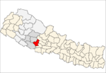
Khung is a village and Village Development Committee in Pyuthan, a Middle Hills district of Province No. 5, western Nepal.
Khung खुङ | |
|---|---|
Village Development Committee | |
 Khung Location in Nepal | |
| Coordinates: 28.20°N 83.02°E | |
| Country | |
| Region | Mid-Western |
| Province | Province No. 5 |
| District | Pyuthan District |
| VDC | Khung |
| Population (2001 Census[1]) | |
| • Total | 2,056 |
| 370 households | |
| Time zone | UTC+5:45 (Nepal Time) |
Villages in this V.D.C.
| Ward | Lat. | Lon | Elev. | ||
|---|---|---|---|---|---|
| Bhedabari | भेडाबारी | 28°13'N | 83°01'E | 1,342m | |
| Chhape | छापे | 28°12'N | 83°01'E | 1,398 | |
| Dashmure | दशमुरे | 8 | 28°11'N | 83°01'E | 1,387 |
| Deurali | देउराली | 28°11'N | 83°02'E | 1,775 | |
| Dihi | डिही | 28°11'N | 83°01'E | 1,317 | |
| Eklesalla | एक्लेसल्ला | 28°12'N | 83°01'E | 1,690 | |
| Khal | खाल | 28°11'N | 83°01'E | 1,545 | |
| Khalchaur | खालचौर | 28°12'N | 83°02'E | 1,885 | |
| Khung | खुङ | 3 | 28°13'N | 83°01'E | 1,590 |
| Ledemela | लेडेमेला | 9 | 28°11'N | 83°01'E | 1,659 |
| Lohata | लोहाटा | 28°12'N | 83°00'E | 1,290 | |
| Ranga Katne | राँगा काट्ने | 28°12'N | 83°02'E | 1,750 | |
| Sali Bisauna | साली बिसौना | 6 | 28°12'N | 83°00'E | 1,170 |
| Sulihale | सुलीहाले | 28°12'N | 83°01'E | 1,625 | |
| Thulo Besi | ठूलो बेसी | 4 | 28°13'N | 83°01'E | 1,145 |
gollark: Or to defragment the system to save space.
gollark: Yes, you could indeed do that.
gollark: Anyway, if you have C++/Java knowledge it shouldn't be *too* hard, the concepts mostly transfer.
gollark: Though I would disagree and say that there are quite a lot of dumb ones.
gollark: It's generally a good idea to ask questions, yes.
References
- "Nepal Census 2001". Nepal's Village Development Committees. Digital Himalaya. Archived from the original on 12 October 2008. Retrieved 21 September 2008.
- "Index of Geographical Names of Nepal, Volume IV: Mid Western Development Region, List of Settlements, Pyuthan" (PDF). Government of Nepal, National Geographic Information Infrastructure Program. Archived from the original (PDF) on 2011-07-24. Retrieved 2011-03-12.
This article is issued from Wikipedia. The text is licensed under Creative Commons - Attribution - Sharealike. Additional terms may apply for the media files.
