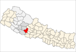
Majhakot, Rapti
Majhakot is a village and Village Development Committee in Pyuthan, a Middle Hills district of Rapti Zone, western Nepal.
Majhakot माझकोट | |
|---|---|
Village Development Committee | |
 Majhakot Location in Nepal | |
| Coordinates: 28.13°N 82.87°E | |
| Country | |
| Region | Mid-Western |
| Zone | Rapti Zone |
| District | Pyuthan District |
| VDC | Majhakot |
| Population (2001 Census[1]) | |
| • Total | 2,357 |
| 476 households | |
| Time zone | UTC+5:45 (Nepal Time) |
Etymology
majha (Nepali: माझ) - middle, center.
kot (Nepali: कोट)- guardroom, prison, police station.
Villages in this VDC
| Ward | Lat. | Lon | Elev. | ||
|---|---|---|---|---|---|
| Ampdhara | आँपधारा | 28°09'N | 82°50'E | 1,195m | |
| Bahundanda | बाहुनडाँडा | 28°08'N | 82°52'E | 1,170 | |
| Dandagaun | डाँडागाउँ | 28°08'N | 82°51'E | 1,670 | |
| Deurali Bhitta | देउराली भित्ता | 28°09'N | 82°50'E | 1,365 | |
| Dhae | धाए | 28°10'N | 82°52'E | 1,630 | |
| Dhanchaur | धनचौर | 28°09'N | 82°52'E | 1,170 | |
| Dhungethanti | ढुङ्गेठाँटी | 28°09'N | 82°50'E | 1,025 | |
| Gurunggaun | गुरुङगाउँ | 1 | 28°08'N | 82°52'E | 1,494 |
| Jumlidhara | जुम्लीधारा | 28°10'N | 82°51'E | 1,730 | |
| Karange | करङ्गे | 28°09'N | 82°51'E | 1,515 | |
| Kholigaun | खोलीगाउँ | 6 | 28°09'N | 82°52'E | 1,618 |
| Kot | कोट | 28°08'N | 82°51'E | 1,665 | |
| Lamkshyang Neta | लमक्ष्याङ नेटा | 4 | 28°09'N | 82°51'E | 1,650 |
| Majhakot | माझकोट | 28°08'N | 82°52'E | 1,545 | |
| Nepane | नेपाने | 28°09'N | 82°50'E | 1,577 | |
| Painyapani | पैंयापानी | 28°09'N | 82°51'E | 1,721 |
gollark: =tex 5.\frac{3}{2}
gollark: Hey, you could implement *hashtags*.
gollark: I'm imagining all the evil stuff I could make stuff do.
gollark: You could call it "5.15". Probably shouldn't. But could.
gollark: Add and subtract are some kind of compose, I forgot which way round, and concat is... some kind of arrowy operator? It returns a new function which runs two functions on the same input and returns two outputs.
References
- "Nepal Census 2001". Nepal's Village Development Committees. Digital Himalaya. Archived from the original on 12 October 2008. Retrieved 21 September 2008.
- "Index of Geographical Names of Nepal, Volume IV: Mid Western Development Region, List of Settlements, Pyuthan" (PDF). Government of Nepal, National Geographic Information Infrastructure Program. Archived from the original (PDF) on 2011-07-24. Retrieved 2011-03-12.
This article is issued from Wikipedia. The text is licensed under Creative Commons - Attribution - Sharealike. Additional terms may apply for the media files.
