Dangbang
Dangbang is a town and Village Development Committee in Pyuthan, a Middle Hills district of Rapti Zone, western Nepal.
Dangwang दाङबाङ | |
|---|---|
Village Development Committee | |
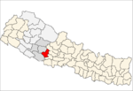
 Dangwang Location in Nepal | |
| Coordinates: 27.95°N 82.98°E | |
| Country | |
| Region | Mid-Western |
| Zone | Rapti Zone |
| District | Pyuthan District |
| VDC | Dangbang |
| Population (2001 Census[1]) | |
| • Total | 3,719 |
| 608 households | |
| Time zone | UTC+5:45 (Nepal Time) |
Villages in VDC
| Ward | Lat. | Lon | Elev. | ||
|---|---|---|---|---|---|
| Airabati | ऐराबती | 27°56'N | 82°57'E | 470m | |
| Amili | अमिली | 4 | 27°57'N | 82°58'E | 1,410 |
| Angri | अङग्री | 27°59'N | 82°59'E | 550 | |
| Baji Pokhari | बाजी पोखरी | 27°57'N | 82°59'E | 1,370 | |
| Batchaur | बाटचौर | 27°57'N | 83°00'E | 1,370 | |
| Belbot | बेलबोट | 4 | 27°56'N | 82°58'E | 830 |
| Besi | बेसी | 27°56'N | 82°58'E | 410 | |
| Bukeni | बुकेनी | 27°58'N | 82°58'E | 890 | |
| Chaklaghat | चाक्लाघाट | 27°58'N | 83°00'E | 530 | |
| Chendhara | चेनधारा | 27°58'N | 82°59'E | 1,213 | |
| Chheda | छेडा | 27°56'N | 83°01'E | 483 | |
| Dabar | डाबर | 27°56'N | 82°59'E | 430 | |
| Dangbang | दाङबाङ | 27°59'N | 82°58'E | 1,190 | |
| Deurali | देउराली | 27°58'N | 82°58'E | 1,236 | |
| Dhanbot | धानबोट | 27°58'N | 82°58'E | 1,410 | |
| Ghakse | घाक्से | 27°57'N | 82°57'E | 1,210 | |
| Juda | जुडा | 27°59'N | 83°00'E | 550 | |
| Khalneta | खल्नेटा | 27°58'N | 82°58'E | 1,470 | |
| Kolbot | कोलबोट | 6 | 27°57'N | 83°00'E | 1,336 |
| Kudule | कुडुले | 27°56'N | 82°58'E | 410 | |
| Majhi Damar | माझी दमार | 27°56'N | 82°59'E | 490 | |
| Majhkhanda | माझखण्ड | 27°55'N | 83°01'E | 520 | |
| Mandre | मान्द्रे | 27°58'N | 83°00'E | 1,213 | |
| Mandrechaur | मान्द्रेचौर | 27°57'N | 83°00'E | 1,013 | |
| Pateri | पतेरी | 27°58'N | 83°00'E | 570 | |
| Rengra | रेङ्गरा | 27°59'N | 82°58'E | 590 | |
| Sajbot | साजबोट | 27°59'N | 82°59'E | 590 | |
| Sallekot | सल्लेकोट | 3 | 27°56'N | 82°57'E | 910 |
| Sarwas | सर्वास | 27°57'N | 82°58'E | 1,310 | |
| Simpani | सिमपानी | 27°56'N | 83°01'E | 530 | |
| Sirsini | सिर्सिनी | 5 | 27°58'N | 82°58'E | 1,450 |
| Takura | टाकुरा | 27°58'N | 82°59'E | 1,050 |
gollark: That's oddly specific.
gollark: Valve doesn't like threes.
gollark: I unfortunately still have 8GB of RAM on my laptop.
gollark: It's just used as a cache or something and I don't know how effectively.
gollark: I mean, except possibly in specific workloads.
References
- "Nepal Census 2001". Nepal's Village Development Committees. Digital Himalaya. Archived from the original on 12 October 2008. Retrieved 21 September 2008.
- "Index of Geographical Names of Nepal, Volume IV: Mid Western Development Region, List of Settlements, Pyuthan" (PDF). Government of Nepal, National Geographic Information Infrastructure Program. Archived from the original (PDF) on 2011-07-24. Retrieved 2011-03-12.
External links
This article is issued from Wikipedia. The text is licensed under Creative Commons - Attribution - Sharealike. Additional terms may apply for the media files.