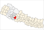
Belbas
Belbas is a Village Development Committee in Pyuthan, a Middle Hills district of Rapti Zone, western Nepal.
Belbas बेलबास | |
|---|---|
Village Development Committee | |
 Belbas Location in Nepal | |
| Coordinates: 28.16°N 82.75°E | |
| Country | |
| Region | Mid-Western |
| Zone | Rapti Zone |
| District | Pyuthan District |
| VDC | Belbas |
| Population (2001 Census[1]) | |
| • Total | 5,333 |
| 1,171 households | |
| Time zone | UTC+5:45 (Nepal Time) |
Etymology
Bel (Nepali: बेल) - an edible fruit-producing tree species, sacred to Lord Shiva and central to a coming of age ceremony for Newar girls.
Bas (Nepali: बास) - resting place or camp.
Thus a resting place with Bel trees.
Villages in VDC
| Ward | Lat. | Lon | Elev. | ||
|---|---|---|---|---|---|
| Basel Tol | बसेल टोल | 28°09'N | 82°46'E | 1,050m | |
| Belbas | बेलबस | 1 | 28°09'N | 82°45'E | 1,235 |
| Bhainsi Lote | भैंसी लोटे | 28°11'N | 82°45'E | 1,650 | |
| Chheda | छेडा | 28°11'N | 82°45'E | 1,625 | |
| Dahachaur | दहचौर | 28°08'N | 82°44'E | 650 | |
| Darenta | दरेन्टा | 28°10'N | 82°47'E | 1,425 | |
| Deurali | देउराली | 28°10'N | 82°47'E | 1,857 | |
| Dhandhara | धानधारा | 28°10'N | 82°47'E | 1,318 | |
| Ghustung | घुस्टुङ | 28°08'N | 82°44'E | 628 | |
| Gurumpa | गुरुम्पा | 28°09'N | 82°46'E | 1,470 | |
| Jhupakot | झुपाकोट | 28°10'N | 82°45'E | 1,745 | |
| Kep | केप | 28°10'N | 82°44'E | 1,138 | |
| Khaireni | खैरेनी | 28°08'N | 82°45'E | 770 | |
| Nalsing | नलसिङ | 28°09'N | 82°43'E | 712 | |
| Nangja | नाङजा | 28°10'N | 82°46'E | 1,405 | |
| Nigala | नाङजा | 28°09'N | 82°45'E | 1,210 | |
| Ninyu | निन्यु | 28°12'N | 82°44'E | 1,570 | |
| Orla | ओर्ला | 28°11'N | 82°44'E | 1,319 | |
| Ranitar | रानीटार | 28°09'N | 82°44'E | 710 | |
| Salabang | सालाबाङ | 28°10'N | 82°46'E | 1,610 | |
| Sikhre | सिख्रे | 28°10'N | 82°44'E | 1,128 | |
| Sotre | सोत्रे | 5 | 28°09'N | 82°44'E | 689 |
| Tapa | तापा | 8 | 28°09'N | 82°43'E | 685 |
| Tapakot | तापाकोट | 28°10'N | 82°44'E | 1,219 | |
| Thapakharka | थापाखर्क | 2 | 28°10'N | 82°45'E | 1,570 |
| Timile | तिमिले | 1 | 28°09'N | 82°46'E | 1,310 |
gollark: ffmpeg is a very convenient audio/video converter tool.
gollark: https://cdn.discordapp.com/attachments/834836108000886805/890803443969695764/aefba502f46e5f061416b2ec54f266baffdfed94ef5f00c425b6ebd48579282c_1.mp4
gollark: It's very bee to compete on how many marketing people you can have pretend to say "humorous" "authentic" things and not how good your product is.
gollark: Fun activity: count all the black dots.
gollark: https://media.discordapp.net/attachments/465999263059673088/889116738980040744/0w8558wwjbo71.png?width=628&height=623
References
- "Nepal Census 2001". Nepal's Village Development Committees. Digital Himalaya. Archived from the original on 12 October 2008. Retrieved 21 September 2008.
- "Index of Geographical Names of Nepal, Volume IV: Mid Western Development Region, List of Settlements, Pyuthan" (PDF). Government of Nepal, National Geographic Information Infrastructure Program. Archived from the original (PDF) on 2011-07-24. Retrieved 2011-03-12.
This article is issued from Wikipedia. The text is licensed under Creative Commons - Attribution - Sharealike. Additional terms may apply for the media files.
