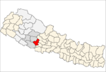
Phopli
Phopli is a town and Village Development Committee within Pyuthan, Rapti Zone, Nepal.
Phopli फोप्ली | |
|---|---|
Village Development Committee | |
 Phopli Location in Nepal | |
| Coordinates: 28.20°N 82.86°E | |
| Country | Nepal |
| Region | Mid-Western |
| Zone | Rapti Zone |
| District | Pyuthan District |
| VDC | Phopli |
| Population (2001 Census[1]) | |
| • Total | 5,050 |
| 1,014 households | |
| Time zone | UTC+5:45 (Nepal Time) |
Villages in this VDC
| Ward | Lat. | Lon | Elev. | ||
|---|---|---|---|---|---|
| Andheri | अँधेरी | 28°11'N | 82°53'E | 958m | |
| Banskot | बाँसकोट | 28°12'N | 82°53'E | 1,310 | |
| Bhaune | भौने | 28°11'N | 82°51'E | 2,030 | |
| Chor Kateri | चोर कटेरी | 28°12'N | 82°51'E | 1,770 | |
| Damai Tol | दमाई टोल | 28°12'N | 82°54'E | 1,345 | |
| Dwarkholagaun | द्वारखोलागाउँ | 28°10'N | 82°53'E | 942 | |
| Gatina | गातिना | 28°11'N | 82°52'E | 1,330 | |
| Ghobange | घोबाङ्गे | 7 | 28°12'N | 82°52'E | 1,648 |
| Goganpani | गोगनपानी | 28°13'N | 82°50'E | 1,710 | |
| Karange | करङ्गे | 28°13'N | 82°51'E | 1,905 | |
| Khairapur | खैरापुर | 3 | 28°11'N | 82°52'E | 1,610 |
| Khamaribas | खामरीबास | 28°12'N | 82°50'E | 2,015 | |
| Luplung | लुपलुङ | 2 | 28°10'N | 82°52'E | 1,690 |
| Mairamare | मैरामारे | 9 | 28°12'N | 82°50'E | 1,841 |
| Marke | मार्के | 28°11'N | 82°53'E | 965 | |
| Patchaur | पातचौर | 28°13'N | 82°51'E | 2,005 | |
| Paule | पौले | 28°12'N | 82°51'E | 1,639 | |
| Phopli | फोप्ली | 6 | 28°11'N | 82°52'E | 1,770 |
| Pokhara | पोखरा | 28°12'N | 82°51'E | 1,771 | |
| Purnagaun | पूर्णगाउँ | 28°11'N | 82°51'E | 1,850 | |
| Sallamare | सल्लामारे | 28°12'N | 82°52'E | 1,490 | |
| Surdip | सुरदिप | 28°13'N | 82°50'E | 1,850 | |
| Syaule | स्याउले | 8 | 28°13'N | 82°50'E | 1,930 |
| Timale | टिमले | 28°12'N | 82°52'E | 1,375 |
gollark: Cells can fix themselves a decent bit.
gollark: Yes, quite often.
gollark: Yes, several times.
gollark: They have their own failure modes.
gollark: Distributed systems are not always *more* robust though.
References
- "Nepal Census 2001". Nepal's Village Development Committees. Digital Himalaya. Retrieved 21 September 2008.
- "Index of Geographical Names of Nepal, Volume IV: Mid Western Development Region, List of Settlements, Pyuthan" (PDF). Government of Nepal, National Geographic Information Infrastructure Program. Archived from the original (PDF) on 2011-07-24. Retrieved 2011-03-12.
This article is issued from Wikipedia. The text is licensed under Creative Commons - Attribution - Sharealike. Additional terms may apply for the media files.
