Khaira, Nepal
Khaira is a town and market center in Pyuthan Municipality in Pyuthan, a Middle Hills district of Rapti Zone, western Nepal. The formerly Village Development Committee along with Pyuthan Khalanga, Bijubar, Dakha Kwadi, Bijaya Nagar, Dharmawati, Maranthana and Khaira was merged to form the new municipality since 18 May 2014.[2][3]
Khaira खैरा | |
|---|---|
 Khaira | |
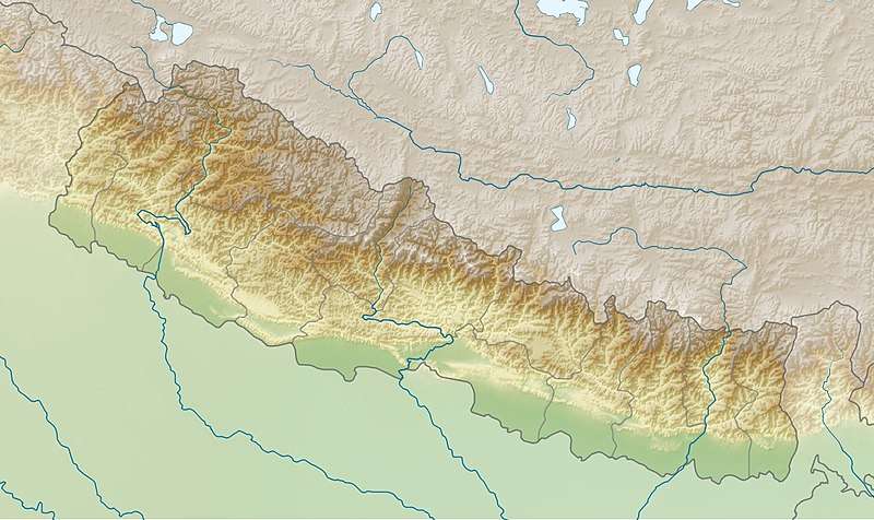
| Coordinates: 28.0761°N 82.8216°E | |
| Country | |
| Region | Mid-Western |
| Zone | Rapti Zone |
| District | Pyuthan District |
| VDC | Khaira |
| Wards | 9 |
| Population (2001 Census[1]) | |
| • Total | 4,217 |
| 769 households (About 7,000 population by ~2010) | |
| Time zone | UTC+5:45 (Nepal Time) |

Climate: There are no systematic weather records in this village, however temperatures average about ten degrees Celsius in winter and 30 degrees in summer. The climate is very pleasant overall. Monsoon rains last from June until August.
Ethnic groups: Mainly Bahun and Chhetri with some Magar, Kami and Damai. Wards 6 and 7 are mainly Bahun. Wards 8 and 9 are mainly Chhettri.
Occupations: The main occupations are agriculture and animal husbandry. Husbandry is not on a commercial scale but to meet household needs for milk, meat and dung for compost. Cows and buffalo for are kept for milk; goat and chicken for meat. There is also some employment in government offices and teaching.
Education: Literacy rates are very high for Bahun and Chhetri castes, but low for other ethnic groups. As of 2010, there are four Ph.D graduates (Hari Prasad Acharya, Bharat Mani Pokhrel, Chandra Pokhrel and Damodar Pokhrel) from this village, plus many with master's degrees.
Primary Schools:
- Adarsha Prathamik Vidhyalaya in Kandrakhola, ward no. 1
- Bhumi Bikas Prathamik Vidhyalaya in Sarangkot, ward no. 2
- Bhimishwori Prathamik Vidhyalaya in Kumikot, ward no. 3
- Bhumeshwori Prathamik Vidhyalaya in Hingkhola, ward no. 7
- Srijana Prathamik Vidhyalaya in Dhanda, ward no. 8.
Enrollment in primary school (classes 1-5): 519 girls, 481 boys
Higher Secondary School: Bhubaneshowari Uchcha Madhyamik Vidhyalaya in Sulikhark, ward no. 6
After high school graduation, students may go to Swargadwari campus in the same district or to schools in other districts depending on the area of specialization. As of 2010 there are plans to add two years of college science to the curriculum at nearby Mukti Madhyamik Vidhyalaya in Ratamata, Bijaya Nagar VDC.
Health care: There is one health center. Patients go to a hospital in Bijuwar for serious cases or for better care.
NGOs: Two NGOs work to eradicate poverty and illiteracy. Phulbari Integrated Rural Development Organization, commonly known as Phulbari Club is located in wards no. 7 while other one is located in ward no. 6.
Technology: Some homes—mainly in wards 6, 7, 8 and 9-have current information technologies like Internet, telephone and television. Other homes do not have these because they lack electricity or purchasing power.
Road access: As the topology goes from plain low lands to big mountains with many ups and downs, there is no motor-road network connecting all wards of the village. A motor-road connects the village gives access to Khalanga the headquarters of Pyuthan district. Another motor-road connects wards 6, 7 and 8 to Bijuwar through Kwadi. For shopping purposes, people mostly go to Bijuwar.
Fuel: There is a twelve megawatt hydroelectric project nearby at Cherneta exploiting the 150 meter elevation difference between the Jhimruk and Madi rivers where they are less than two kilometers apart. Residents of the ward 6, 7, 8 and 9 get electricity from this project. Kerosene lamps are the alternative source of light. Wood is the main fuel for cooking.
Crops: Rice, maize, barley, wheat, mustard, potato, cabbage and cauliflower. The Jhimruk river flowing near the village has a fertile floodplain ideal for irrigated fields.
Diet: Main meals are dal-bhat-tarkari (lentil soup and boiled rice with vegetables and chutney or pickle) in the morning and evening. In the afternoon a light meal of bread and/or roasted soybeans with tea or buttermilk may be taken.
Religion: Almost all people of this village follow Hindu religion. They observe festivals common to most Nepalese, including Teej, Dasain, Tihar, Maghe Sankranti, first day of new year and Janai Purnima (a holy day to change sacred threads for Bahun and Chhetri).
Temples and holy places:
- Bhumesthan in Khairakot, ward no. 8
- Jhakrithan in Thulodhunga, ward no. 9
- Gorakhnath temple in Kholapari, ward no. 7
- Shiva temple (Shivalaya) established by Dr. Hari Prasad Acharya, in Aanplapata, ward no. 6
Villages in VDC
| Ward | Lat. | Lon | Elev. | ||
|---|---|---|---|---|---|
| Badchaur | बडचौर | 28°04'N | 82°49'E | 779m | |
| Banskholagaun | बाँसखोलागाउँ | 28°05'N | 82°51'E | 982 | |
| Beldanda | बेलडाँडा | 28°04'N | 82°50'E | 1,110 | |
| Darbang | दरबाङ | 28°03'N | 82°51'E | 1,243 | |
| Dhundi | धुँदी | 28°03'N | 82°50'E | 722 | |
| Ganjuri | गाँजुरी | 28°05'N | 82°50'E | 765 | |
| Ghorthap | घोरथाप | 28°03'N | 82°50'E | 1,010 | |
| Khaira | खैरा | 28°04'34"N | 82°49'18"E | 770 | |
| Khairakot | खैराकोट | 8 | 28°04'N | 82°51'E | 1,410 |
| Kumikot | कुमिकोट | 3 | 28°04'N | 82°50'E | 1,055 |
| Kusmarukh | कुस्मारुख | 28°05'N | 82°50'E | 1,270 | |
| Pakhapani | पाखापानी | 28°04'N | 82°51'E | 1,053 | |
| Ramche | राम्चे | 28°04'N | 82°52'E | 1,130 | |
| Rapchu | रप्चु | 28°04'N | 82°51'E | 1,205 | |
| Sarangkot | सराङकोट | 2 | 28°03'N | 82°51'E | 1,270 |
| (need lat./lon., elevation) | |||||
| Kandrakhola | कन्द्राखोला | 1 | |||
| Hingkhola | हिङखोला | 7 | |||
| Dhanda | ढाँडा | 8 | |||
| Sulikharka | सुलीखर्क | 6 | |||
| Anplapata | आँपलपाटा | 6 | |||
| Thulodhunga | ठूलोढुङ्गा | 9 | |||
| Kholapari | खोलापरि | 7 |
References
- "Nepal Census 2001". Nepal's Village Development Committees. Digital Himalaya. Archived from the original on 12 October 2008. Retrieved 21 September 2008.
- "72 new municipalities announced". My Republica.com. Archived from the original on 2014-06-18. Retrieved 2014-06-10.
- "Government announces 72 new municipalities". The Kathmandu Post. Archived from the original on 2014-10-06. Retrieved 2014-06-10.
- "Index of Geographical Names of Nepal, Volume IV: Mid Western Development Region, List of Settlements, Pyuthan" (PDF). Government of Nepal, National Geographic Information Infrastructure Program. Archived from the original (PDF) on 2011-07-24. Retrieved 2011-03-12.
External links