Tiram
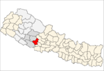
Tiram is a town and Village Development Committee in Pyuthan, a Middle Hills district of Rapti Zone, western Nepal.
Mandabi Gaupalika 1 तिराम Dhurunga | |
|---|---|
Village Development Committee | |
 Mandabi Gaupalika 1 Location in Nepal | |
| Coordinates: 28.02°N 82.77°E | |
| Country | |
| Region | Mid-Western |
| Zone | Rapti Zone |
| District | Pyuthan District |
| VDC | Tiram |
| Wards | 1 |
| Population (2001 Census[1]) | |
| • Total | 4,926 |
| 827 households | |
| Time zone | UTC+5:45 (Nepal Time) |
| 28°01′04″N 082°46′14″E | |
Tiram is a hill town surrounded by terraced rice fields with a mostly Bahun and Chhetri population. It is the home of a politically prominent family named Upadhyaya. Tiram is situated on a spur of the Mahabharat Range overlooking Mardi Khola, the largest tributary of the Rapti.
A motorable gravel road from Tribhuwannagar, Dang Deokhuri District passes through the town and descends toward a junction along Mardi Khola with a more important spur road linking the administrative centers of Pyuthan and Rolpa districts to the main east-west Mahendra Highway.
Villages in this VDC
| Ward | Lat. | Lon | Elev. | ||
|---|---|---|---|---|---|
| Amdanda | आमडाँडा | 28°02'N | 82°45'E | 810m | |
| Amghat | आमघाट | 28°01'N | 82°48'E | 580 | |
| Arkhale | अर्खले | 27°58'N | 82°46'E | 1,230 | |
| Bade Chaur | बडे चौर | 28°02'N | 82°45'E | 690 | |
| Bhingrikholagaun | भिङग्रीखोलागाउँ | 5 | 27°59'N | 82°48'E | 870 |
| Bhirkuna | भिरकुना | 27°59'N | 82°48'E | 910 | |
| Budhichaur | बुढीचौर | 6 | 27°59'N | 82°47'E | 1,136 |
| Dhaire Khapte | धैरे ख्ण्टे | 27°58'N | 82°46'E | 1,450 | |
| Ghyakhore | घ्याखोरे | 27°59'N | 82°49'E | 730 | |
| Goddhara | गोद्धारा | 27°59'N | 82°46'E | 1,350 | |
| Kateni Chheda | कटेनी छेडा | 27°59'N | 82°47'E | 1,530 | |
| Kharibang | खरीबाङ | 28°00'N | 82°46'E | 990 | |
| Kimchaur | किमचौर | 7 | 28°01'N | 82°45'E | 1,198 |
| Kumaltar | कुमालटार | 3 | 28°02'N | 82°47'E | 570 |
| Mutaha | मुताहा | 28°00'N | 82°49'E | 615 | |
| Nigreli | निग्रेली | 27°59'N | 82°45'E | 1,410 | |
| Pangbang | पाङबाङ | 8 | 28°00'N | 82°45'E | 990 |
| Pangkot | पाङकोट | 9 | 27°59'N | 82°45'E | 570 |
| Rajje | रज्जे | 27°59'N | 82°45'E | 1,130 | |
| Siddhathan | सिद्धथान | 27°58'N | 82°47'E | 1,690 | |
| Simalchaur | सिमलचौर | 28°01'N | 82°47'E | 605 | |
| Simle | सिम्ले | 27°59'N | 82°47'E | 1,430 | |
| Takura | टाकुरा | 27°59'N | 82°48'E | 1,310 | |
| Thadi Odar | ठाडी ओडार | 28°00'N | 82°49'E | 650 | |
| Thakeleni | थक्लेनी | 4 | 28°01'N | 82°48'E | 879 |
| Timile | टिमिले | 28°02'N | 82°46'E | 585 | |
| Tiram | तिराम | 1 | 28°01'N | 82°46'E | 1,225 |
gollark: It's a VPS with lots of storage, or actually in some cases shared hosting, sold for torrenting.
gollark: You can get rather cheap VPSes.
gollark: A "seedbox" is just a special-purpose VPS.
gollark: (The official server is not open source but https://github.com/juanfont/headscale exists)
gollark: (But automatically shares routes and keys and such)
References
- "Nepal Census 2001". Nepal's Village Development Committees. Digital Himalaya. Retrieved 21 September 2008.
- "Index of Geographical Names of Nepal, Volume IV: Mid Western Development Region, List of Settlements, Pyuthan" (PDF). Government of Nepal, National Geographic Information Infrastructure Program. Archived from the original (PDF) on 2011-07-24. Retrieved 2011-03-12.
Dhurunga
This article is issued from Wikipedia. The text is licensed under Creative Commons - Attribution - Sharealike. Additional terms may apply for the media files.
