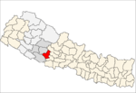
Kochibang
Kochibang is a village and Village Development Committee in Pyuthan, a Middle Hills district of Rapti Zone, western Nepal.
Kochibang कोचीबाङ | |
|---|---|
Village Development Committee | |
 Kochibang Location in Nepal | |
| Coordinates: 28.09°N 82.65°E | |
| Country | |
| Region | Mid-Western |
| Zone | Rapti Zone |
| District | Pyuthan District |
| VDC | Kochibang |
| Population (2001 Census[1]) | |
| • Total | 2,630 |
| 482 households | |
| Time zone | UTC+5:45 (Nepal Time) |
Villages in this V.D.C.
| Ward | Lat. | Lon | Elev. | ||
|---|---|---|---|---|---|
| Amdanda | आमडाँडा | 28°06'N | 82°39'E | 1,235m | |
| Ampata | आमपाटा | 28°05'N | 82°37'E | 910 | |
| Baksing | बाक्सिङ | 28°07'N | 82°37'E | 1,208 | |
| Bahrabise | बाह्रबिसे | 28°04'N | 82°38'E | 870 | |
| Bhaldanda | भलडाँडा | 28°06'N | 82°39'E | 1,275 | |
| Bhanjyang | भञ्ज्याङ | 28°07'N | 82°38'E | 1,635 | |
| Bhompa | भोम्पा | 28°06'N | 82°37'E | 1,265 | |
| Dabang | दाबाङ | 28°05'N | 82°39'E | 1,234 | |
| Danda Kateri | डाँडा कटेरी | 28°05'N | 82°41'E | 1,235 | |
| Dharampani | धरमपानी | 28°07'N | 82°40'E | 1,930 | |
| Ghurche | घुर्चे | 28°06'N | 82°37'E | 1,570 | |
| Jhupeli | झुपेली | 28°06'N | 82°40'E | 1,638 | |
| Jogithum | जोगीथुम | 28°03'N | 82°41'E | 950 | |
| Kali Pokhari | काली पोखरी | 28°05'N | 82°42'E | 1,710 | |
| Khalte | खाल्टे | 28°05'N | 82°38'E | 1,210 | |
| Kochibang | कोचीबाङ | 1 | 28°05'N | 82°40'E | 1,415 |
| Kusunde | कुसुण्डे | 2 | 28°04'N | 82°41'E | 1,590 |
| Laksmi Khoriya | लक्ष्मी खोरिया | 28°06'N | 82°38'E | 1,461 | |
| Lami Khorya | लामी खोरिया | 28°06'N | 82°37'E | 1,219 | |
| Mirsing | मिर्सिङ | 28°05'N | 82°38'E | 1,170 | |
| Rum | रुम | 28°05'N | 4 | 82°39'E | 1,435 |
| Rumdanda | रुमडाँडा | 28°05'N | 82°40'E | 1,608 | |
| Rupakot | रुपाकोट | 28°05'N | 82°41'E | 1,310 | |
| Sakribang | साक्रीबाङ | 28°06'N | 82°39'E | 1,513 | |
| Sallabot | सल्लाबोट | 3 | 28°04'N | 82°40'E | 1,149 |
| Tar | टार | 28°06'N | 82°36'E | 895 | |
| Tirmire | तिरमिरे | 28°05'N | 82°40'E | 1,290 |
gollark: * it is an eye, and also the eye of the person who claims to have it
gollark: As well as the various other problems, I don't understand how they can actually use this sort of thing to prevent Sybil attack issues without a central authority saying "yes, this is an eye".
gollark: It is also possible to DIY gene therapy now, although that bit is probably not safe.
gollark: Apparently someone was naturally born with that, and didn't even horribly die, so it's probably safe to do.
gollark: I guess it would be nontrivial to do that in adults.
References
- "Nepal Census 2001". Nepal's Village Development Committees. Digital Himalaya. Archived from the original on 12 October 2008. Retrieved 21 September 2008.
- "Index of Geographical Names of Nepal, Volume IV: Mid Western Development Region, List of Settlements, Pyuthan" (PDF). Government of Nepal, National Geographic Information Infrastructure Program. Archived from the original (PDF) on 2011-07-24. Retrieved 2011-03-12.
This article is issued from Wikipedia. The text is licensed under Creative Commons - Attribution - Sharealike. Additional terms may apply for the media files.
