Podayva Glacier
Podayva Glacier (Bulgarian: ледник Подайва, romanized: lednik Podayva, IPA: [ˈlɛdnik poˈdajvɐ]) is the 4.5 km long and 3 km wide glacier on Pasteur Peninsula, Brabant Island in the Palmer Archipelago, Antarctica, situated northeast of Dodelen Glacier and west of Burevestnik Glacier. It drains the north slopes of Stribog Mountains, flows northwards and enters the sea east of Cape Roux and west of Marinka Point.
| Podayva Glacier | |
|---|---|
 Location of Brabant Island in the Antarctic Peninsula region | |
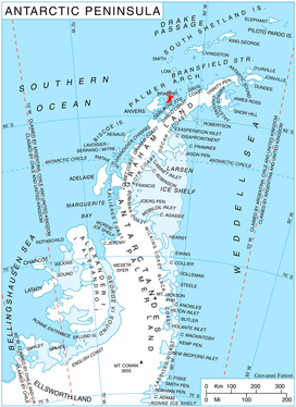
 Location of Podayva in Antarctica | |
| Location | Palmer Archipelago |
| Coordinates | 64°02′25″S 62°25′30″W |
| Length | 2.5 nmi (5 km; 3 mi) |
| Width | 1.6 nmi (3 km; 2 mi) |
| Thickness | unknown |
| Terminus | Cape Roux |
| Status | unknown |
The glacier is named after the settlement of Podayva in Northeastern Bulgaria.
Location
Podayva Glacier is centred at 64°02′25″S 62°25′30″W. British mapping in 1980 and 2008.
gollark: I mean, democracy has generally proven the least bad one, but æææaaæææææææaaææææææ still.
gollark: Do *any* political systems actually work properly at this point?
gollark: I think you can "short" them if you believe that.
gollark: They use outdated 4G.
gollark: That seems weirdly long. I thought it was shorter.
Maps
- Antarctic Digital Database (ADD). Scale 1:250000 topographic map of Antarctica. Scientific Committee on Antarctic Research (SCAR). Since 1993, regularly upgraded and updated.
- British Antarctic Territory. Scale 1:200000 topographic map. DOS 610 Series, Sheet W 64 62. Directorate of Overseas Surveys, Tolworth, UK, 1980.
- Brabant Island to Argentine Islands. Scale 1:250000 topographic map. British Antarctic Survey, 2008.
References
- Bulgarian Antarctic Gazetteer. Antarctic Place-names Commission. (details in Bulgarian, basic data in English)
- Podayva Glacier. SCAR Composite Antarctic Gazetteer.
External links
- Podayva Glacier. Copernix satellite image

Brabant Island from northeast, with Anvers Island (on the right) and Antarctic Peninsula in the background; Pasteur Peninsula is seen as the nearest part of the island on the right.
This article includes information from the Antarctic Place-names Commission of Bulgaria which is used with permission.
| Types |
| ||||||
|---|---|---|---|---|---|---|---|
| Anatomy |
| ||||||
| Processes | |||||||
| Measurements | |||||||
| Volcanic relations | |||||||
| Landforms |
| ||||||
| |||||||
This article is issued from Wikipedia. The text is licensed under Creative Commons - Attribution - Sharealike. Additional terms may apply for the media files.