Pelter Glacier
Pelter Glacier (71°57′S 98°22′W) is a glacier about 5 nautical miles (9.3 km; 5.8 mi) long on Thurston Island, flowing from the east side of Noville Peninsula into the west side of Murphy Inlet. Delineated from air photos taken by U.S. Navy Squadron VX-6 in January 1960. Named by Advisory Committee on Antarctic Names (US-ACAN) for J.A. Pelter, aerial photographer with the Byrd Antarctic Expedition in 1933–35.
| Pelter Glacier | |
|---|---|
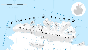 Map of Thurston Island | |
 Location of Pelter Glacier in Antarctica | |
| Location | Ellsworth Land |
| Coordinates | 71°57′00″S 98°22′00″W |
| Length | 5 nautical miles (9.3 km; 5.8 mi) |
| Thickness | unknown |
| Terminus | Murphy Inlet |
| Status | unknown |
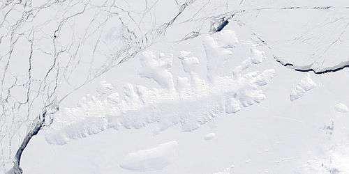
Satellite image of Thurston Island.
Maps
- Thurston Island – Jones Mountains. 1:500000 Antarctica Sketch Map. US Geological Survey, 1967.
- Antarctic Digital Database (ADD). Scale 1:250000 topographic map of Antarctica. Scientific Committee on Antarctic Research (SCAR). Since 1993, regularly upgraded and updated.
References


| Types |
| ||||||
|---|---|---|---|---|---|---|---|
| Anatomy |
| ||||||
| Processes | |||||||
| Measurements | |||||||
| Volcanic relations | |||||||
| Landforms |
| ||||||
| |||||||
This article is issued from Wikipedia. The text is licensed under Creative Commons - Attribution - Sharealike. Additional terms may apply for the media files.