Payne Glacier
Payne Glacier (71°55′S 96°42′W) is a glacier in the north part of Evans Peninsula, Thurston Island. It flows into the sea east of Cape Walden. Named by Advisory Committee on Antarctic Names (US-ACAN) after Photographer's Mate J.B. Payne, aircrewman in the Eastern Group of U.S. Navy Operation Highjump, which obtained aerial photographs of Thurston Island and adjacent coastal areas, 1946–47.
| Payne Glacier | |
|---|---|
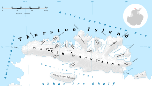 Map of Thurston Island | |
 Location of Payne Glacier in Antarctica | |
| Type | tributary |
| Location | Ellsworth Land |
| Coordinates | 71°55′00″S 96°42′00″W |
| Thickness | unknown |
| Terminus | east of Cape Walden |
| Status | unknown |
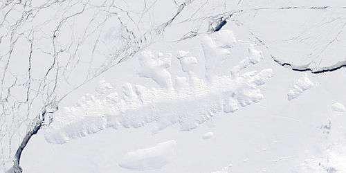
Satellite image of Thurston Island.
Maps
- Thurston Island – Jones Mountains. 1:500000 Antarctica Sketch Map. US Geological Survey, 1967.
- Antarctic Digital Database (ADD). Scale 1:250000 topographic map of Antarctica. Scientific Committee on Antarctic Research (SCAR). Since 1993, regularly upgraded and updated.
References


| Types |
| ||||||
|---|---|---|---|---|---|---|---|
| Anatomy |
| ||||||
| Processes | |||||||
| Measurements | |||||||
| Volcanic relations | |||||||
| Landforms |
| ||||||
| |||||||
This article is issued from Wikipedia. The text is licensed under Creative Commons - Attribution - Sharealike. Additional terms may apply for the media files.