Grigorov Glacier
Grigorov Glacier (Bulgarian: Григоров ледник, romanized: Grigorov lednik, IPA: [ɡriˈɡɔrof ˈlɛdnik]) is the 1.8 km long and 1.3 km wide glacier on the south side of Stavertsi Ridge on Albena Peninsula, Brabant Island in the Palmer Archipelago, Antarctica. It drains the east slopes of Mount Cabeza and flows southeastwards to enter Hill Bay west of Kostur Point.[1]
| Grigorov Glacier | |
|---|---|
 Location of Brabant Island in the Antarctic Peninsula region | |
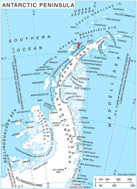
 Location of Grigorov Glacier in Antarctica | |
| Location | Palmer Archipelago |
| Coordinates | 64°09′05″S 62°07′30″W |
| Length | 1 nmi (2 km; 1 mi) |
| Width | 0.7 nmi (1 km; 1 mi) |
| Thickness | unknown |
| Terminus | Hill Bay |
| Status | unknown |
The glacier is named after the Bulgarian scientist Stamen Grigorov (1878–1945) who discovered the bacteria Lactobacillus bulgaricus used in the production of yoghurt.[1]
Location
Grigorov Glacier is located at 64°09′05″S 62°07′30″W. British mapping in 1980.
gollark: Working but slow, I think.
gollark: !help
gollark: Also, emergency backup Esobøŧ is online. I think.
gollark: We could have r9k-test and pingchat-test.
gollark: <@!422087909634736160> <@!474286909636476939> <@!405953712113057794>
Maps
- Antarctic Digital Database (ADD). Scale 1:250000 topographic map of Antarctica. Scientific Committee on Antarctic Research (SCAR). Since 1993, regularly upgraded and updated.
- British Antarctic Territory. Scale 1:200000 topographic map. DOS 610 Series, Sheet W 64 62. Directorate of Overseas Surveys, Tolworth, UK, 1980.
- Brabant Island to Argentine Islands. Scale 1:250000 topographic map. British Antarctic Survey, 2008.
Notes
- Grigorov Glacier. SCAR Composite Antarctic Gazetteer.
References
- Bulgarian Antarctic Gazetteer. Antarctic Place-names Commission. (details in Bulgarian, basic data in English)
- Grigorov Glacier. SCAR Composite Antarctic Gazetteer
External links
- Grigorov Glacier. Adjusted Copernix satellite image
This article includes information from the Antarctic Place-names Commission of Bulgaria which is used with permission.

Brabant Island from northeast, with Anvers Island (on the right) and Antarctic Peninsula in the background.
| Types |
| ||||||
|---|---|---|---|---|---|---|---|
| Anatomy |
| ||||||
| Processes | |||||||
| Measurements | |||||||
| Volcanic relations | |||||||
| Landforms |
| ||||||
| |||||||
This article is issued from Wikipedia. The text is licensed under Creative Commons - Attribution - Sharealike. Additional terms may apply for the media files.