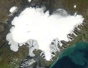
Ice cap
An ice cap is a mass of ice that covers less than 50,000 km2 (19,000 sq mi) of land area (usually covering a highland area). Larger ice masses covering more than 50,000 km2 (19,000 sq mi) are termed ice sheets.[1][2][3]
Description
Ice caps are not constrained by topographical features (i.e., they will lie over the top of mountains). By contrast, ice masses of similar size that are constrained by topographical features are known as ice fields. The dome of an ice cap is usually centred on the highest point of a massif. Ice flows away from this high point (the ice divide) towards the ice cap's periphery.[1][3]
Ice caps have significant effects on the geomorphology of the area that they occupy. Plastic moulding, gouging and other glacial erosional features become present upon the glacier's retreat. Many lakes, such as the Great Lakes in North America, as well as numerous valleys have been formed by glacial action over hundreds of thousands of years.
On Earth, there are about 30 million cubic kilometres (7.2 million cubic miles) of total ice mass. The average temperature of an ice mass ranges between −20 and −30 °C (−4 and −22 °F). The core of an ice cap exhibits a constant temperature that ranges between −15 and −20 °C (5 and −4 °F).
Variants
High-latitude regions covered in ice, though strictly not an ice cap (since they exceed the maximum area specified in the definition above), are called polar ice caps; the usage of this designation is widespread in the mass media[4] and arguably recognized by experts.[5] Vatnajökull is an example of an ice cap in Iceland.[6]
Plateau glaciers are glaciers that overlie a generally flat highland area. Usually the ice overflows as hanging glaciers in the lower parts of the edges.[7] An example is Biscayarfonna in Svalbard.[8]
References
- Benn, Douglas; Evans, David (1998). Glaciers and Glaciation. London: Arnold. ISBN 0-340-58431-9.
- Bennett, Matthew; Glasser, Neil (1996). Glacial Geology: Ice Sheets and Landforms. Chichester, England: John Wiley and Sons Ltd. ISBN 0-471-96345-3.
- Greve, R.; Blatter, H. (2009). Dynamics of Ice Sheets and Glaciers. Springer. doi:10.1007/978-3-642-03415-2. ISBN 978-3-642-03414-5.
- "Time Magazine Online: Arctic Ice Explorers". CNN. 2009-03-11. Retrieved 2010-05-04.
- "Cryosphere Glossary". The National Snow and Ice Data Center. Retrieved 27 March 2020.
- Flowers, Gwenn E.; Marshall, Shawn J.; Bjŏrnsson, Helgi; Clarke, Garry K. C. (2005). "Sensitivity of Vatnajŏkull ice cap hydrology and dynamics to climate warming over the next 2 centuries" (PDF). Journal of Geophysical Research. 110: F02011. Bibcode:2005JGRF..11002011F. doi:10.1029/2004JF000200. Retrieved 2007-05-31.
- Whalley, Brian. "Plateau Glaciers and their significance". Vignettes: Key Concepts in Geomorphology. Retrieved 27 March 2020 – via Science Education Resource Center at Carleton College.
- "Biscayarfonna (Svalbard)". Norwegian Polar Institute. Retrieved 11 October 2019.
