Kashin Glacier
Kashin Glacier (Bulgarian: ледник Къшин, romanized: lednik Kashin, IPA: [ˈlɛdnik kɐˈʃin]) is the 8 km long and 2.7 km wide glacier on Fallières Coast in Graham Land, Antarctica. It is situated southwest of Perutz Glacier, north of Marvodol Glacier and east-southeast of Bader Glacier, flows northward between Shapkarev Buttress and Rudozem Heights, and flows into Bourgeois Fjord next southwest of Perutz Glacier.
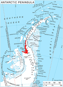
Location of Fallières Coast on the Antarctic Peninsula.
The glacier is named after the settlement of Kashin in Northern Bulgaria.
Location
Kashin Glacier is centred at 67°38′20″S 66°35′10″W. British mapping in 1978.
Maps
- Antarctic Digital Database (ADD). Scale 1:250000 topographic map of Antarctica. Scientific Committee on Antarctic Research (SCAR). Since 1993, regularly upgraded and updated.
- British Antarctic Territory. Scale 1:200000 topographic map. DOS 610 Series, Sheet W 67 66. Directorate of Overseas Surveys, Tolworth, UK, 1978.
gollark: Or orbital laser strikes, obviously the best way.
gollark: Or very small computers.
gollark: I mean, if you could do that maybe you could... build machinery which assembles other quark-scale stuff, somehow.
gollark: Yes, just casually edit the strong nuclear force.
gollark: > wake me up when they finally create quark chem<@206392503509843969> IIRC you can't work with quarks on their own because they only like to exist in groups for unfathomable physics reasons.
References
- Bulgarian Antarctic Gazetteer. Antarctic Place-names Commission. (details in Bulgarian, basic data in English)
- Kashin Glacier. SCAR Composite Antarctic Gazetteer
External links
- Kashin Glacier. Copernix satellite image
This article includes information from the Antarctic Place-names Commission of Bulgaria which is used with permission.
This article is issued from Wikipedia. The text is licensed under Creative Commons - Attribution - Sharealike. Additional terms may apply for the media files.