Birley Glacier
Birley Glacier (65°58′S 64°21′W) is a glacier, at least 10 nautical miles (19 km) long, flowing west into the eastern extremity of Barilari Bay north of Vardun Point, on the west coast of Graham Land. First seen and roughly surveyed in 1909 by the French Antarctic Expedition under Jean-Baptiste Charcot, it was re-surveyed in 1935–36 by the British Graham Land Expedition (BGLE) under John Rymill, and later named for Kenneth P. Birley, who contributed toward the cost of the BGLE, 1934–37.[1]
| Bilrley Glacier | |
|---|---|
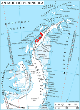 Location of Graham Coast on the Antarctic Peninsula | |
 Location of Birley Glacier in Antarctica | |
| Location | Graham Land |
| Coordinates | 65°58′00″S 64°21′00″W |
| Length | 10 nmi (19 km; 12 mi) |
| Thickness | unknown |
| Highest elevation | 1,621 m (5,318 ft) |
| Terminus | Barilari Bay |
| Status | unknown |
References
- "Birley Glacier". Geographic Names Information System. United States Geological Survey. Retrieved 2011-07-06.

This article is issued from Wikipedia. The text is licensed under Creative Commons - Attribution - Sharealike. Additional terms may apply for the media files.