Anderson Glacier (Antarctica)
Anderson Glacier is a heavily crevassed glacier 12 nautical miles (22 km) long, flowing southeast into Cabinet Inlet between Cape Casey and Balder Point, on the east coast of Graham Land.
| Aleksiev Glacier | |
|---|---|
 Location of Foyn Coast on the Antarctic Peninsula | |
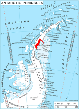
 Location of Aleksiev Glacier in Antarctica | |
| Location | Graham Land |
| Coordinates | 66°24′00″S 63°55′00″W |
| Length | 12 nmi (22 km; 14 mi) |
| Thickness | unknown |
| Highest elevation | 213 m (699 ft) |
| Terminus | Cabinet Inlet |
| Status | unknown |
History
Anderson Glacier was charted by the Falklands Islands Dependencies Survey (FIDS) and photographed from the air by the Ronne Antarctic Research Expedition in December 1947. It was named by FIDS for Sir John Anderson, M.P., Lord President of the Council and member of the British War Cabinet.[1]
gollark: (*all* recent x86 CPUs have hardware crypto so you don't need much CPU power)
gollark: If you just use it as a VPN you need basically nothing but fast networking and a high transfer cap.
gollark: Reputable providers will sell you a decently usable VPS for $5/month or so and probably less reputable ones for $20/year.
gollark: It's a VPS with lots of storage, or actually in some cases shared hosting, sold for torrenting.
gollark: You can get rather cheap VPSes.
References
- "Anderson Glacier". Geographic Names Information System. United States Geological Survey. Retrieved 2011-06-13.

This article is issued from Wikipedia. The text is licensed under Creative Commons - Attribution - Sharealike. Additional terms may apply for the media files.