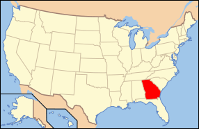
National Register of Historic Places listings in Polk County, Georgia
This is a list of properties and districts in Polk County, Georgia that are listed on the National Register of Historic Places (NRHP).
- This National Park Service list is complete through NPS recent listings posted August 14, 2020.[1]
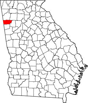
Location of Polk County in Georgia
Current listings
| [2] | Name on the Register | Image | Date listed[3] | Location | City or town | Description |
|---|---|---|---|---|---|---|
| 1 | Cedartown Commercial Historic District | 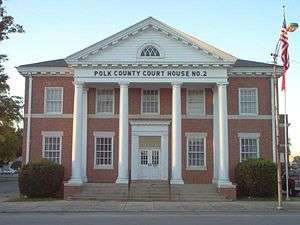 Cedartown Commercial Historic District |
December 24, 1992 (#92001715) |
Roughly bounded by East Avenue and South Philpot, Gibson and College Streets 34°00′40″N 85°15′20″W |
Cedartown | |
| 2 | Cedartown Waterworks-Woman's Building-Big Spring Park Historic District | 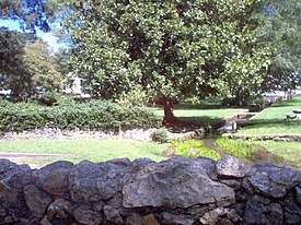 Cedartown Waterworks-Woman's Building-Big Spring Park Historic District |
December 7, 2000 (#00001475) |
Junction of Wissahickon Avenue and Bradford Street 34°00′52″N 85°15′31″W |
Cedartown | |
| 3 | Hawkes Children's Library | 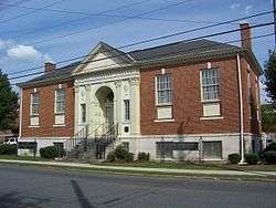 Hawkes Children's Library |
November 24, 1980 (#80001223) |
North College Street 34°00′47″N 85°15′23″W |
Cedartown | |
| 4 | Northwest Cedartown Historic District | .JPG) Northwest Cedartown Historic District |
April 30, 2008 (#08000354) |
Roughly bounded by Jule Peek Avenue, Spruce Street, Wissahickon Avenue and Marshall Street 34°01′12″N 85°15′48″W |
Cedartown | |
| 5 | Rockmart Downtown Historic District | 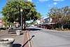 Rockmart Downtown Historic District |
June 24, 2009 (#09000458) |
Roughly bounded by Water, Beauregard, Narble, and Elm Streets 33°59′48″N 85°03′13″W |
Rockmart | |
| 6 | Rockmart Woman's Club | June 20, 1995 (#95000738) |
North Marble Street 33°59′58″N 85°02′15″W |
Rockmart | ||
| 7 | St. James' Episcopal Church | 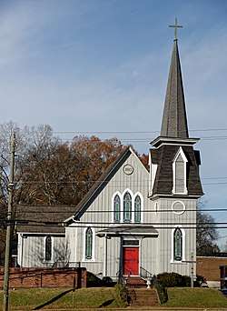 St. James' Episcopal Church |
October 7, 2019 (#100004293) |
302 and 308 West Ave. 34°00′41″N 85°15′28″W |
Cedartown | |
| 8 | South Philpot Street Historic District | _Cedartown.JPG) South Philpot Street Historic District |
November 2, 2011 (#11000776) |
Roughly bounded by S. Philpot St., East Ave, E. Ware & Park Sts. 34°00′44″N 85°15′05″W |
Cedartown |
gollark: Won't they be visible if you're near them anyway?
gollark: Of course, you can't stop someone stealing the drone, or sending false data...
gollark: Ah, that's a shame.
gollark: I mean, OC's got chunkloader upgrades, you should be able to make it portable.
gollark: Well, if the server has dynmap (does it?) you can actually gather the data from that.
References
- "National Register of Historic Places: Weekly List Actions". National Park Service, United States Department of the Interior. Retrieved on August 14, 2020.
- Numbers represent an ordering by significant words. Various colorings, defined here, differentiate National Historic Landmarks and historic districts from other NRHP buildings, structures, sites or objects.
- The eight-digit number below each date is the number assigned to each location in the National Register Information System database, which can be viewed by clicking the number.
| Wikimedia Commons has media related to National Register of Historic Places in Polk County, Georgia. |
| Topics | |
|---|---|
| Lists by state |
|
| Lists by insular areas | |
| Lists by associated state | |
| Other areas | |
| Related | |
| |
This article is issued from Wikipedia. The text is licensed under Creative Commons - Attribution - Sharealike. Additional terms may apply for the media files.