National Register of Historic Places listings in Burke County, Georgia
This is a list of properties and districts in Burke County, Georgia that are listed on the National Register of Historic Places (NRHP).
- This National Park Service list is complete through NPS recent listings posted August 14, 2020.[1]
Current listings
| [2] | Name on the Register | Image | Date listed[3] | Location | City or town | Description |
|---|---|---|---|---|---|---|
| 1 | Burke County Courthouse | 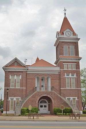 Burke County Courthouse |
September 18, 1980 (#80000980) |
Courthouse Sq. 33°05′26″N 82°00′57″W |
Waynesboro | |
| 2 | Haven Memorial Methodist Episcopal Church | 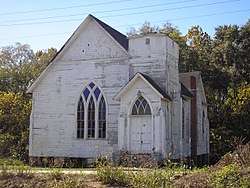 Haven Memorial Methodist Episcopal Church |
April 12, 1996 (#96000397) |
Barron St., S of Jct. of Barron and 6th Sts. 33°05′27″N 82°00′42″W |
Waynesboro | |
| 3 | Hopeful Baptist Church | 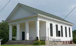 Hopeful Baptist Church |
January 11, 1993 (#92001734) |
Winter Rd. E of jct. with Blythe Rd. 33°12′35″N 82°08′03″W |
Keysville | Monumental Greek Revival church built 1850–51, notable for having white and black members before the Civil War. |
| 4 | John James Jones House | 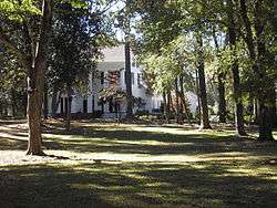 John James Jones House |
February 15, 1980 (#80000981) |
525 Jones Ave. 33°05′11″N 82°01′06″W |
Waynesboro | |
| 5 | McCanaan Missionary Baptist Church and Cemetery |  McCanaan Missionary Baptist Church and Cemetery |
June 14, 2001 (#01000643) |
McCanaan Church Rd. 32°59′03″N 81°42′08″W |
Sardis | |
| 6 | Sapp Plantation | 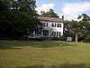 Sapp Plantation |
February 8, 1980 (#80000979) |
NW of Sardis on GA 24 33°00′04″N 81°49′07″W |
Sardis | |
| 7 | Waynesboro Commercial Historic District | 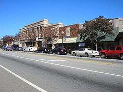 Waynesboro Commercial Historic District |
June 10, 1993 (#93000496) |
E. 6th, E. 7th, E. 8th, S. Liberty and Myrick Sts. 33°11′30″N 82°01′01″W |
Waynesboro | |
| 8 | Waynesboro Historic District | 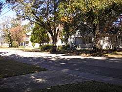 Waynesboro Historic District |
March 25, 2009 (#09000153) |
Roughly bounded by Walker Street, 12th Street, Waters Street, Corker Row, 4th Street, and Jones Avenue 33°05′28″N 82°01′00″W |
Waynesboro |
gollark: I have not seen any good coherent alternatives to capitalism proposed.
gollark: I know* that but was being ironical.
gollark: I don't like them.
gollark: I know what onions are. They are vegetables of some kind.
gollark: This is very mildly NSFW of you.
References
- "National Register of Historic Places: Weekly List Actions". National Park Service, United States Department of the Interior. Retrieved on August 14, 2020.
- Numbers represent an ordering by significant words. Various colorings, defined here, differentiate National Historic Landmarks and historic districts from other NRHP buildings, structures, sites or objects.
- The eight-digit number below each date is the number assigned to each location in the National Register Information System database, which can be viewed by clicking the number.
| Wikimedia Commons has media related to National Register of Historic Places in Burke County, Georgia. |
| Topics | |
|---|---|
| Lists by state |
|
| Lists by insular areas | |
| Lists by associated state | |
| Other areas | |
| Related | |
| |
This article is issued from Wikipedia. The text is licensed under Creative Commons - Attribution - Sharealike. Additional terms may apply for the media files.