Lowesdale, New South Wales
Lowesdale is a town community in Australia in the central south part of the Riverina and situated about 2 kilometres north of Buraja and 92 kilometres east of Berrigan on the Riverina Highway. At the 2006 census, Lowesdale had a population of 220.[1]
| Lowesdale New South Wales | |
|---|---|
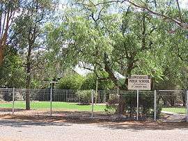 Lowesdale Public School | |
Lowesdale | |
| Coordinates | 35°51′0″S 146°22′0″E |
| Population | 220 (2006 census)[1] |
| Postcode(s) | 2646 |
| Elevation | 132 m (433 ft) |
| Location | |
| LGA(s) | Federation Council |
| County | Hume |
| State electorate(s) | Albury |
| Federal Division(s) | Farrer |
Lowesdale Post Office opened on 1 August 1876 and closed in 1994.[2]

A rest area on the Riverina Highway, near Lowesdale
Notes and references
- Australian Bureau of Statistics (25 October 2007). "Lowesdale (State Suburb)". 2006 Census QuickStats. Retrieved 26 October 2009.
- Premier Postal History, Post Office List, retrieved 11 June 2009
| Wikimedia Commons has media related to Lowesdale, New South Wales. |
gollark: So we need P2P soviet forth?
gollark: In American Forth, you have to... vote for what procedure to run next?
gollark: Soviet Forth and American Forth?
gollark: How has this implementation EVER WORKED CORRECTLY?!
gollark: It is not usable right now while I fix the timeshare bit.
This article is issued from Wikipedia. The text is licensed under Creative Commons - Attribution - Sharealike. Additional terms may apply for the media files.