Tullakool, New South Wales
Tullakool is a village community in the south west part of the Riverina. The place by road, is situated about 23 kilometres east from Burraboi and 27 km (17 mi) west from Wakool. It was the location of the first commercial rice crop in the Murray valley. At the 2006 census, Tullakool had a population of 330.[1]
| Tullakool New South Wales | |
|---|---|
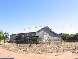 Community Hall | |
Tullakool | |
| Coordinates | 35°22′0″S 144°09′0″E |
| Population | 330 (2006 census)[1] |
| Postcode(s) | 2732 |
| Location | |
| LGA(s) | Murray River Council |
| County | Wakool |
| Parish | Beremegad |
| State electorate(s) | Murray-Darling |
| Federal Division(s) | Farrer |
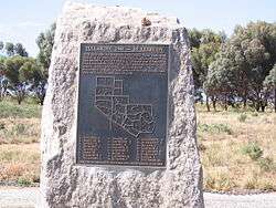
Memorial at Tullakool
In 1948 the area was divided into Soldier settlement allotments.
Notes and references
- Australian Bureau of Statistics (25 October 2007). "Tullakool (State Suburb)". 2006 Census QuickStats. Retrieved 29 October 2007.
- Travelmate
| Wikimedia Commons has media related to Tullakool, New South Wales. |
gollark: Partly.
gollark: I'm planning to implement full text search, so I may end up having to apiaristically store some data uncompressed for that.
gollark: minoteaur uses zstd for note compression actually.
gollark: I did benchmark it.
gollark: Zstandard, yes.
This article is issued from Wikipedia. The text is licensed under Creative Commons - Attribution - Sharealike. Additional terms may apply for the media files.