Tootool, New South Wales
Tootool is a rural community in the central east part of the Riverina. It is situated by road, about 4 kilometres east of French Park and 16 kilometres west of The Rock.
| Tootool New South Wales | |
|---|---|
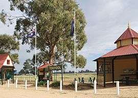 Tootool rest area | |
Tootool | |
| Coordinates | 35°11′14″S 146°58′27″E |
| Postcode(s) | 2655 |
| Elevation | 188 m (617 ft) |
| Location |
|
| LGA(s) | Lockhart Shire |
| County | Mitchell |
| State electorate(s) | Wagga Wagga |
Tootool Post Office opened on 1 August 1901 and closed in 1966.[1]
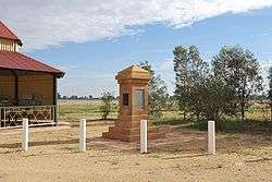
War memorial
Notes and references
- Premier Postal History, Post Office List, retrieved 11 June 2009
| Preceding station | NSW Branch lines | Following station | ||
|---|---|---|---|---|
French Park towards Oaklands | Oaklands Line | The Rock Terminus |
| Wikimedia Commons has media related to Tootool, New South Wales. |
gollark: I can't tell if you're serious.
gollark: §8[195,73,94][PM] §5[ §nSELL SHOP§5 ]: §bHey gollark, you've been standing in the cabin for a while now. Make sure than after you're done, you'll make place for others. Excessive §4afking§b in the cabin is §alogged§b, and you may be §4denied access§b to Wolf Mall when you're unneccesarely obstructing the SELL SHOP for others! Thank you kindly for understanding!
gollark: It's an internal API which I expose for reasons, like skynet.URL.
gollark: skynet.connect is I think done in skynet.listen too.
gollark: <@258639553357676545>
This article is issued from Wikipedia. The text is licensed under Creative Commons - Attribution - Sharealike. Additional terms may apply for the media files.