Adjungbilly Creek
The Adjungbilly Creek, a mostly–perennial river[2] that is part of the Murrumbidgee catchment within the Murray–Darling basin, is located in the South West Slopes and Riverina regions of New South Wales, Australia.
| Adjungbilly | |
|---|---|
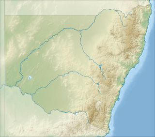 Location of the Adjungbilly Creek mouth in New South Wales | |
| Location | |
| Country | Australia |
| State | New South Wales |
| Region | South Eastern Highlands (IBRA), Riverina, South West Slopes |
| LGAs | Snowy Valleys, Cootamundra-Gundagai |
| Town | Adjungbilly |
| Physical characteristics | |
| Source | Adjungbilly Swamp |
| • location | near Tumorrama |
| • coordinates | 35°10′44″S 148°24′54″E |
| • elevation | 888 m (2,913 ft) |
| Mouth | confluence with Tumut River |
• location | near Darbalara |
• coordinates | 35°1′28″S 148°11′45″E |
• elevation | 225 m (738 ft) |
| Length | 46 km (29 mi) |
| Basin features | |
| River system | Murrumbidgee catchment, Murray–Darling basin |
| Tributaries | |
| • left | Sandy Creek (Adjungbilly) |
| [1] | |
Course and features
The Adjungbilly Creek (technically a river[2]) rises in the Adjungbilly Swamp, near Tumorrama, on the western slopes of the Australian Alps, and flows generally northwest in a highly meandering course before reaching its confluence with the Tumut River, near Darbalara, approximately 2 kilometres (1.2 mi) above its junction with the Murrumbidgee River. The creek descends 664 metres (2,178 ft) over its 46-kilometre (29 mi) course.[1]
gollark: I actually disable my ability to read when it's convenient.
gollark: I would just switch to GTech™ GGPS™.
gollark: I could never get inertial navigation to work so it just uses GPS every 0.1 seconds.
gollark: Except sometimes it doesn't get a GPS ping back or something and breaks horribly.
gollark: Deviations of about a block.
References
- "Map of Adjungbilly Creek, NSW". Bonzle Digital Atlas of Australia. Retrieved 8 December 2014.
- "Adjungbilly Creek". Geographical Names Register (GNR) of NSW. Geographical Names Board of New South Wales. Retrieved 8 December 2014.

External links
- "Murrumbidgee and Lake George catchments". Office of Environment and Heritage (map). Government of New South Wales.
- Bevitt, R.; Erskine, W.; Gillespie, G.; Harriss, J.; Lake, P.; Miners, B.; Varley, I. (May 2009). "Expert panel environmental flow assessment of various rivers affected by the Snowy Mountains Scheme" (PDF). NSW Department of Water and Energy. ISBN 978-0-7347-5656-5.
Rivers of the Murrumbidgee River catchment, New South Wales and the Australian Capital Territory, Australia | |||||
|---|---|---|---|---|---|
| |||||
| |||||
Climate
| Climate data for Adjungbilly, NSW (Red Hill State Forest); 640 m AMSL; 35° 10′ 00.12″ S | |||||||||||||
|---|---|---|---|---|---|---|---|---|---|---|---|---|---|
| Month | Jan | Feb | Mar | Apr | May | Jun | Jul | Aug | Sep | Oct | Nov | Dec | Year |
| Average high °C (°F) | 28.7 (83.7) |
27.8 (82.0) |
25.1 (77.2) |
19.5 (67.1) |
14.5 (58.1) |
11.1 (52.0) |
10.0 (50.0) |
11.7 (53.1) |
15.3 (59.5) |
18.6 (65.5) |
21.9 (71.4) |
26.3 (79.3) |
19.2 (66.6) |
| Average low °C (°F) | 12.5 (54.5) |
12.8 (55.0) |
10.5 (50.9) |
6.7 (44.1) |
3.7 (38.7) |
1.9 (35.4) |
0.8 (33.4) |
1.5 (34.7) |
3.3 (37.9) |
5.9 (42.6) |
8.0 (46.4) |
10.8 (51.4) |
6.5 (43.7) |
| Average precipitation mm (inches) | 73.3 (2.89) |
56.1 (2.21) |
76.1 (3.00) |
78.6 (3.09) |
108.3 (4.26) |
96.5 (3.80) |
117.0 (4.61) |
118.9 (4.68) |
91.5 (3.60) |
105.3 (4.15) |
85.1 (3.35) |
70.0 (2.76) |
1,076.7 (42.4) |
| Average precipitation days (≥ 0.2 mm) | 6.5 | 5.9 | 6.3 | 8.1 | 11.8 | 12.9 | 14.5 | 15.2 | 11.5 | 12.1 | 9.2 | 7.5 | 121.5 |
| Source: Australian Bureau of Meteorology; Red Hill State Forest | |||||||||||||
This article is issued from Wikipedia. The text is licensed under Creative Commons - Attribution - Sharealike. Additional terms may apply for the media files.