Currawarna
Currawarna is a rural community in the central east part of the Riverina. It is situated by road, about 6 kilometres north west of Millwood and 32 kilometres south of Coolamon. At the 2016 census, Currawarna had a population of 189 people.[1]
| Currawarna New South Wales | |
|---|---|
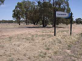
 Entering Currawarna | |
 Currawarna | |
| Coordinates | 35°01′S 147°04′E |
| Population | 189 (2016 census)[1] |
| Postcode(s) | 2650 |
| Elevation | 180 m (591 ft) |
| Location | |
| LGA(s) | City of Wagga Wagga |
| County | Bourke |
| State electorate(s) | Wagga Wagga |
The place name Currawarna is derived from the Wiradjuri aboriginal language meaning "pine tree".[2]
Currawarna Post Office opened on 1 August 1899 and closed in 1979.[3]

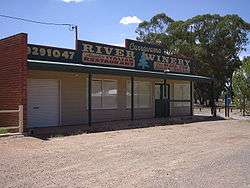
Currawarna River Winery & restaurants
Notes and references
- Australian Bureau of Statistics (27 June 2017). "Currawarna (State Suburb)". 2016 Census QuickStats. Retrieved 27 June 2017.

- "Currawarna". Geographical Names Register (GNR) of NSW. Geographical Names Board of New South Wales. Retrieved 4 August 2013.

- Premier Postal History, Post Office List, retrieved 11 June 2009
gollark: You should use PotatOS Bin instead.
gollark: This should usher in a new age of skynet-based uselessness.
gollark: The skynet CLI thing is going pretty well.
gollark: Having basically all shops exclusively housed within a mall controlled by a single person is *not great*.
gollark: Have you considered opening a location out of wolf mall?
External links
![]()
This article is issued from Wikipedia. The text is licensed under Creative Commons - Attribution - Sharealike. Additional terms may apply for the media files.