Moira, New South Wales
Moira is a rural community in the central south part of the Riverina and the site of a railway station. It is situated by road, about 11 kilometres north of Barnes and 15 kilometres south west of Mathoura.
| Moira New South Wales | |
|---|---|
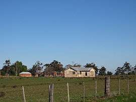 Moira homestead | |
Moira | |
| Coordinates | 35°55′37″S 144°50′52″E |
| Postcode(s) | 2710 |
| Elevation | 99 m (325 ft) |
| Location |
|
| LGA(s) | Murray River Council |
| County | Cowper |
| State electorate(s) | Murray |
| Federal Division(s) | Farrer |
Moira Post Office opened on 16 December 1879 and closed in 1970.[1]
Notes
- Premier Postal History, Post Office List, retrieved 11 June 2009
gollark: That could be a heavserver feature!
gollark: Most things can.
gollark: Ideatic.
gollark: Don't worry, under rule something I won't* spoil it. However, I do not consider posting contextless images which don't appear to imply much of a long-ago-released series "spoilers".
gollark: I watched the entire show ever a few months back.
External links
| Wikimedia Commons has media related to Moira, New South Wales. |
This article is issued from Wikipedia. The text is licensed under Creative Commons - Attribution - Sharealike. Additional terms may apply for the media files.