Beelbangera
Beelbangera is a town in the north west of the Riverina and situated about 2 kilometres north-east of Griffith and about 7 kilometres south-west of Yenda. At the 2011 census Beelbangera had a population of 311.[1]
| Beelbangera New South Wales | |
|---|---|
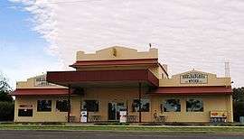 General store at Beelbangera | |
Beelbangera | |
| Coordinates | 34°16′0″S 146°6′0″E |
| Population | 311 (2011 census)[1] |
| • Density | 14.502/km2 (37.56/sq mi) |
| Postcode(s) | 2680 |
| Area | 21.445 km2 (8.3 sq mi)[2] |
| Location | |
| LGA(s) | City of Griffith |
| County | Cooper |
| State electorate(s) | Murray |
| Federal Division(s) | Riverina |
The place name Beelbangera is derived from the local Aboriginal word meaning "native companion".[4]
Beelbangera Post Office opened on 1 September 1919.[5]
Notes and references
- Australian Bureau of Statistics (31 October 2012). "Beelbangera (State Suburbs)". 2011 Census QuickStats. Retrieved 30 March 2015.

- "Map of Beelbangera, NSW".
- Travelmate Archived 24 March 2007 at the Wayback Machine
- "Beelbangera". Geographical Names Register (GNR) of NSW. Geographical Names Board of New South Wales. Retrieved 13 June 2009.
- Premier Postal History. "Post Office List". Retrieved 11 June 2009.
gollark: And my general argument against gifts applies here too, of course.
gollark: Fixed prices and people not knowing each other too well means you just buy random pointless trinkets.
gollark: I don't like the way gifting works in general but secret Santa is particularly awful.
gollark: They're actually bad, though.
gollark: If I were somehow wrong, I would simply choose to be right instead.
External links
![]()
| Preceding station | NSW Branch lines | Following station | ||
|---|---|---|---|---|
Griffith towards Roto | Temora- Roto Line | Yenda towards Temora |
This article is issued from Wikipedia. The text is licensed under Creative Commons - Attribution - Sharealike. Additional terms may apply for the media files.