List of show mines
This is a list of show mines, that are currently open to the public. Focus is on underground mining activity.
Argentina
| Name | Province | Municipality | Notes | Location | Picture |
|---|---|---|---|---|---|
| Minas de Wanda | Misiones | Wanda | Amethyst | 25.9709°S 54.5641°W |
Australia
| Name | State | Municipality | Notes | Location | Picture |
|---|---|---|---|---|---|
| Historic Daydream Mine | New South Wales | Broken Hill | Silver, started 1882, relatively old mine for Australia | 31.8830°S 141.3270°E | 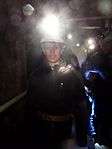 |
| Big Opal Mine | New South Wales | Lightning Ridge | Black Opal | 29.4524°S 147.9672°E | |
| Chambers of The Black Hand | New South Wales | Lightning Ridge | Black Opal | 29.4563°S 147.9669°E | .jpg) |
| Walk-in Mine | New South Wales | Lightning Ridge | Black Opal | 29.4026°S 147.9685°E | |
| Bald Hill Mine | New South Wales | Hill End | Gold | 33.0333°S 149.4166°E | 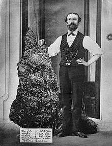 |
| Bobby Dazzler Sapphire Mine | Queensland | Rubyvale | Sapphire | 23.4193°S 147.6993°E | 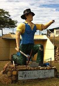 |
| Miners Heritage Walk In Mine | Queensland | Rubyvale | Sapphire | 23.4082°S 147.6892°E | |
| Wheal Hughes | South Australia | Moonta | Copper, might be closed in 2014 | 34.0550°S 137.6140°E | |
| Umoona Opal Mine and Museum | South Australia | Coober Pedy | Opal, major parts of the city are underground, due to the excessive summer heat | 29.0100°S 134.7552°E | 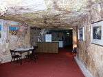 |
| Old Timers Mine | South Australia | Coober Pedy | Opal | 29.0089°S 134.7594°E | 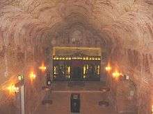 |
| Douggies Underground Mine Tours | Tasmania | Queenstown | Copper, 300 m shaft; also named: C.M.T. Underground Mine Tour | 42.0795°S 145.5546°E | 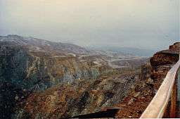 |
| Beaconsfield Mine & Heritage Centre | Tasmania | Beaconsfield | Gold, formerly Grubb Shaft Gold and Heritage Museum | 41.2016°S 146.8158°E | |
| Central Deborah Gold Mine | Victoria | Bendigo | Gold, offers adventure tours to 228 m depth | 36.7648°S 144.2704°E | 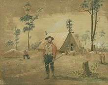 |
| Long Tunnel Extended Mine | Victoria | Walhalla | Gold, with gold rush ghost town | 37.9389°S 146.4493°E | 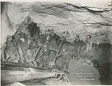 |
| State Coal Mine | Victoria | Wonthaggi | Coal | 38.6187°S 145.5966°E |
Austria
| Name | State | Municipality | Notes | Location | Picture |
|---|---|---|---|---|---|
| Terra Mystica | Kärnten | Bad Bleiberg | Lead | 46.6287°N 13.6486°E | |
| Schaubergwerk Knappenberg | Kärnten | Hüttenberg | 46.9344°N 14.5686°E |  | |
| Seegrotte Hinterbrühl | Niederösterreich | Hinterbrühl | Gypsum; flooded mine with underground boat tours | 48.0860°N 16.2573°E | |
| Schaubergwerk Grillenberg | Niederösterreich | Payerbach | Iron | 47.6929°N 15.8929°E | |
| Salzwelten Hallstatt | Oberösterreich | Hallstatt | Salt; mining since Bronze Age; oldest industrial complex in Europe | 47.5564°N 13.6450°E | |
| Salzwelten Hallein | Salzburg | Hallein | Salt | 47.6671°N 13.0898°E | |
| Kupferzeche Larzenbach | Salzburg | Hüttau, district Niedernfritz | Copper, from the 13th century till 1869 | 47.4164°N 13.3070°E | |
| Barbarastollen Leogang | Salzburg | Leogang | Mining started before the Middle Ages | 47.4395°N 12.6993°E | 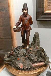 |
| Schaustollen Mühlbach am Hochkönig | Salzburg | Mühlbach am Hochkönig | Copper; the adit continues through the mountain to the municipality Sankt Johann im Pongau and served as emergency route for the residents, in cases the street could not be used | 47.3795°N 13.1232°E | |
| Schaubergwerk Hochfeld | Salzburg | Neukirchen am Großvenediger | Copper | 47.2209°N 12.2740°E | |
| Silberbergwerk Ramingstein | Salzburg | Ramingstein | Silver, mining came to an end 1780; everything kept in its original state, without electric light | 47.0768°N 13.8596°E | |
| Schaubergwerk Sunnpau | Salzburg | Sankt Veit im Pongau | Copper; mining started before the Middle Ages | 47.3373°N 13.1369°E | |
| Zinkwand hiking trail | Salzburg and Steiermark | Weißpriach, Rohrmoos-Untertal | Silver, cobalt, zinc and others; via ferrata to a 300 m long adit, that underpasses the main chain of the alps | 47.2697°N 13.6821°E | |
| Salzwelten Altaussee | Steiermark | Altaussee | Salt | 47.6514°N 13.7392°E | 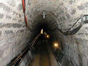 |
| Silberbergwerk Arzberg | Steiermark | Arzberg | Silver | 47.2493°N 15.5139°E |  |
| Erzberg | Steiermark | Eisenerz | Iron | 47.5250°N 14.9116°E | .jpg) |
| Magnesitbergwerk Keltenberg | Steiermark | Hohentauern | Magnesite | 47.4457°N 14.4634°E | |
| Sunfixl cave | Steiermark | Kohlschwarz | Underground sandstone mine | 47.1386°N 15.0939°E | |
| Schaubergwerk Oberzeiring | Steiermark | Oberzeiring | Silver | 47.2523°N 14.4863°E | |
| Paradeisstollen Radmer | Steiermark | Radmer | Copper; medieval, mining railway | 47.5438°N 14.7564°E | |
| Annastollen Bromriesen | Steiermark | Rohrmoos-Untertal, district Obertal | Silver and nickel | 47.3166°N 13.6834°E | |
| Knappenlöcher Fieberbrunn | Tirol | Fieberbrunn | Adits in original state, no electric light | 47.4906°N 12.5291°E | |
| Schaubergwerk Ulpenalpe | Tirol | Fügen | Iron, copper, cobalt, pyrite, quartz; could only be reached via the upper station of the cable car Spieljochbahn | 47.3265°N 11.7799°E | |
| Schaubergwerk Kupferplatte | Tirol | Jochberg | Copper | 47.3892°N 12.4254°E | |
| Schwazer Silberbergwerk | Tirol | Schwaz | Silver; one of the largest silver mines in the Middle Ages; most important financial source for Fugger and the Habsburg dynasties | 47.3536°N 11.7275°E | |
| Schaubergwerk Lehenlahn | Tirol | Wildschönau | Silver; medieval | 47.4291°N 11.9712°E | |
| Goldschaubergwerk | Tirol | Zell am Ziller | Gold | 47.2216°N 11.8956°E | |
| Bergwerk in Bartholomäberg | Vorarlberg | Bartholomäberg, district Worms | 47.0980°N 9.9116°E |
Belgium
| Name | Province | Municipality | Notes | Location | Picture |
|---|---|---|---|---|---|
| Schieferstollen Recht | Wallonia | Sankt Vith | Slate | 50.3235°N 6.0485°E | |
| Blegny Mine | Wallonia | Blegny | Coal, UNESCO-World Heritage Site | 50.6870°N 5.7239°E | 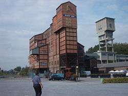 |
| Bertrix mine | Wallonia | Bertrix, near Neufchâteau | Slate; also named: Au Coeur de l'Ardoise | 49.8125°N 5.2722°E | 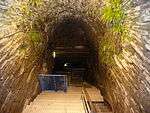 |
| Les minières de silex néolithique de Spiennes à Mons | Wallonia | Mons-Spiennes | Flintstone, prehistoric, UNESCO-World Heritage Site | 50.4306°N 3.9786°E | 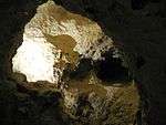 |
| Carriere souterraine de Geromont | Wallonia | Comblain-au-Pont | Limestone, in-ground, near stalactite cave Grotte de l'Abîme | 50.4306°N 3.9786°E | .jpg) |
| Grottes de Folx-les-Caves | Wallonia | Orp-Jauche | Limestone, in-ground | 50.6679°N 4.9385°E | 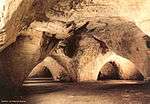 |
| Ardoisalle | Wallonia | Vresse-sur-Semois | Slate | 49.8361°N 4.9666°E | |
| Carrières souterraines de la Malogne | Wallonia | Cuesmes | Phosphate, in limestone | 50.4257°N 3.9219°E |
Bolivia
| Name | Department | Municipality | Note | Location | Picture |
|---|---|---|---|---|---|
| Mines in Cerro Rico | Potosí | Potosí | Silver and zinc, for centuries largest silver mine worldwide, still active, with guided tours | 65.7496°S 19.6189°W | 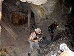 |
| Mina San José | Oruro | Oruro | Silver, Zinc | 17.9602°S 67.1235°W |
Brazil
| Name | State | Municipality | Notes | Location | Picture |
|---|---|---|---|---|---|
| Mine des Chico Rei | Minas Gerais | Ouro Preto | Gold, huge size; also named: Encardideira | 20.3862°S 43.4996°W | 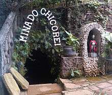 |
| Minas da Passagem | Minas Gerais | Mariana | Gold, they claim to be the largest gold show mine worldwide, over 30 km underground galleries, underground lake | 20.3913°S 43.4385°W | |
| Mina Fonte Meu Bem Querer | Minas Gerais | Ouro Preto | Gold | 20.3877°S 43.4914°W | |
| Mina Velha | Minas Gerais | Ouro Preto | Gold, started 1704 | 20.3857°S 43.4822°W |
Bulgaria
| Name | State | Municipality | Notes | Location | Picture |
|---|---|---|---|---|---|
| Mining museums of Pernik | Pernik Province | Pernik | Coal | 42.609167°N 23.028889°E | 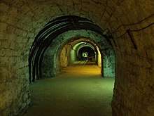 |
Canada
| Name | Province | Municipality | Notes | Location | Picture |
|---|---|---|---|---|---|
| Atlas Coal Mine | Alberta | Drumheller | Kohle | 51.3283°N 112.4825°W | |
| Bellevue Underground Mine | Alberta | Crowsnest Pass | Kohle | 49.5778°N 114.3654°W | |
| Bell Island's Mine | Newfoundland and Labrador | Wabana at Bell Island | Iron; galleries below the sea | 47.6457°N 52.9474°W | 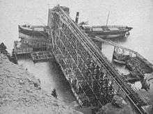 |
| Simpson Mine | Ontario | Bruce Mines | Copper | 46.2833°N 83.7833°W | |
| Cobalt Mining Museum | Ontario | Cobalt | Silver | 47.3956°N 79.6856°W | 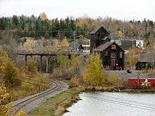 |
| Mine Cristal | Québec | Bonsecours | Rock crystal | 45.4434°N 72.2818°W | |
| Mines Capelton | Québec | Capelton | Copper | 45.3393°N 71.8471°W | |
| Thetford Mines | Québec | Thetford Mines | Chrysotile | 46.0961°N 71.3259°W |
Colombia
| Name | Region | Municipality | Notes | Location | Picture |
|---|---|---|---|---|---|
| Catedral de Sal de Zipaquirá | Cundinamarca | Zipaquira | Salt | 5.0187°N 74.009°W |
Croatia
| Name | County | Region | Notes | Location | Picture |
|---|---|---|---|---|---|
| Rudnik Zrinski | Zagreb | Medvednica | Lead and zinc, medieval; nearby mountain hut Graik | 45.9107°N 15.9443°E |
Czech Republic
| Name | Region | Municipality | Notes | Location | Picture |
|---|---|---|---|---|---|
| Grafitový důl Český Krumlov | Jihočeský kraj | Český Krumlov | Graphite | 48.8158°N 14.3038°E | 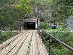 |
| Kovárna | Královéhradecký kraj | Pec pod Sněžkou | Iron, arsen and copper | 50.7278°N 15.7314°E | 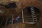 |
| Chrustenická šachta | Středočeský kraj | Beroun, district Chrustenice | Iron | 50.0044°N 14.1650°E | 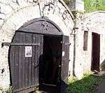 |
| Hornické Muzeum Příbram | Středočeský kraj | Příbram | Biggest mining museum in Czech Republic, incl. 3 show adits | 49.6827°N 13.9870°E | |
| Hora Svaté Kateřiny | Ústecký kraj | Hora Svaté Kateřiny | Silver and copper; galleries partly on German territory; might be temporarily closed | 50.6101°N 13.4366°E | |
| Štola Sv. Jana Evangelisty | Ústecký kraj | Jiřetín pod Jedlovou | Silver | 50.8749°N 14.5652°E | |
| Štola Starý Martin | Ústecký kraj | Krupka | Tin | 50.6973°N 13.8466°E | |
| Štola Země zaslíbená | Ústecký kraj | Měděnec | Malachite | 50.4242°N 13.1115°E | 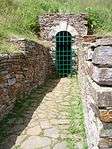 |
Denmark
| Name | Region | Municipality | Notes | Location | Picture |
|---|---|---|---|---|---|
| Thingbæk Kalkminer, Bundgaards Museum | North Denmark | Skorping | Coal, nowadays also cheese production | 56.8319°N 9.8117°E | 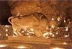 |
| Daugbjerg Kalkgruber | Central Denmark | Stoholm | Lime | 56.4577°N 9.0486°E |  |
| Mønsted Kalkgruber | Central Denmark | Stoholm | Lime, claim to be the largest in the world | 56.4561°N 9.1663°E | 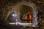 |
Germany
| Name | State | Municipality | Notes | Location | Picture |
|---|---|---|---|---|---|
| Tiefer Stollen | Baden-Württemberg | Aalen, district Wasseralfingen | Iron, also asthma therapy | 48.8552°N 10.1211°E | |
| Salzbergwerk Kochendorf | Baden-Württemberg | Bad Friedrichshall, district Kochendorf | Common salt; active period 1899–1994 | 49.2183°N 9.2101°E | 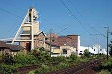 |
| Himmlisch Heer | Baden-Württemberg | Dornstetten, district Hallwangen | Silver | 48.4898°N 8.5031°E |  |
| Besucherbergwerk Schauinsland | Baden-Württemberg | Freiburg im Breisgau | Lead, Zinc, large underground galleries | 47.9111°N 7.8994°E | 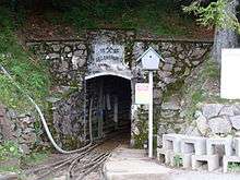 |
| Friedrichs Fundgrube | Baden-Württemberg | Freudenstadt | Silver, between 1267 und 1730 | 48.4582°N 8.4093°E | |
| Friedrichs Fundgrube | Baden-Württemberg | Großerlach | Silver, small gallery: 30 m length, from the 18th century | 49.0530°N 9.5177°E | |
| Segen Gottes | Baden-Württemberg | Haslach | Silver | 48.2921°N 8.0853°E | 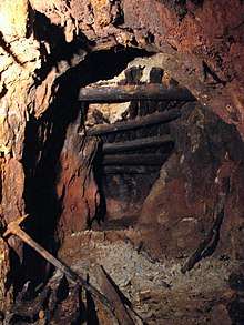 |
| Grube Teufelsgrund | Baden-Württemberg | Münstertal/Schwarzwald | Fluorite | 47.8451°N 7.8201°E |  |
| Grube Hella-Glück | Baden-Württemberg | Neubulach | Copper, silver, bismuth | 48.6555°N 8.7056°E |  |
| Grube Frischglück | Baden-Württemberg | Neuenbürg | Iron | 48.8333°N 8.5929°E |  |
| Besucherstollen Niedereschach | Baden-Württemberg | Niedereschach | Copper and lead, from the 16th century, 2 small galleries (Karl and Otto) | 48.1231°N 8.4984°E 48.1312°N 8.4985°E | |
| Grube Wenzel | Baden-Württemberg | Oberwolfach | Silver | 48.3200°N 8.2058°E | 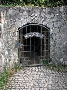 |
| Grube Anna-Elisabeth | Baden-Württemberg | Schriesheim | Silver, vitriol (copper sulphate) | 49.4778°N 8.6736°E | 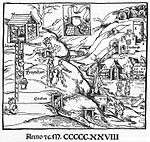 |
| Silbergründle | Baden-Württemberg | Seebach | Lead, zinc | 48.5800°N 8.1680°E | 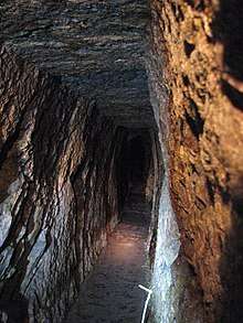 |
| Grube Caroline | Baden-Württemberg | Sexau | Lead, zinc | 48.1255°N 7.9191°E | |
| Wetzsteinstollen | Baden-Württemberg | Spiegelberg | Sandstone | 49.0217°N 9.4336°E | 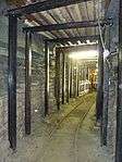 |
| Hoffnungsstollen | Baden-Württemberg | Todtmoos | Pyrrhotite and nickel | 47.7446°N 7.9856°E | 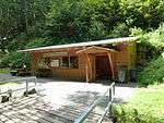 |
| Silberbergwerk Suggental | Baden-Württemberg | Waldkirch | Silver | 48.0667°N 7.9350°E | 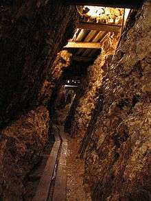 |
| Grube Marie in der Kohlbach | Baden-Württemberg | Weinheim, district Hohensachsen | Lead, silver | 49.51564°N 8.68044°E | 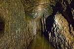 |
| Grube Finstergrund | Baden-Württemberg | Wieden | Fluorspar | 47.8328°N 7.9032°E | 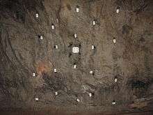 |
| Silberschacht | Bavaria | Bach a.d. Donau | Gemstone, silver | 49.0256°N 12.3021°E | |
| Kupferberg Mine | Bavaria | Kupferberg | Copper | 50.1393°N 11.5758°E | |
| Salzbergwerk Alte Saline | Bavaria | Bad Reichenhall | Salt | 47.7210°N 12.8773°E | |
| Grube Stephansberg | Bavaria | Bamberg | Sand, underground; 12 km galleries, thereof 2 km open to the public | 49.8864°N 10.8873°E | |
| Salzbergwerk Berchtesgaden | Bavaria | Berchtesgaden | Salt | 47.6383°N 13.0175°E |  |
| Schaubergwerk Silberberg | Bavaria | Bodenmais | Pyrite, Vitriol | 49.0574°N 13.1259°E | 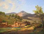 |
| Grube Grünten | Bavaria | Burgberg (Allgäu) | Iron | 47.5389°N 10.3220°E | |
| Grube Gleißinger Fels | Bavaria | Fichtelberg, district Neubau | Biotite, Granite | 50.0078°N 11.8368°E | |
| Schmutzlerzeche | Bavaria | Goldkronach | Gold, small mine, 35 m gallery | 50.0104°N 11.7063°E | 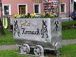 |
| Grube Mittlerer Name Gottes | Bavaria | Goldkronach | Gold | 50.0104°N 11.7063°E |  |
| Grube Kropfmühl | Bavaria | Hauzenberg | Graphite | 48.6258°N 13.6605°E | |
| Fürstenzeche | Bavaria | Lam | Silver | 49.1986°N 13.0766°E | |
| Friedrich-Wilhelm-Stollen | Bavaria | Lichtenberg | Iron, copper, fluorspar | 50.3913°N 11.6857°E | 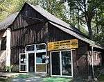 |
| Tiefstollen Peissenberg | Bavaria | Peißenberg | Coal tar | 47.7971°N 11.0579°E | |
| Grube Wilhelmine | Bavaria | Sommerkahl | Copper | 50.0691°N 9.2719°E | 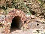 |
| Reichhardt–Schacht | Bavaria | Stulln | Fluorspar | 49.4384°N 12.1055°E | |
| Grube Gottessegen | Hesse | Alheim, district Oberellenbach | Barite | 51.0179°N 9.6420°E | |
| Grube Bertsch | Hesse | Bad Wildungen, district Bergfreiheit | Copper | 51.0502°N 9.0915°E | 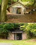 |
| Burgbergstollen | Hesse | Battenberg (Eder) | Iron | 51.0157°N 8.6424°E | _Burgbergstollen-DSCF3388.jpg) |
| Hessian Brown Coal Museum | Hesse | Borken | Brown coal | 51.0452°N 9.2843°E |  |
| Grube Christiane | Hesse | Diemelsee, district Adorf | Iron | 51.3739°N 8.7997°E | |
| Grube Ypsilanta | Hesse | Dillenburg, district Oberscheld | Iron | 50.7415°N 8.3692°E | |
| Goldbergbau Eisenberg | Hesse | Korbach, district Goldhausen | Gold, shaft: Georgschacht | 51.2495°N 8.8222°E | |
| Grube Gustav | Hesse | Meißner, district Abterode | Barium, copper, barite | 51.2115°N 9.9383°E | |
| Grube Fortuna | Hesse | Solms, district Oberbiel | Iron | 50.5745°N 8.4230°E | 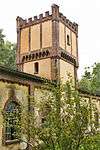 |
| Grube Ludwig | Hesse | Wald-Michelbach | Manganese, from 1889 till 1918 | 49.5651°N 8.8509°E | |
| Grube Ludwig | Hesse | Wetzlar | Iron, alsoHausertorstollen;started 1842, November 13, from 1944 used for underground war production | 50.5594°N 8.5033°E | |
| Schiefergrube Christine | Hesse | Willingen (Upland) | Slate | 51.2984°N 8.6119°E | |
| Knesebeckschacht | Lower Saxony | Bad Grund (Harz) | Lead, zinc, silver, alternative names: Erzbergwerk Grund and Grube Hilfe Gottes | 51.8058°N 10.2250°E | |
| Scholmzeche | Lower Saxony | Bad Lauterberg | Lead, zinc, iron | 51.6294°N 10.4717°E | 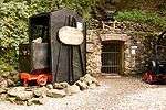 |
| Klosterstollen | Lower Saxony | Barsinghausen | Stone coal | 52.2995°N 9.4691°E | |
| Grube Dorothea | Lower Saxony | Clausthal-Zellerfeld | Silver, Silver, lead glance | 51.7980°N 10.3611°E | |
| Grube Rosenhof | Lower Saxony | Clausthal-Zellerfeld | underground wheel pit | 51.8066°N 10.3136°E | |
| Besucherbergwerk Rammelsberg | Lower Saxony | Goslar | UNESCO-World Heritage Site | 51.8875°N 10.4316°E | 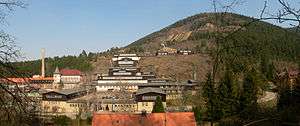 |
| Feggendorfer Stollen | Lower Saxony | Lauenau | Stone coal | 52.2914°N 9.4095°E | |
| Grube Lautenthals Glück | Lower Saxony | Langelsheim, district Lautenthal | Lead glance, zinc blende; 150 m of underground ore transport with ships | 51.8641°N 10.2825°E | _IMG_5556.jpg) |
| Museum Industriekultur | Lower Saxony | Osnabrück | Stone coal, with 300 m historical underground galleries | 52.3151°N 8.0088°E | 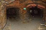 |
| Hüttenstollen Osterwald | Lower Saxony | Salzhemmendorf, district Osterwald | Stone coal | 52.1144°N 9.6255°E | 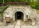 |
| Grube Catharina Neufang | Lower Saxony | Sankt Andreasberg | Lead, silver; access via Grube Samson | 51.7130°N 10.5158°E | |
| Grube Roter Bär | Lower Saxony | Sankt Andreasberg | Iron | 51.7125°N 10.5269°E | 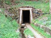 |
| Grube Samson | Lower Saxony | Sankt Andreasberg | Last fully operational man engine, worldwide; UNESCO-World Heritage Site | 51.7130°N 10.5161°E | |
| Grube Wennsglückt | Lower Saxony | Sankt Andreasberg | Silver, cobalt, copper | 51.7121°N 10.5274°E | 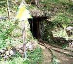 |
| 19-Lachter-Stollen | Lower Saxony | Wildemann | Lead, zinc | 51.8239°N 10.2814°E | 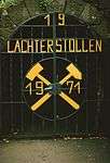 |
| Schieferschaubergwerk Raumland | North Rhine-Westphalia | Bad Berleburg, district Raumland | Slate | 51.0232°N 8.3867°E | |
| Erzbergwerk Ramsbeck | North Rhine-Westphalia | Bestwig, district Ramsbeck | Lead, zinc; with operational mine railway | 51.3156°N 8.4028°E | 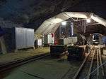 |
| Venetianerstollen | North Rhine-Westphalia | Bestwig, district Ramsbeck | Copper | 51.3045°N 8.3972°E | |
| Zeche Graf Wittekind | North Rhine-Westphalia | Dortmund, district Syburg | Stone coal | 51.4210°N 7.4801°E | 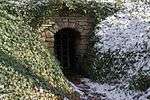 |
| Grube Wohlfahrt | North Rhine-Westphalia | Hellenthal, district Rescheid | Lead, zinc | 50.4346°N 6.4550°E | |
| Stahlberger Erbstollen | North Rhine-Westphalia | Hilchenbach, district Müsen | Iron | 50.9922°N 8.0263°E | 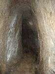 |
| Grube Altenberg | North Rhine-Westphalia | Kreuztal, district Littfeld | Iron, lead, zinc | 51.0061°N 8.0077°E | |
| Kilianstollen | North Rhine-Westphalia | Marsberg | Copper | 51.4533°N 8.8616°E | |
| Wodan-Stollen | North Rhine-Westphalia | Neunkirchen, district Salchendorf | Iron | 50.7983°N 8.0187°E | 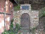 |
| Grube Günnersdorf | North Rhine-Westphalia | Mechernich | Lead, zinc; part of mining museum Mechernich | 50.5865°N 6.6492°E | |
| Besucherbergwerk Philippstollen | North Rhine-Westphalia | Olsberg | Iron | 51.3650°N 8.5216°E | 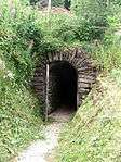 |
| Bleierzgrube Neu-Glück | North Rhine-Westphalia | Plettenberg | Lead | 51.2216°N 7.8707°E | |
| Besucherbergwerk Kleinenbremen | North Rhine-Westphalia | Porta Westfalica, district Kleinenbremen | Iron | 52.2306°N 9.0411°E | 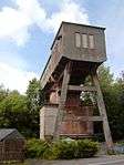 |
| Reinhold Förster Erbstollen | North Rhine-Westphalia | Siegen, district Eiserfeld | Iron; outstanding portal | 50.8330°N 7.9841°E | 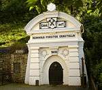 |
| Grube Silberhardt | North Rhine-Westphalia | Windeck, district Öttershagen | Silver | 50.8231°N 7.6430°E | 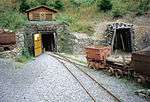 |
| Zeche Nachtigall | North Rhine-Westphalia | Witten, district Bommern | Stone coal | 51.4289°N 7.3134°E | |
| Grube Wilhelm (Antweiler) | Rhineland-Palatinate | Antweiler | Copper | 50.4009°N 6.8322°E | |
| Schmittenstollen | Rhineland-Palatinate | Bad Münster am Stein-Ebernburg | Mercury | 49.7904°N 7.7817°E | |
| Mühlenberger Stollen | Rhineland-Palatinate | Bleialf | Lead | 50.2394°N 6.2864°E | |
| Besucherbergwerk Herrenberg | Rhineland-Palatinate | Bundenbach | Slate | 49.8437°N 7.3834°E | |
| Alvenslebenstollen | Rhineland-Palatinate | Burglahr | Gallery drainage, total length 1546 m, 400 m could be visited | 50.6157°N 7.5005°E | |
| Fell Exhibition Slate Mine | Rhineland-Palatinate | Fell | Slate | 49.7558°N 6.7990°E | 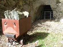 |
| Kupferbergwerk Hosenberg | Rhineland-Palatinate | Fischbach | Copper, historical ore dressing plants | 49.7546°N 7.3818°E | |
| Grube Holzappel | Rhineland-Palatinate | Holzappel | Lead, zinc | 50.3408°N 7.8927°E | |
| Edelsteinmine Steinkaulenberg | Rhineland-Palatinate | Idar-Oberstein | Precious stones | 49.7293°N 7.2872°E | |
| Grube Maria | Rhineland-Palatinate | Imsbach | Iron | 49.5913°N 07.8999°E | |
| Weiße Grube | Rhineland-Palatinate | Imsbach | Copper, cobalt, iron, silver | 49.5917°N 07.8997°E | 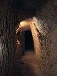 |
| Römerbergwerk Meurin | Rhineland-Palatinate | Kretz | Tuff, from Roman times | 50.3962°N 7.3533°E | 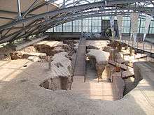 |
| Grube Bendisberg | Rhineland-Palatinate | Langenfeld, district St. Jost | Lead, zinc | 50.3607°N 7.1025°E | |
| Dachschieferbergwerk Assberg | Rhineland-Palatinate | Limbach | Slate, started 1548 | 50.6944°N 7.7927°E | |
| Eisenerzgrube Edelstein | Rhineland-Palatinate | Luckenbach | Iron | 50.7019°N 7.8317°E | |
| Lavakeller Mendig | Rhineland-Palatinate | Mendig, district Niedermendig | Trachyte, also vulcano museum Lava-Dome | 50.3757°N 7.2827°E | 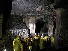 |
| Pützlöcher | Rhineland-Palatinate | Newel, district Butzweiler | Copper, started by the Romans | 49.8221°N 6.6344°E | |
| St.-Anna-Stollen | Rhineland-Palatinate | Nothweiler | Iron | 49.0668°N 7.8112°E | 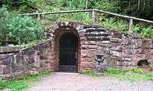 |
| Museum Steinbruch Rammelsbach | Rhineland-Palatinate | Rammelsbach | Hard rock, quarryman duties, geology | 49.5446°N 7.4503°E | |
| Grube Bindweide | Rhineland-Palatinate | Steinebach/Sieg | Iron | 50.7329°N 7.8291°E | 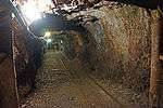 |
| Grube Georg | Rhineland-Palatinate | Willroth | Iron | 50.5672°N 7.5222°E | 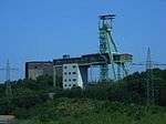 |
| Kalkbergwerk am Königsberg | Rhineland-Palatinate | Wolfstein | Lime | 49.5815°N 7.6119°E | 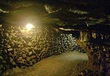 |
| Saarländisches Bergbaumuseum | Saarland | Bexbach | Underground show mine in the museum | 49.3494°N 7.2594°E | 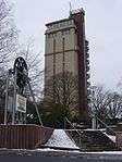 |
| Kupferbergwerk Düppenweiler | Saarland | Beckingen | Copper | 49.4127°N 6.7830°E | 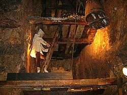 |
| Schlossberghöhlen | Saarland | Homburg | Red sandstone, largest sandstone caves in Europe | 49.3211°N 7.3433°E | 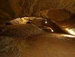 |
| Kupferbergwerk Walhausen | Saarland | Nohfelden, district Saar | Copper, lead | 49.5606°N 7.1294°E | |
| Erlebnisbergwerk Velsen | Saarland | Saarbrücken | Stone coal | 49.2164°N 6.8337°E | |
| Besucherbergwerk Rischbachstollen | Saarland | St. Ingbert | Stone coal | 49.2851°N 7.1002°E | |
| Emilianus-Stollen | Saarland | Wallerfangen, district St. Barbara | Copper, Azurite, Malachite; Roman mine from approx. 200 A.D. | 49.3302°N 6.6798°E | 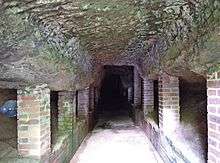 |
| Bergbaumuseum Altenberg | Saxony | Altenberg | Zinc, also ore dressing plant | 50.7628°N 13.7694°E | _2006-06-28.jpg) |
| Vereinigt Zwitterfeld zu Zinnwald | Saxony | Altenberg, district Zinnwald | Tin | 50.7410°N 13.7654°E | _2006-06-28.jpg) |
| Erzgebirgsmuseum | Saxony | Annaberg-Buchholz | Silver, started 1500; museum with silver mine ‘‘Im Gößner‘‘ | 50.5784°N 13.0044°E | 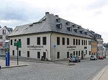 |
| Dorothea-Stolln | Saxony | Annaberg-Buchholz, district Cunersdorf | Silver, cobalt, copper, nickel, uranium; with underground boat tour | 50.5582°N 13.0016°E | |
| Markus-Röhling-Stolln | Saxony | Annaberg-Buchholz, district Frohnau | Silver, cobalt, from 1500 till 1857 | 50.5984°N 12.9954°E | _2006-11-04.jpg) |
| Fundgrube St. Briccius | Saxony | Annaberg-Buchholz, district Geyersdorf | Silver, copper | 50.5737°N 13.0401°E | |
| Vestenburger Stolln | Saxony | Aue | Tin | 50.5822°N 12.7067°E | |
| Reichenbach-Stolln | Saxony | Lößnitz | Silver, lead glance, arsenopyrite from 1500 till 1927 | 50.5978°N 12.7373°E | |
| Marie-Louise-Stolln | Saxony | Bad Gottleuba-Berggießhübel, district Berggießhübel | Iron, copper | 50.8749°N 13.9495°E | _2007-02-10.jpg) |
| Besucherbergwerk Bad Schlema | Saxony | Bad Schlema | Silver, uranium; also Markus-Semmler-Stollen; part of UNESCO-World Heritage Site Erzgebirge | 50.6014°N 12.6567°E | 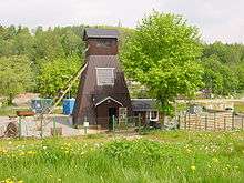 |
| Bartholomäusschacht | Saxony | Brand-Erbisdorf, district Erbisdorf | Silver | 50.8603°N 13.3195°E | 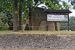 |
| Besucherbergwerk St. Christoph | Saxony | Breitenbrunn | Iron, tin | 50.4800°N 12.7545°E | |
| Oberer Rother Adler | Saxony | Breitenbrunn, district Rittersgrün | Iron, 19th century | 50.4716°N 12.8113°E | 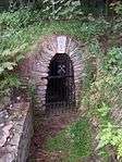 |
| Besucherstolln Fuchsloch | Saxony | Breitenbrunn, district Rittersgrün | medieval mine | 50.4578°N 12.8447°E | |
| [elsendome Rabenstein | Saxony | Chemnitz | Marble, 700 m underground gallery with lake and green grotto; option for cave diving | 50.8365°N 12.8429°E | |
| Fortuna-Stolln | Saxony | Deutschneudorf, district Deutschkatharinenberg | Copper, silver; has seen undercover German transports of unknown goods by the end of WWII; operational steam engine from 1922 | 50.6114°N 13.4390°E | |
| Aurora Erbstolln | Saxony | Dorfhain | Silver, lead, barite, fluorite | 50.9249°N 13.5506°E | |
| Zinngrube Am Sauberg | Saxony | Ehrenfriedersdorf | Tin, 750 years of history | 50.6425°N 12.9739°E | |
| Himmelfahrt Fundgrube | Saxony | Freiberg | Silver, later lead and zinc; also named Besucherbergwerk Freiberg Reiche Zeche | 50.9282°N 13.357°E | 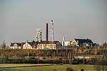 |
| Herkules Frisch Glück | Saxony | Grünhain-Beierfeld, district Waschleithe | Iron, copper, sulphur, arsene, lead glance, marble; underground lake | 50.5522°N 12.8253°E | |
| St. Lampertus-Schacht | Saxony | Hohenstein-Ernstthal, district Ernstthal | Arsenopyrite with traces of gold and silver; formerly Saxony's most profitable gold mine | 50.8052°N 12.7259°E | |
| Frisch Glück „Glöckl" | Saxony | Johanngeorgenstadt | Silver, bismuth, uranium | 50.4283°N 12.7314°E | 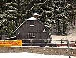 |
| Andreas-Gegentrum-Stolln | Saxony | Jöhstadt, district Steinbach | Silver, cobalt | 50.5465°N 13.1400°E | |
| Besucherbergwerk Am Graben | Saxony | Kirchberg | Iron | 50.6213°N 12.5251°E | |
| Altes Kalkbergwerk Miltitz | Saxony | Klipphausen, district Miltitz | Lime and marble; including visit to Adolf-von-Heynitz-Stolln; starting 1944 used as underground production plant | 51.1035°N 13.4153°E | |
| Kalkwerk Lengefeld | Saxony | Lengefeld | Marble | 50.7004°N 13.1706°E | 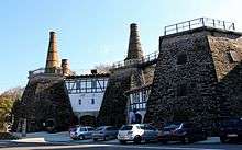 |
| Besucherbergwerk Wismutstolln | Saxony | Lichtenau, district Merzdorf | Silver, medieval; starting 1950 exploration for uranium; alternative name: Alte Silberfundgrube Hülfe des Herrn am Erzberge zu Biensdorf | 50.9313°N 13.0130°E | |
| Besucherbergwerk Trau auf Gott-Erbstolln | Saxony | Lichtenberg | Silver | 50.8263°N 13.4353°E | 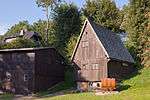 |
| St. Anna Fundgrube | Saxony | Limbach-Oberfrohna, district Herrnsdorf (zu Wolkenburg-Kaufungen) | Copper, lead, silver; medieval | 50.8980°N 12.6582°E | |
| Segen Gottes Erbstolln | Saxony | Limbach-Oberfrohna, district Uhlsdorf (Wolkenburg region) | Copper, lead, silver; medieval | 50.8898°N 12.6438°E | |
| Rudolphschacht | Saxony | Marienberg, district Lauta | historical horse-capstan | 50.6629°N 13.1439°E | .jpg) |
| Molchner Stolln | Saxony | Marienberg, district Pobershau | Zinc, silver | 50.6372°N 13.2169°E | 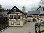 |
| Grube Tannenberg | Saxony | Muldenhammer, district Tannenbergsthal | Zinc | 50.4158°N 12.4596°E | 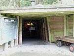 |
| Bergbaumuseum Oelsnitz | Saxony | Oelsnitz | Stone coal; formerly VEB Steinkohlenwerk Karl Liebknecht and VEB Steinkohlenwerk Oelsnitz/Erzgeb. | 50.7250°N 12.7300°E | .jpg) |
| Gnade Gottes Erbstollen | Saxony | Olbernhau | Non-ferrous metal mining for Saigerhütte Grünthal | 50.6605°N 13.3665°E | |
| Alaunbergwerk Ewiges Leben | Saxony | Plauen | Potash alum, between 1542 and 1846 | 50.4986°N 12.1353°E | |
| Alaunwerk Mühlwand | Saxony | Reichenbach im Vogtland, district Rotschau | Potash alum, between 1691 and 1827 | 50.5994°N 12.2908°E | 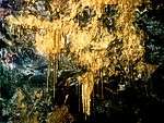 |
| Alte Hoffnung Erbstolln | Saxony | Rossau, district Schönborn-Dreiwerden | Lead, copper, silver; with underground boat tour | 50.9602°N 13.002°E | |
| Besucherbergwerk Grüner Zweig | Saxony | Schlettau | Silver, starting around 1500 | 50.5567°N 12.9533°E | |
| Fundgrube Weißer Hirsch | Saxony | Schneeberg | Silver, cobalt, bismuth, nickel; later uranium | 50.5882°N 12.6376°E | 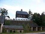 |
| Fundgrube und Erbstollen Morgenstern | Saxony | Schwarzenberg, district Pöhla | Zinc, iron, silver, wolfram; starting 1500 | 50.4976°N 12.8177°E | |
| Besucherbergwerk Pöhla | Saxony | Schwarzenberg, district Pöhla | Zinc and uranium; 3 km underground galleries open to the public | 50.4925°N 12.8202°E |  |
| Segen Gottes Erbstollen | Saxony | Striegistal, district Gersdorf | Silver; medieval | 51.066°N 13.216°E | |
| Wille Gottes Stolln | Saxony | Thalheim | Arsen | 50.7085°N 12.8374°E | |
| Besucherbergwerk Am Steghaus | Saxony | Zschopau | Silver, lead glance; in neighbourhood to „Heilige-Dreifaltigkeits-Fundgrube“ | 50.7455°N 13.0856°E | |
| St. Anna am Freudenstein | Saxony | Zschorlau | Silver; also Oberer und Unterer Troster Stolln | 50.5828°N 12.6581°E | 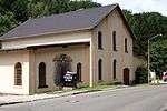 |
| Grube Glasebach | Saxony-Anhalt | Harzgerode, district Straßberg | Fluorspar | 51.6125°N 11.0608°E | |
| Erzgrube Büchenberg | Saxony-Anhalt | Oberharz am Brocken, district Elbingerode | Iron | 51.7912°N 10.8179°E | |
| Drei Kronen & Ehrt | Saxony-Anhalt | Oberharz am Brocken, district Elbingerode | Iron pyrite, sulphur; formerly ‚‘Grube Einheit‘‘ | 51.7639°N 10.8258°E |  |
| Röhrigschacht | Saxony-Anhalt | Sangerhausen, district Wettelrode | Copper | 51.5174°N 11.2825°E | 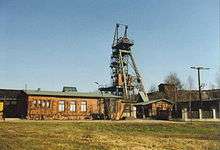 |
| Besucherbergwerk Am Aschenberg | Thuringia | Bad Liebenstein | Bergbautechnik in einem alten Bierkeller | 50.8119°N 10.3618°E | |
| Besucherbergwerk Hühn | Thuringia | Brotterode-Trusetal, district Trusetal | Barite and fluorspare | 50.7836°N 10.4219°E | |
| Marienglashöhle | Thuringia | Friedrichroda | Gypsum and copper-slate | 50.8625°N 10.5416°E | 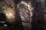 |
| Rabensteiner Stollen | Thuringia | Harztor, district Ilfeld | Stone coal | 51.6023°N 10.7899°E | 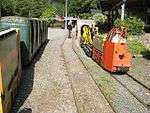 |
| Besucherbergwerk Lange Wand | Thuringia | Harztor, district Niedersachswerfen | Copper-slate | 51.5691°N 10.7862°E | |
| Schaubergwerk Volle Rose | Thuringia | Ilmenau | Barite and fluorspore | 50.6644°N 10.9236°E | |
| Besucherbergwerk Vereinigte Reviere | Thuringia | Kamsdorf | Iron, silver, copper | 50.6442°N 11.4695°E | |
| Erlebnisbergwerk Merkers | Thuringia | Krayenberg, district Merkers | Salt mine; major hide away for treasures in late WWII | 50.8203°N 10.1247°E | 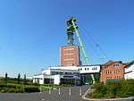 |
| Saalfeld Fairy Grottoes | Thuringia | Saalfeld | Alaun | 50.6350°N 11.3413°E | 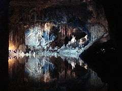 |
| Besucherbergwerk Finstertal | Thuringia | Schmalkalden, district Asbach | Iron | 50.7287°N 10.4955°E | |
| Schaubergwerk Morassina | Thuringia | Schmiedefeld | Alaun | 50.5353°N 11.2255°E | |
| Erlebnisbergwerk Glückauf | Thuringia | Sondershausen | Salt | 51.3699°N 10.8466°E | 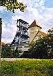 |
| Besucherbergwerk Schwarzer Crux | Thuringia | Suhl, district Vesser | Iron | 50.6031°N 10.7928°E | |
| Märchen- und Sandsteinhöhle | Thuringia | Walldorf | Sand (underground) | 50.6119°N 10.3850°E | |
Finland
| Name | Province | Municipality | Notes | Location | Picture |
|---|---|---|---|---|---|
| Lampivaara Amtyst Mine | Lappland | Lampivaara | Amethyst | 63.2404°N 30.0055°E | |
| Tytyri gruvmuseum | Southern Finland Province | Lohja | Lime | 60.2644°N 24.0681°E |
France
| Name | Region | Département | Municipality | Notes | Location | Picture |
|---|---|---|---|---|---|---|
| Caverne du dragon | Picardie | Aisne | Oulches-la-Vallée-Foulon | Lime; medieval | 49.4414°N 3.7324°E | 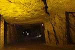 |
| Catacombs of Paris | Île-de-France | Paris | Lime, gypsum; starting 18th century: used as necropolis for over 6 million people | 48.8340°N 2.3323°E | ||
| Mine de Blanzy | Burgundy | Saône-et-Loire | Blanzy | Coal | 46.7014°N 4.3826°E | |
| Gabe Gottes | Alsace | Haut-Rhin | Sainte-Marie-aux-Mines | Silver | 48.2303°N 7.1642°E | 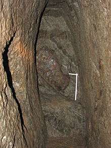 |
| Saint Louis Eisenthür | Alsace | Haut-Rhin | Sainte-Marie-aux-Mines | Silver | 48.2452°N 7.1831°E |  |
| Silvergrube St. Barthélemy | Alsace | Haut-Rhin | Sainte-Marie-aux-Mines | Silver | 48.2405°N 7.1801°E | |
| Saint Jean Engelsbourg | Alsace | Haut-Rhin | Sainte-Marie-aux-Mines | Silver; alternative name Parc Tellure | 48.2136°N 7.1362°E | |
| Mine St. Nicolas | Alsace | Haut-Rhin | Steinbach | Lead, silver, iron, copper | 47.8205°N 7.1522°E | |
| Mine Temoin | Languedoc-Roussillon | Gard | Alès | Coal | 44.1321°N 4.0665°E | 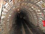 |
| Pioch Farrus Mine | Languedoc-Roussillon | Gard | Cabrières | Copper; oldest mine in France | 43.5797°N 3.3692°E | |
| Mine de Vielle-Aure | Midi-Pyrénées | Hautes-Pyrénées | Vielle-Aure | Manganese | 42.8131°N 0.2959°W | |
| Mine du Val de Fer | Lorraine | Meurthe-et-Moselle | Neuves-Maisons | Iron | 48.6156°N 6.1087°E | |
| Musée des Mines de Fer Aumetz | Lorraine | Moselle | Aumetz | Iron | 49.4228°N 5.9491°E |  |
| Mines de Fer de Neufchef | Lorraine | Moselle | Neufchef | Iron | 49.3256°N 6.0280°E | |
| St. Joseph | Lorraine | Vosges | La Croix-aux-Mines | Silver; medieval; altgernative name: Mine d’argent de la Croix aux Mines | 48.2239°N 7.0508°E | |
| La Mine, grandeur nature | Lorraine | Moselle | Petite-Rosselle | Coal; largest show mine in France | 49.2038°N 6.8632°E | 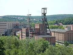 |
| Minier Lewarde | Nord-Pas-de-Calais | Nord | Lewarde | Coal | 50.3317°N 3.1719°E | |
| Mine Bleue | Pays de la Loire | Maine-et-Loire | Noyant-la-Gravoyère | Slate | 47.7131°N 0.9564°W | |
| Mine Couriot | Rhône-Alpes | Loire | Saint-Étienne | Coal | 45.43841°N 4.3763°E | |
| Mine de Cap Garonne | Provence-Alpes-Côte d’Azur | Var | Le Pradet | Copper | 43.0813°N 6.0351°E | |
| Terra Vinea, Les caves Rochere | Languedoc-Roussillon | Aude | Rochere | Gypsum | 43.0516°N 2.9275°E | |
| Cathédrale d'Images | Provence-Alpes-Côte d’Azur | Bouches-du-Rhône | Les Baux-de-Provence | Lime | 43.7438°N 4.7952°E | 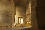 |
Greece
| Name | Provinz | Municipality | Notes | Location | Picture |
|---|---|---|---|---|---|
| Phocis Mining Park | Phocis | Delphi | Bauxite | 38.6321°N 22.3717°E |
Indonesia
| Name | Province | Municipality | Notes | Location | Picture |
|---|---|---|---|---|---|
| Lubang Mbah Suro | Padang, Sumatra | Sawahlunto | Coal | 0.6805°S 100.7762°E |
Ireland
| Name | County | Municipality | Notes | Location | Picture |
|---|---|---|---|---|---|
| Glengowla Mines | Oughterard | Galway | Silver and lead | 53.4182°N 9.3732°W | |
| Arigna Mining Experience | Arigna | Roscommon | Coal | 54.077°N 8.1206°W |
Italy
| Name | Province | Municipality | Notes | Location | Picture | |
|---|---|---|---|---|---|---|
| Bergwerk Villanders | South Tyrol | Villanders | The mine of Villanders was one of the importenst mines at the Middle Ages in the area of Tirol. In the mine of Villanders was alsow found silver.[1] | 46.654196°N 11.54336°E |  | |
| Schaubergwerk Prettau | South Tyrol | Prettau (Ahrntal) | Copper | 47.045104°N 12.120516°E |  | |
| BergbauWelt Ridnaun-Schneeberg | South Tyrol | Ridnaun Municipality Ratschings | Together with Passeier-Schneeberg highest lying mine in Europe | 46.928317°N 11.270977°E |  | |
| BergbauWelt Passeier-Schneeberg | South Tyrol | Moos in Passeier | Together with Ridnaun-Schneeberg highest lying mine in Europe | 46.900686°N 11.183386°E | ||
| Miniere Val Trompia | Brescia | Montana di Val Trompia | Iron; minor climbing activity necessary to visit the mine; also historical furnace | 45.678956°N 10.187376°E | ||
| Miniera Marzoli di Pezzaze | Brescia | Stravignino | Iron; with mine railway | 45.774853°N 10.241672°E | ||
| Miniera Schilpario | Bergamo | Schilpario | Barite and fluorite; also named: Parco Minerario Ing. Andrea Bonicelli | 46.019168°N 10.199290°E | ||
| Miniera di Gambatesa | Genoa | Val Graveglia | Iron; active mine till August 2012 | 44.334561°N 9.436825°E | ||
| Galleria Ravaccione | Massa-Carrara | Carrara | Marble; in-ground mine | 44.090005°N 10.133976°E |  |
|
| Parco Archeominerario di San Silvestro | Livorno | Campiglia Marittima | Lead and copper | 43.076459°N 10.589732°E |  |
Japan
| Name | Prefecture | Municipality | Notes | Location | Picture |
|---|---|---|---|---|---|
| Sado gold mine | Niigata | Island Sado | Gold and Silver | 38.0166°N 138.3666°E | 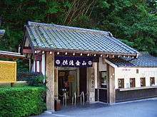 |
| Iwami Ginzan Silver Mine | Shimane | Ōda | Silver; UNESCO-World Heritage Site | 35.1137°N 132.4453°E | |
| Yubari-si Sekitan-no-Rekisimura | Hokkaido | Yubari | Coal; with large museum area | 43.0683°N 141.9891°E |
Luxembourg
| Name | Province | Municipality | Notes | Location | Picture |
|---|---|---|---|---|---|
| Kupfergrube Stolzembourg | Stolzembourg Municipality Putscheid | Copper | 49.9685°N 6.1615°E | 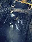 | |
| Musée National des Mines | Rumelange | Iron | 49.4576°N 6.0219°E | 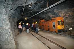 | |
| Fond-de-Gras | Petingen | Iron | 49.5350°N 5.8586°E | 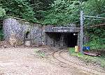 |
Mexico
| Name | State | Municipality | Notes | Location | Picture |
|---|---|---|---|---|---|
| Mina de El Edén | Zacatecas | Zacatecas | Gold and silver, since 1586; offers extensive guided tours | 25.5543°N 100.4955°W | |
| Mineral de Pozos | Guanajuato | Guanajuato, Mexico | 21.2219°N 101.2733°W |  | |
| Guanajuato Mines | Guanajuato | Guanajuato | Several show mines | 21.0127°N 103.4939°W |
New Zealand
| Name | Province | Municipality | Notes | Location | Picture |
|---|---|---|---|---|---|
| Banbury Tourist Mine | Denniston | Coal; one of the oldest coal mines in New Zealand, with ghost town | 41.7526°S 171.8114°E | 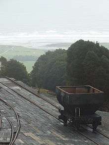 | |
| Mitchells Gully Gold Mine | Charleston | Gold | 41.9051°S 171.4391°E |
Netherlands
| Name | Province | Municipality | Notes | Location | Picture |
|---|---|---|---|---|---|
| Fluweelengrot | Limburg | Valkenburg aan de Geul | Clay; with historical charcoal drawings and underground chapel; medieval | 50.8602°N 5.8305°E |  |
| Gemeentegrot | Limburg | Valkenburg aan de Geul | Lime; with historical charcoal drawings | 50.8625°N 5.8288°E | 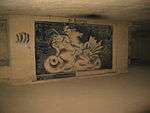 |
| Romeinse Katakomben | Limburg | Valkenburg aan de Geul | Lime; with historical copies of Roman catacombs | 50.8655°N 5.8216°E | |
| Steenkolenmijn Valkenburg | Limburg | Valkenburg aan de Geul | Lime; transformed to coal mine for touristic purposes | 50.8563°N 5.8255°E | |
| Geulhemmergroeve] | Limburg | Geulhem | Lime | 50.8669°N 5.7836°E | |
| Sibbergroeve | Limburg | Sibbe | Lime, with underground chapel from 1865 | 50.8206°N 5.8309°E | |
| Jezuïetenberg | Limburg | Maastricht | Lime; with jesuit chapel | 50.8222°N 5.6630°E | 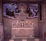 |
| Sint Pietersberg | Limburg | Maastricht | Lime; during cold war headquarter of NORTHAG | 50.8222°N 5.6630°E | 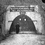 |
Norway
| Name | Province | Municipality | Notes | Location | Picture |
|---|---|---|---|---|---|
| Kongensgruve | Buskerud | Saggrenda near Kongsberg | Silver | 59.6306°N 9.6017°E | 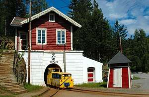 |
| Smaragdgruvene Byrud Gård | Akershus | Minnesund, Eidsvoll | Gemstone | 60.4137°N 11.1985°E | |
| Blaafarveværket | Buskerud | Modum | Cobalt, blue color pigments | 59.9127°N 9.8875°E | |
| Røros Kobberverk | Sør-Trøndelag | Røros | Copper; with furnace and original miners dwelling; 2 show mines: Olavsgruva and Nyberget mine; UNESCO- World Heritage Site | 62.5772°N 11.3891°E | 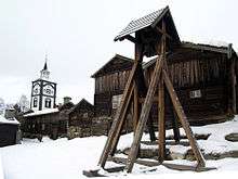 |
| Rutilgruva | Telemark | Kragerø | Rutile | 58.8655°N 9.3705°E | 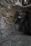 |
| Folldal Gruver | Hedmark | Folldal | Copper, zinc, sulphur; large mining complex with 70 buildings; operational from 1748 till 1993 | 62.1396°N 9.9930°E | 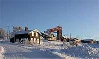 |
| Orkla Industriemuseum | Trøndelag | Løkken Verk | 2 show mines | 63.1247°N 9.7050°E | |
| Sulitjelma Besøksgruver | Nordland | Sulitjelma near Fauske | 100 km north of the polar circle, 1.5 km mining railway, starting in 2015 part of the Sulitjelma Line will become museums railway; mine was operational from 1887 till 1991 | 67.1031°N 16.0786°E | 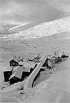 |
| Gruve 3 | Spitzbergen | Longyearbyen | Coal, from 1969 till 1996 | 78.2375°N 15.4455°E |
Pakistan
| Name | Region | Municipality | Notes | Location | Picture |
|---|---|---|---|---|---|
| Khewra Salt Mine | Pind Dadan Khan | Khewra | Salt | 32.6479°N 73.0083°E |
Poland
| Name | Voivodeship | Municipality | Notes | Location | Picture |
|---|---|---|---|---|---|
| Kopalnia Uranu w Kletnie | Dolnośląskie | Kletno | Uranium, since 1948 | 50.2481°N 16.8452°E | 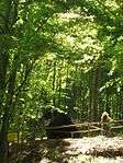 |
| Sztolnie Kowary | Dolnośląskie | Kowary | Iron; uranium since 1948 | 50.7588°N 15.8466°E | 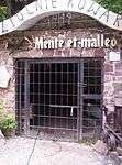 |
| Muzeum Górnictwa i Hutnictwa Złota | Dolnośląskie | Złoty Stok | Gold; mining railway, underground waterfall | 50.4391°N 16.8746°E | 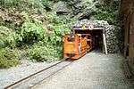 |
| Podziemia kredowe w Chełmie | Lubelskie | Chełm | Lime | 51.3130°N 23.4712°E | 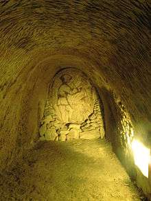 |
| Saltmine Wieliczka | Małopolskie | Wieliczka | Salt; huge mine, started in the 13th century, UNESCO World Heritage Site | 49.9836°N 20.0555°E | 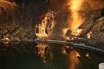 |
| Saltmine Bochnia | Małopolskie | Bochnia | Salt; huge mine, started in the 12th century, UNESCO World Heritage Site | 49.969167°N 20.4175°E | 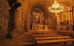 |
| Sztolnia Czarnego Pstrąga | Śląskie | Tarnowskie Góry | Lead and zinc; guided tours with boats | 50.4302°N 18.8005°E | 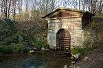 |
| Zabytkowa Kopalnia Srebra | Śląskie | Tarnowskie Góry | Silver; 1740 m tour length, therof 270 m with boats, open-air steam engine museum | 50.4255°N 18.8496°E | |
| Skansen Górniczy Królowa Luiza | Śląskie | Zabrze | Coal, since 1791; 1.5 km guided tour | 50.2975°N 18.8061°E | 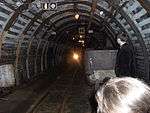 |
| Zabytkowa Kopalnia Węgla Kamiennego Guido | Śląskie | Zabrze | Coal; Steinkohle; visits to the 170 m and the 320 m levels | 50.2897°N 18.7916°E | .jpg) |
| Prahistoryczne Kopalnie Krzemienia w Krzemionkach | Śląskie | Swietokrzyski | Firestone, prehistoric | 50.9692°N 21.4855°E | |
| Saltmine Kłodawa | Wielkopolskie | Kłodawa | Salt, with coloured salt in blue and pink | 52.2380°N 18.9220°E |
Portugal
| Name | District | Municipality | Notes | Location | Picture |
|---|---|---|---|---|---|
| Cova dos Mouros | Faro | Ribeira da Foupana | Copper; prehistoric | 37.3990°N 7.6979°W |
Republic of China, Taiwan
| Name | Provinz | Municipality | Notes | Location | Picture |
|---|---|---|---|---|---|
| Jinguashi Mine | Jinguashi | Rueifang | Gold, also named: Jinguashi Gold Ecological Park | 25.1090°N 121.8576°E | 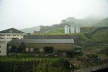 |
| Affe Ecological Park | Jinguashi | Rueifang | Coal | 25.0865°N 121.8278°E |
Romania
| Name | District | Municipality | Notes | Location | Picture |
|---|---|---|---|---|---|
| Salina Turda | Siebenbürgen | Turda | Salt | 46.5765°N 23.7945°E | 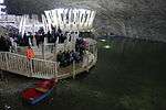 |
| Salina Praid | Siebenbürgen | Praid near Sovata | Salt | 46.5508°N 25.1251°E | 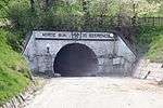 |
Slovakia
| Name | Province | Municipality | Notes | Location | Picture |
|---|---|---|---|---|---|
| Baňa Cígeľ | Idrija | Brown coal; 2 km overhead monorail ride to enter the minem then 500 m walking tour | 48.7337°N 18.6345°E | ||
| Štôlna Bartolomej | Banská Štiavnica | Oldest mining town in Slowakia | 48.4508°N 18.8871°E | 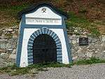 |
Slovenia
| Name | Province | Municipality | Notes | Location | Picture |
|---|---|---|---|---|---|
| Antonijev rov | Idrija | Mercury | 45.999°N 14.0225°E | 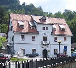 | |
| Museum Mežica | Mežica | Lead and zinc | 46.5120°N 14.8567°E | .jpg) | |
| Muzej Premogovništva Slovenije | Velenje | Coal | 46.3724°N 15.0985°E |
South Korea
| Name | Province | Municipality | Notes | Location | Picture |
|---|---|---|---|---|---|
| Jasujeong mines | Ulsan | Eonyang | Amethyst | 35.5484°N 129.0878°E |
Spain
| Name | Region | Province | Municipality | Notes | Location | Picture |
|---|---|---|---|---|---|---|
| Parque Minero de Riotinto | Andalusia | Huelva | Minas de Riotinto | Pyrite; gave name to the mining company Rio Tinto Group | 37.6833°N 6.5833°W | 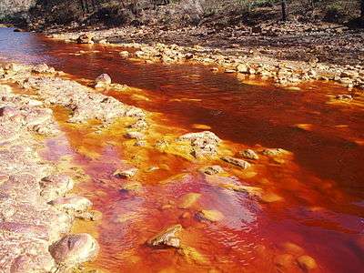 |
| Mina de la Jayona | Extremadura | Badajoz | Sierra de la Jayona | Iron | 38.1634°N 5.9004°W | |
| Minas de Arditurri | Basque | Gipuzkoa | Oiartzun | Iron; started in Roman times, till 1984 | 43.2838°N 1.8080°W | |
| Món De Sal | Catalonia | Barcelona | Barcelona | Salt | 41.9135°N 1.6465°E | 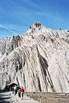 |
| Parque Arqueológico Minas de Gavà | Catalonia | Barcelona | Gavà | Prehistoric mine (approx. 4000 BD) | 41.3099°N 2.001°E | 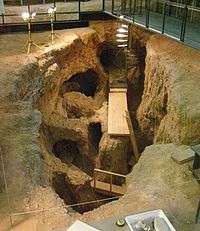 |
| Minas de Manganeseeso de Puras de Villafranca | Castile and León | Burgos | Belorado | Manganese | 42.3781°N 3.2424°W | |
| La Union | Murcia | Murcia | La Union | Silver, lead, zinc, pyrite; large mining region with many adits and remains from ore processing | 37.6153°N 0.8729°W |  |
Sweden
| Name | Province | Municipality | Notes | Location | Picture |
|---|---|---|---|---|---|
| Falun Mine (Falu gruva) | Dalarna | Lernbo, Municipality Smedjebacken | Copper; started in the 9th century; during 17th century 2/3 of worldwide copper production, closed 1992 | 60.5988°N 15.6122°E | 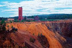 |
| Flogbergets gruva | Dalarna | Lernbo, Municipality Smedjebacken | Part of Ekomuseum Bergslagen, Silver, Iron, zinc, manganese | 60.1455°N 15.3047°E |  |
| Hornkullens silvergruvor | Värmlands län | Nykroppa | Silver | 59.6222°N 14.3000°E |  |
| Stollbergs gruva | Dalarna | Lernbo, Municipality Smedjebacken | Part of Ekomuseum Bergslagen, Silver, Iron, zinc, manganese | 60.1869°N 15.2791°E | 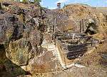 |
| Loos Koboltgruva | Gävleborgs län | Los | Nickel; ore from this mine led 1735 to the discovery of the element nickel. | 61.7422°N 15.1565°E | .jpg) |
| Tykarpsgrottan | Skåne län | Iganberga | Lime; underground mining, because lime is very rare in Sweden | 56.1695°N 13.8620°E | 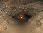 |
| Malmbergsgruvan | Norrbottens län | Gällivare | Iron; next to an active iron mine | 67.1959°N 20.7080°E | 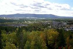 |
| Kiruna gruva | Norrbottens län | Kiruna | Iron, magnesite; next to an active mine | 67.8502°N 20.1926°E | 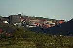 |
| Bondstollen Koppaberg | Örebro län | Koppaberg | Iron, silver, gold, sulfide | 59.8750°N 14.9911°E | 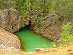 |
| Skottvångs gruva | Södermanlands län | Gnesta and Strängnäs | Iron | 59.1810°N 17.1354°E | |
| Lockgruvan | Örebro län | Nora | Iron | 59.4919°N 15.0081°E | |
| Koppartorp | Södermanlands län | Tunaberg Municipality Nyköping | Copper, cobalt; with ghost town and many old abandoned mines | 58.6369°N 16.8997°E | 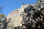 |
| Långban | Värmlands län | Filipstad | Flooded, cave diving opportunity | 59.8500°N 14.2500°E | 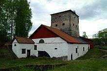 |
| Kristinebergsgruvan | Västerbotten | Lycksele | Copper, zinc, silver, gold | 65.0586°N 18.5679°E | 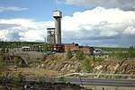 |
| Storbergets gruvor | Gävleborgs län | Torsåker | 60 open pits plus small adits | 60.5270°N 16.3921°E | 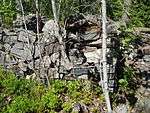 |
| Sala silvergruva | Västmanlands län | Sala | Silver | 64.8009°N 20.7423°E | |
| Vildmarksgruvan | Västerbotten | Skellefteå | Pegmatite | 64.8009°N 20.7423°E | |
| Kleva gruva | Småland | Ventlanda | Copper, nickel; 2 km adits open to the public, underground church | 57.4377°N 15.2057°E | |
| Fröå gruva | Åreskutan bei Åre | Skellefteå | Copper | 63.4041°N 13.2083°E | 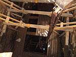 |
Switzerland
| Name | Canton | Municipality | Notes | Location | Picture |
|---|---|---|---|---|---|
| Landesplattenberg | Glarus | Engi, district Hinterdorf | Slate | 46.9749°N 9.1425°E | |
| Silberberg Davos | Graubünden | Davos Monstein | Silver | 46.7132°N 9.7587°E | |
| Stollen am Mot Madlain | Graubünden | Scuol, district S-charl | Silver and lead; medieval | 46.7266°N 10.3277°E | |
| La Presta | Neuchâtel | Val-de-Travers | Asphalt | 46.9319°N 6.6611°E | |
| Gipsmuseum Schleitheim | Schaffhausen | Schleitheim, district Oberwiesen | Gypsum | 47.751389°N 8.489722°E | |
| Gonzen | St. Gallen | Sargans | Iron (hematite, magnetite, hausmannite) | 47.0672°N 9.4338°E | |
| Salzbergwerk Bex | Waadt | Bex | Salt; part of an active mine | 46.2608°N 7.0291°E | 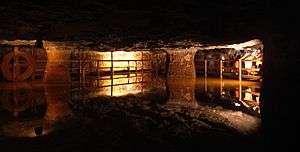 |
| Coppermine „La Lée“ | Wallis | Anniviers, district Zinal | 46.1065°N 7.6310°E | ||
| Bergwerk Riedhof | Zürich | Aeugst am Albis | Braunkohle und Mergel-Bergwerk | 47.2865°N 8.4824°E | |
| Quarzsandbergwerk Chrästel | Zürich | Buchs | Quartz sand | 47.4578°N 8.4532°E | |
| Bergwerk Käpfnach | Zürich | Horgen | Brown coal and clay, 80 km of galleries in total | 47.2533°N 8.6136°E |
Ukraine
| Soledar Salt Mine | Donetsk | Soledar | Salt | 48.6830°N 38.0934°E | 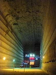 |
United Kingdom
USA
| Name | State | Municipality | Notes | Location | Picture | |
|---|---|---|---|---|---|---|
| Goldfield Ghost Town | Arizona | Apache Junction | Gold; with ghost town | 33.4567°N 111.4922°W | ||
| Copper Queen Mine | Arizona | Bisbee | Copper | 31.4403°N 109.9133°W | 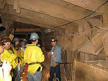 | |
| Good Enough Mine | Arizona | Tombstone | Silver | 31.7098°N 110.0657°W | 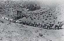 | |
| Gold Bug Mine | California | Placerville | Gold | 38.7442°N 120.7973°W | ||
| Eagle and High Peak Mine | California | Julian | Gold | 33.0811°N 116.5973°W | ||
| Himalaya Tourmaline Mine | California | Santa Ysabel | Tourmaline; 8 km underground galleries | 33.232°N 116.7591°W | ||
| Smuggler Mine | Colorado | Aspen | Silver | 39.1930°N 106.8070°W | 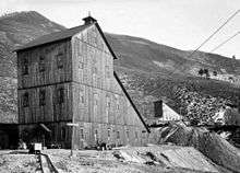 |
|
| Lebanon Silver Mine | Colorado | Georgetown | Silver; additional attraction: Georgetown Loop Railroad | 39.6972°N 105.7108°W | ||
| Country Boy Mine | Colorado | Breckenridge | Gold; from approx. 1880 | 39.4824°N 106.0152°W | ||
| Carbonate Mine | Colorado | Breckenridge | Gold; guided tours in the summer | 39.4900°N 106.0284°W | ||
| Hidee Gold Mine | Colorado | Central City | Gold | 39.7870°N 105.5015°W | ||
| Hopemore Mine | Colorado | Leadville | Gold, silver, lead, zinc | 39.2453°N 106.2348°W |  | |
| Bachelor-Syracuse Mine Tour | Colorado | Ouray | Gold | 38.7530°N 105.1605°W | ||
| Mollie Kathleen Gold Mine | Colorado | Cripple Creek | Gold; 330 m man-ride | 38.0594°N 107.6785°W | 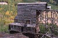 | |
| Old Hundred Gold Mine | Colorado | Silverton | Gold, operated 1905 till 1973 | 37.8237°N 107.5850°W |  | |
| Phoenix Mine | Colorado | Idaho Springs | Gold | 39.748981°N 105.565626°W | ||
| Old New-Gate Prison & Copper Mine | Connecticut | East Granby | Copper, 18th century; later turned into a prison | 41.9619°N 72.7455°W | 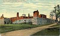 | |
| Consolidated Mine | Georgia | Dahlonega | Gold, caused 1828 first gold rush, see also Stockmar Gold Mine | 34.5383°N 83.9700°W | ||
| Stockmar Gold Mine im Pine Mountain Mine | Georgia | Villa Rica | Gold, caused 1826 first gold rush, see also Consolidated Mine | 33.7580°N 84.8835°W | ||
| Crystal Gold Mine | Idaho | Kellog | Gold | 47.5320°N 116.0912°W | ||
| Sierra Silver Mine | Idaho | Wallace | Silver | 47.4716°N 115.9255°W | ||
| Vinegar Hill Mine | Illinois | Galena | Lead | 42.4969°N 90.4154°W | ||
| Strataca Kansas Underground Salt Mine | Kansas | Hutchinson | Salt | 38.0436°N 97.8675°W | 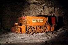 | |
| Portal 31 | Kentucky | Lynch | Coal; huge | 36.9651°N 82.9143°W | ||
| Delaware Copper Mine | Michigan | Mohawk | Copper | 47.4231°N 88.0996°W | ||
| Iron Mountain Iron Mine | Michigan | Iron Mountain | Iron | 45.7825°N 87.8654°W | 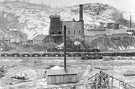 | |
| Quincy Mine | Michigan | Hancock | Copper; huge | 47.1383°N 88.5697°W | 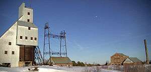 | |
| Bonne Terre Mine | Missouri | Bonne Terre | Lead; claim to have the largest underground lake worldwide | 37.9227°N 90.5522°W | 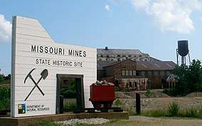 | |
| Soudan Underground Mine | Minnesota | Lake Vermilion | Iron | 47.8246°N 92.2562°W | 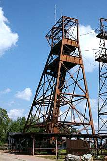 | |
| Free Enterprise Radon Mine | Montana | Boulder | Uranium; nowadays also radon-therapy | 47.8246°N 92.2562°W | ||
| Techatticup Mine und Savage Mine | Nevada | Nelson | Gold, both mines could only be visited with a boat tour on the Eldorado Canyon | 35.7095°N 114.8032°W | 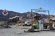 | |
| Chollar Mine | Nevada | Virginia City | Gold and silver; additional nearby mines: Ponderosa Mine, Comstock Gold Mill and others could be visited | 39.3018°N 119.6509°W | 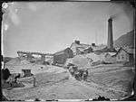 | |
| The Sterling Hill Mining Museum | New Jersey | Ogdensburg | Zinc | 41.0830°N 74.6066°W | 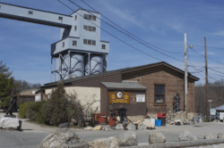 | |
| Reed Gold Mine | North Carolina | Midland | Gold | 35.285°N 80.4696°W | 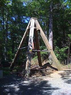 | |
| Sheffield Mine | North Carolina | Franklin | Gemstone | 35.27233°N 83.393465°W | ||
| Tour-Ed Mine | Pennsylvania | Tarentum | Coal | 40.6173°N 79.7604°W | ||
| Lackawanna Coal Mine | Pennsylvania | Scranton | Coal | 41.4168°N 75.7163°W | ||
| No. 9 Coal Mine and Museum | Pennsylvania | Lansford | Coal | 40.8285°N 75.8970°W | ||
| Pioneer Tunnel | Pennsylvania | Ashland | Coal; mining railway | 40.7779°N 76.3522°W | ||
| Seldom Seen Tourist Coal Mine | Pennsylvania | Patton | Coal | 40.6668°N 78.6809°W | ||
| Broken Boot Gold Mine | South Dakota | Deadwood | Gold | 44.3707°N 103.7429°W | ||
| Park City Silver mining | Utah | Park City | Silver | 40.6594°N 111.4997°W | 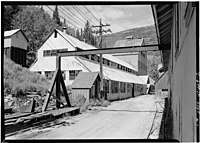 | |
| Pocahontas Exhibition Coal Mine | Virginia | Pocahontas | Coal | 37.3080°N 81.3497°W | 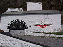 | |
| Morefield Gem Mine | Virginia | Amelia Courthouse | Gemstone | 37.3579°N 77.9180°W | ||
| Beckley Exhibition Coal Mine (Phillips-Sprague Mine) | West Virginia | Beckley | Coal | 37.7841°N 81.1936°W |  | |
| Bevans Lead Mine (Platteville Mining Museum) | Wisconsin | Platteville | Lead and zinc | 42.7328°N 90.4727°W |
External links (sources)
- "Trier University - List of Show Mines". Trier University of Applied Sciences. Retrieved August 26, 2014.
- "Network Archaeological Open-Air Museums (EXARC) - List". EXARC (Archaeological Open-Air Museums, Experimental Archaeology, Ancient Technology and Interpretation). Retrieved August 26, 2014.
- "List of shocaves and show mines". Showcaves.com. Retrieved August 26, 2014.
- "Society for mining archgeology (GAG) - list of show mines". Retrieved August 26, 2014.
- "Bavarian Ministry of Economic Affairs and Media, Energy and Technology - List of Show Mines" (PDF). Bavarian Ministry of Economic Affairs and Media, Energy and Technology. Archived from the original (PDF) on November 29, 2014. Retrieved August 26, 2014.
- "Saxonian Ministry of Economic Affairs, Labour and Technology - List of Show Mines" (PDF). Saxonian Ministry of Economic Affairs, Labour and Technology. Retrieved August 26, 2014.
- "Thuringia Mining Authority - List of Show Mines" (PDF). Archived from the original (PDF) on March 1, 2014. Retrieved August 26, 2014.
- "Technical University Freiberg - List of Show Mines". Technical University Freiberg. Retrieved August 26, 2014.
- "Union Internationale de Spéléologie (UIS) - List of Show Mines". Union Internationale de Spéléologie. Retrieved August 26, 2014.
gollark: OH NOSYNCHRONOUS XMLHTTPREQUESTKILL HIM
gollark: I saw it from my user page this morning, I think.
gollark: Hmm, troubling!
gollark: Will it autogenerate esowiki pages and interpreters?
gollark: Very exciting.
References
- "Bergwerk Villanders - Eisacktal Südtirol". Bergwerk Villanders (in German). Retrieved 2016-06-05.
This article is issued from Wikipedia. The text is licensed under Creative Commons - Attribution - Sharealike. Additional terms may apply for the media files.

Aug2005.jpg)
.jpg)
