Mechernich
Mechernich (Kölsch: Meischernisch) is a town in the district of Euskirchen in the south of the state of North Rhine-Westphalia, Germany. It is located in the "Naturpark Nordeifel" in the Eifel hills, approx. 15 km south-west of Euskirchen and 55 km from Cologne. Mechernich is a former mining town and had, in 2009, its 700-years celebration of foundation.
Mechernich | |
|---|---|
 Coat of arms | |
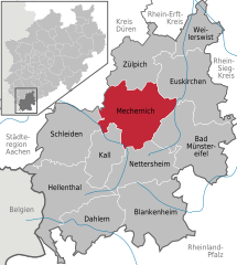
Location of Mechernich within Euskirchen district   | |
 Mechernich  Mechernich | |
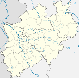
| Coordinates: 50°36′N 6°39′E | |
| Country | Germany |
| State | North Rhine-Westphalia |
| Admin. region | Köln |
| District | Euskirchen |
| Government | |
| • Mayor | Hans-Peter Schick (CDU) |
| Area | |
| • Total | 136.3 km2 (52.6 sq mi) |
| Elevation | 365 m (1,198 ft) |
| Population (2018-12-31)[1] | |
| • Total | 27,598 |
| • Density | 200/km2 (520/sq mi) |
| Time zone | CET/CEST (UTC+1/+2) |
| Postal codes | 53894 |
| Dialling codes | 02443, 02256, 02484 |
| Vehicle registration | EU |
| Website | www.mechernich.de |
Districts
Mechernich has the following districts:
Antweiler, Berg, Bergbuir, Bergheim, Bescheid, Bleibuir, Breitenbenden, Denrath, Dreimühlen, Eicks, Eiserfey, Firmenich, Floisdorf, Gehn, Glehn, Harzheim, Heufahrtshütte, Holzheim, Hostel, Kalenberg, Kallmuth, Katzvey, Kommern, Kommern-Süd, Lessenich, Lorbach, Lückerath, Mechernich, Obergartzem, Rissdorf, Roggendorf, Satzvey, Schaven, Schützendorf, Strempt, Urfey, Voißel, Vollem, Vussem, Wachendorf, Weiler am Berge, Weißenbrunnen, Weyer and Wielspütz.

Lead and zinc mines
Lead and zinc mines have existed in the central part of the Mechernich region since ancient times during the Roman occupation. Since the 13th century the most prevalent product brought to the surface has been lead. The main ore minerals galena, sphalerite and cerussite are disseminated in nodular impregnations (Knotten) and veinlets in the region in and surrounding Mechernich. Mining activities at the Mechernich lead line in 1882 saw almost 4,500 people engaged in pit work. And as late as 1952 the lead mine and its mills were still worked from numerous mines and open cuts south and southwest of Mechernich and were responsible for 20% of lead production in West Germany. But mining proved more and more expensive and all mining ceased in 1957.
Mining tour
A tour takes place in the Eifel region, in the galleries of the mining museum in Mechernich.
Museums
- Kommern Open Air Museum in Kommern
- Mining museum and visitor mine of Grube Günnersdorf
- Nuclear bunker of the North Rhine-Westphalia State Central Bank[2]
Twin town
Since 30 July 1967, the twin town of Mechernich is Nyons, France.
References
- "Bevölkerung der Gemeinden Nordrhein-Westfalens am 31. Dezember 2018" (in German). Landesbetrieb Information und Technik NRW. Retrieved 10 July 2019.
- Bunker documentation sites – start page