Belvoir, Doubs
Belvoir is a commune in the Doubs department in the Bourgogne-Franche-Comté region in eastern France.
Belvoir | |
|---|---|
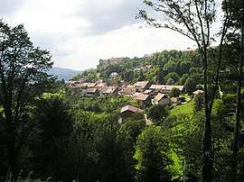
 A general view of Belvoir | |
 Coat of arms | |
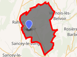
Location of Belvoir 
| |
 Belvoir  Belvoir | |
| Coordinates: 47°19′06″N 6°36′15″E | |
| Country | France |
| Region | Bourgogne-Franche-Comté |
| Department | Doubs |
| Arrondissement | Montbéliard |
| Canton | Bavans |
| Intercommunality | Vallon de Sancey |
| Government | |
| • Mayor (2008–2014) | Christian Brand |
| Area 1 | 9.31 km2 (3.59 sq mi) |
| Population (2017-01-01)[1] | 104 |
| • Density | 11/km2 (29/sq mi) |
| Time zone | UTC+01:00 (CET) |
| • Summer (DST) | UTC+02:00 (CEST) |
| INSEE/Postal code | 25053 /25430 |
| Elevation | 506–671 m (1,660–2,201 ft) |
| 1 French Land Register data, which excludes lakes, ponds, glaciers > 1 km2 (0.386 sq mi or 247 acres) and river estuaries. | |
Geography
Belvoir lies 18 km (11 mi) southeast of Clerval on a prominent hill.
History
Belvoir is noted for its castle, built by Jean de Chalon. It has been rebuilt, and the date of 1224 inscribed above the arch of the north tower is the oldest inscription in Arabic numerals in the region.
The lords of Belvoir were noted both in war and in peace: Hervis and Huon were Crusaders, and Vincent, the friend of Louis IX of France, wrote the first encyclopedia.
The Rohan family were the last noble owners of the castle.
Population
| Year | Pop. | ±% |
|---|---|---|
| 1962 | 120 | — |
| 1968 | 130 | +8.3% |
| 1975 | 115 | −11.5% |
| 1982 | 100 | −13.0% |
| 1990 | 98 | −2.0% |
| 1999 | 102 | +4.1% |
| 2008 | 99 | −2.9% |
| 2012 | 97 | −2.0% |
gollark: It's not like all applications can just use arbitrarily large amounts of GPUs.
gollark: https://eng.uber.com/neural-networks-jpeg/
gollark: Uber had a blog post somewhere on feeding data from partway through JPEG decompression to a CNN, which apparently worked okay.
gollark: Did anyone try mixing efficient and normal attention things in different layers?
gollark: I had to fix my nickname, which was wrong.
See also
References
- "Populations légales 2017". INSEE. Retrieved 6 January 2020.
| Wikimedia Commons has media related to Belvoir (Doubs). |
This article is issued from Wikipedia. The text is licensed under Creative Commons - Attribution - Sharealike. Additional terms may apply for the media files.