Blamont
Blamont is a commune in the Doubs department in the Bourgogne-Franche-Comté region in eastern France.
Blamont | |
|---|---|
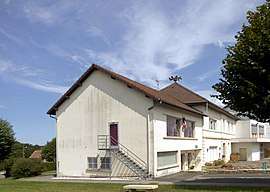
 The town hall in Blamont | |
.svg.png) Coat of arms | |
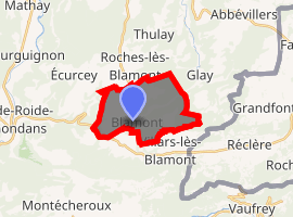
Location of Blamont 
| |
 Blamont  Blamont | |
| Coordinates: 47°23′11″N 6°50′56″E | |
| Country | France |
| Region | Bourgogne-Franche-Comté |
| Department | Doubs |
| Arrondissement | Montbéliard |
| Canton | Maîche |
| Intercommunality | Balcons du Lomont |
| Government | |
| • Mayor (2008–2014) | Claude Perrot |
| Area 1 | 10.06 km2 (3.88 sq mi) |
| Population (2017-01-01)[1] | 1,221 |
| • Density | 120/km2 (310/sq mi) |
| Time zone | UTC+01:00 (CET) |
| • Summer (DST) | UTC+02:00 (CEST) |
| INSEE/Postal code | 25063 /25310 |
| Elevation | 403–603 m (1,322–1,978 ft) |
| 1 French Land Register data, which excludes lakes, ponds, glaciers > 1 km2 (0.386 sq mi or 247 acres) and river estuaries. | |
Population
| Year | Pop. | ±% |
|---|---|---|
| 1962 | 725 | — |
| 1968 | 728 | +0.4% |
| 1975 | 1,045 | +43.5% |
| 1982 | 1,021 | −2.3% |
| 1990 | 1,026 | +0.5% |
| 1999 | 1,042 | +1.6% |
| 2008 | 1,108 | +6.3% |
| 2012 | 1,140 | +2.9% |
gollark: It's *unlikely*, at least.
gollark: Anyway, plain text files would look bad and can't have images and stuff.
gollark: I don't know, maybe?
gollark: They probably won't, but it's possible if it's on someone else's stuff.
gollark: They *can*.
See also
Famous inhabitants
- The writer Charles François Philibert Masson
References
- "Populations légales 2017". INSEE. Retrieved 6 January 2020.
| Wikimedia Commons has media related to Blamont. |
This article is issued from Wikipedia. The text is licensed under Creative Commons - Attribution - Sharealike. Additional terms may apply for the media files.