Urtière
Urtière is a commune in the Doubs department in the Bourgogne-Franche-Comté region in eastern France.
Urtière | |
|---|---|
The chapel in Urtière | |
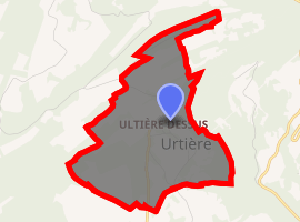
Location of Urtière 
| |
 Urtière  Urtière | |
| Coordinates: 47°15′31″N 6°55′35″E | |
| Country | France |
| Region | Bourgogne-Franche-Comté |
| Department | Doubs |
| Arrondissement | Montbéliard |
| Canton | Maîche |
| Intercommunality | Pays de Maîche |
| Government | |
| • Mayor (2014-2020) | Christian Garressus |
| Area 1 | 2.15 km2 (0.83 sq mi) |
| Population (2017-01-01)[1] | 11 |
| • Density | 5.1/km2 (13/sq mi) |
| Time zone | UTC+01:00 (CET) |
| • Summer (DST) | UTC+02:00 (CEST) |
| INSEE/Postal code | 25573 /25470 |
| Elevation | 816–988 m (2,677–3,241 ft) |
| 1 French Land Register data, which excludes lakes, ponds, glaciers > 1 km2 (0.386 sq mi or 247 acres) and river estuaries. | |
Population
| Year | Pop. | ±% |
|---|---|---|
| 2006 | 8 | — |
| 2007 | 8 | +0.0% |
| 2008 | 8 | +0.0% |
| 2009 | 8 | +0.0% |
| 2010 | 8 | +0.0% |
| 2011 | 8 | +0.0% |
| 2012 | 8 | +0.0% |
| 2013 | 8 | +0.0% |
| 2014 | 6 | −25.0% |
| 2015 | 6 | +0.0% |
| 2016 | 8 | +33.3% |
Politics
Presidential Elections Second Round:[2]
| Election | Winning Candidate | Party | % | |
|---|---|---|---|---|
| 2017 | Emmanuel Macron | EM | 55.56 | |
| 2012 | Nicolas Sarkozy | UMP | 80.00 | |
| 2007 | Nicolas Sarkozy | UMP | 66.67 | |
| 2002 | Jacques Chirac | RPR | 100.00 | |
gollark: I said ALMOST all. Purely functional/recursive data structure manipulation is... okay.
gollark: Linked lists are awful data structures for almost all situations.
gollark: Solution: purely functional Macron.
gollark: Or just try a bunch of values and profile it, even.
gollark: You can just assume they're evenly distributed, as a good hash function does this.
See also
References
- "Populations légales 2017". INSEE. Retrieved 6 January 2020.
- http://www.lemonde.fr/data/france/presidentielle-2017/
| Wikimedia Commons has media related to Urtière. |
This article is issued from Wikipedia. The text is licensed under Creative Commons - Attribution - Sharealike. Additional terms may apply for the media files.