Rurey
Rurey is a commune in the Doubs department in the Bourgogne-Franche-Comté region in eastern France.
Rurey | |
|---|---|
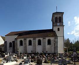 The church in Rurey | |
Location of Rurey 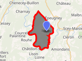
| |
 Rurey  Rurey | |
| Coordinates: 47°05′50″N 6°00′35″E | |
| Country | France |
| Region | Bourgogne-Franche-Comté |
| Department | Doubs |
| Arrondissement | Besançon |
| Canton | Saint-Vit |
| Intercommunality | Canton of Quingey |
| Government | |
| • Mayor (2008–2014) | Maurice Demesmay |
| Area 1 | 14.77 km2 (5.70 sq mi) |
| Population (2017-01-01)[1] | 340 |
| • Density | 23/km2 (60/sq mi) |
| Time zone | UTC+01:00 (CET) |
| • Summer (DST) | UTC+02:00 (CEST) |
| INSEE/Postal code | 25511 /25290 |
| Elevation | 285–520 m (935–1,706 ft) |
| 1 French Land Register data, which excludes lakes, ponds, glaciers > 1 km2 (0.386 sq mi or 247 acres) and river estuaries. | |
Geography
Rurey lies 14 km (8.7 mi) east of Quingey in the valley of the Loue between Ornans and Quingey.
Population
| Year | Pop. | ±% |
|---|---|---|
| 1962 | 167 | — |
| 1968 | 183 | +9.6% |
| 1975 | 154 | −15.8% |
| 1982 | 189 | +22.7% |
| 1990 | 227 | +20.1% |
| 1999 | 282 | +24.2% |
| 2008 | 319 | +13.1% |
| 2012 | 327 | +2.5% |
gollark: Friends surreptitiously replace friends' iPhones with alternatives.
gollark: Wow, people really do do ridiculous conformity things.
gollark: Or you can use something like syncthing, since they actually expose a filesystem.
gollark: I'm pretty sure Android devices just support plain MTP.
gollark: I also have a very trivial UDP to Discord bridge as a backup alerting system for someone.
See also
External links
| Wikimedia Commons has media related to Rurey. |
- Rurey on the regional Web site (in French)
| Authority control |
|
|---|
This article is issued from Wikipedia. The text is licensed under Creative Commons - Attribution - Sharealike. Additional terms may apply for the media files.